Download
1 / 40
400 likes | 402 Views
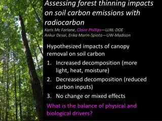
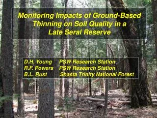
Monitoring Impacts of Ground-Based Thinning on Soil Quality in a Late Seral Reserve. D.H. Young PSW Research Station R.F. Powers PSW Research Station B.L. Rust Shasta Trinity National Forest. Shasta-Trinity National Forest Eastern Klamath Geology 3000 ft. Elev.

E N D
Monitoring Impacts of Ground-Based Thinning on Soil Quality in a Late Seral Reserve D.H. Young PSW Research Station R.F. Powers PSW Research Station B.L. Rust Shasta Trinity National Forest
Shasta-Trinity National Forest Eastern Klamath Geology 3000 ft. Elev. 70-80 in. MAP Iron Canyon Area
Boomer series Ultic Haploxeralf loam/clay loam 18” A horizon Db ~ 0.76 Site Index 25 m (50 yr)
IRON CANYON LATE SERAL RESERVE Mixed Conifer-Black Oak/Dogwood 70-80 Years, Even-aged Basal area 100-180 ft2/acre Overstocked and Fuel Loaded 2800-3000’ elevation / 70-80” MAP
LSR THINNING PRESCRIPTION • Thin from below (May 2001) • Retain 50-60 % crown cover • Retain older, mature trees • Favor ponderosa pine for eagle nests • Remove 80% of fuel ladder • Mechanical harvest - • Timbco feller buncher • rubber tired grapple skidder
Harvested In May Are these impacts important??
Disturbance -101 • EXTENT • % area, depth • SEVERITY • undisturbed extreme
Disturbance -101 • EXTENT • % area, depth • SEVERITY • undisturbed extreme • DISTRIBUTION • dispersed concentrated • DURATION • short term long term • mitigation? • natural recovery?
Harvest Equipment x Timing of Operations x Fine Textured Soils = SOILS CONCERN
Harvest Equipment x Timing of Operations x Fine Textured Soils = SOILS CONCERN Did we meet the soil standards??
National Forest Soil Scientists are Charged with Monitoring Management Impacts Did we meet the soil standards?? How do we go about monitoring??
National Forest Soil Scientists are Charged with Monitoring There are not clear protocols. This is a problem.
Basic Monitoring Approach • STRATIFY THE AREA (extent) • Disturbance Classes • ASSESS EACH CLASS (severity) • Bulk Density, Penetrometer • ASSESS SAMPLING EFFECTIVENESS • Statistical Significance of Estimates • ASSESS THE IMPORTANCE • Regional Standards = ? = Ecological Impacts
National Forest Soil Scientists are Charged with Monitoring LUMPER SPLITTER There are not clear protocols. This is a problem.
Iron Canyon Soil Monitoring Determining Disturbance Extent • Disturbance Classes • LOW • forest floor completely intact, • no sign of traffic • MODERATE • forest floor disturbed, • but not a skid trail • HIGH • obvious skid trails
WE AGREED UPON DISTURBANCE CATEGORIES AND LAID OUT 100-FT TRANSECTS
Iron Canyon Soil Monitoring Determining Disturbance Extent Disturbances were partitioned about equally
Soil pit in “Low disturbance” forest floor intact, little compaction in A horizon Soil pit in “High disturbance” fine roots through A/AB to Bt platy structure thru A horizons Ahorizons Bt horizons QUALITATIVE
Iron Canyon Soil Monitoring Determining Disturbance Severity QUANTITATIVE
Iron Canyon Soil Monitoring Determining Disturbance Severity Averages by Disturbance Category (10-20 cm depth)
Iron Canyon Soil Monitoring Determining Disturbance Severity Averages by Disturbance Category (10-20 cm depth) Region 5 Standard: 10% Porosity Reduction Initial Db: 0.89 Threshold Db: 1.06
RECORDING PENETROMETER Many times faster than bulk density Simulates what roots experience Measures strength at 15 mm intervals to 60 cm depth Electronic files
Iron Canyon Soil Monitoring Determining Disturbance Severity
Iron Canyon Soil Monitoring Determining Disturbance Severity
Iron Canyon Soil Monitoring Determining Disturbance Severity Averages by Disturbance Category (10-20 cm depth)
Iron Canyon Soil Monitoring Determining Disturbance Severity Averages by Disturbance Category (10-20 cm depth) No Regional Standard. Root activity inhibited: >2000 Root activity ceases: >3000
Iron Canyon Soil Monitoring Determining Disturbance Severity Averages by Disturbance Category (10-20 cm depth) Monitoring indicates the thinning operation was conducted in compliance with R5 soil standards
Iron Canyon Soil Monitoring Determining Disturbance Severity Averages by Disturbance Category (10-20 cm depth) Monitoring indicates the thinning operation was conducted in compliance with R5 soil standards Although.... We lacked a true undisturbed area to use for baseline comparison.
IMPORTANT QUESTIONS What’s the site condition before entry? Was it truly “pristine”? Or did it come with “baggage”? Does legacy disturbance matter? Or, is “natural recovery” adequate to mitigate old disturbance?
IMPORTANT QUESTIONS What’s the site condition before entry? Was it truly “pristine”? Or did it come with “baggage”? Does legacy disturbance matter? Or, is “natural recovery” adequate to mitigate old disturbance? Are there cumulative effects?
Iron Canyon WatershedSite 1 2001 Harvest Site 2 2003 Harvest Site 2 Site 1
Pre-harvestStand Conditions Overstocked and Fuel Loaded
40 YEAR DISTURBANCE LEGACY 1960’s Era Skid Trails
40 YEAR DISTURBANCE LEGACY 1960’s Era Skid Trails Dedicated for permanent traffic system??
Iron Canyon II Soil Monitoring Determining Disturbance Extent
Iron Canyon II Soil Monitoring Pre-Harvest Residual Disturbance Averages by Disturbance Category (10-20 cm depth) Region 5 Standard: 10% Porosity Reduction Initial Db: 0.76 Threshold Db: 0.95
Iron Canyon II Soil Monitoring Pre-Harvest Residual Disturbance Averages by Disturbance Category (10-20 cm depth)