Download
1 / 7
70 likes | 150 Views
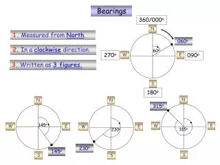
85. 96. 05. 15. 86. 06. 84. 95. 07. 14. 04. 87. 03. 94. 13. 08. 09. 02. 12. 11. 10. 01. 50. 49. 55. 54. 60. 51. 56. 52. 53. 92. 57. 58. 59. 10. 09. 08. 07. 06. 10. 09. 11. 12. 13. 14. 47. 46. 45. 48. 5. 10. 9. 8. 7. 6. 4. 3. 2. 1. 11. 12.

E N D
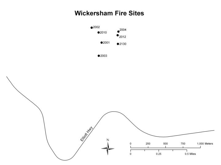
85 96 05 15 86 06 84 95 07 14 04 87 03 94 13 08 09 02 12 11 10 01 50 49 55 54 60 51 56 52 53 92 57 58 59 10 09 08 07 06 10 09 11 12 13 14 47 46 45 48 5 10 9 8 7 6 4 3 2 1 11 12 13 14 15 07 06 05 08 See fireline map for additional probe locations on fireline. 30m -5m 42 43 44 41 20 19 18 17 16 02 03 04 01 thaw probe location N vegetation plot ~30 m apart 05 8 50 vegetation plot with new number fiberglass pole ~2m apart 10 Wickersham Fire Sites—West Side #2003 W Unburned Control (BS-2C) #2001 W Light Burn (BS-2L) #2010 W Fireline (Fireline2) (FirelineA) (Fireline between 2H&2L) #2002 W Heavy Burn (BS-2H) Disturbed Area 100 97 98 99 18 19 20 01 02 03 04 05 17 20 19 18 17 16 15 Old Fireline (FirelineB) (Fireline between 2L&2C) not measured 91 93 16 88 89 90 83 82 81 Cushman Creek LEGEND GIS map of site locations NOTE: Map is not to scale, see GIS map for actual site locations.
6 1 2 3 4 5 7 8 9 10 6 6 1 1 2 2 3 3 4 4 5 5 7 7 8 8 9 9 10 10 -3m 34m 20m 20m 0m 0m Cushman Creek GIS map of site locations N 8 Wickersham Fire Sites—East Side #2012 E Fireline (Fireline1) (Lower CatLine) #2004 E Heavy Burn (BS-1H) #2130 E Unburned Control (BS-4C) See fireline map for additional probe locations on fireline. LEGEND: thaw probe location fiberglass pole ~2m apart NOTE: Map is not to scale, see GIS map for actual site locations.
06 10 05 11 15 01 20 09 04 07 19 12 14 02 13 08 13 08 03 18 03 12 09 04 02 07 14 17 16 01 05 15 06 11 10 30 21 22 40 36 35 39 34 33 28 37 23 29 27 26 25 32 24 31 38 17 18 19 20 16 516 520 519 518 517 513 515 514 507 502 512 501 506 503 505 510 509 508 504 511 50 Vegetation plot with new number, ~30 m apart 10 Wickersham Fire Sites—East Side INF Vegetation Plots #2012 E Fireline (Fireline1) (Lower CatLine) #2130 E Unburned Control (BS-4C) #2004 E Heavy Burn (BS-1H) 20 19 18 17 16 15 Couldn’t find any poles or veg plots in 2005. This was the plot setup from the original field notes. 14 13 12 11 10 09 08 07 06 05 04 03 LEGEND: 02 01 GIS map of site locations Cushman Creek N NOTE: Map is not to scale, see GIS map for actual site locations. Thaw probe line
Probe & Surface Level Locations (m) #8 Fiberglass pole ~2m apart N Large fiberglass pole marker East Fireline surface level zero point. Subtract this surface level measurement from all other surface level measurements. LEGEND
LEGEND Probe & Surface Level Locations (m) #8 Fiberglass pole ~2m apart N Large fiberglass pole marker West Fireline surface level zero point. Subtract this surface level measurement from all other surface level measurements.