Download
1 / 24
240 likes | 460 Views
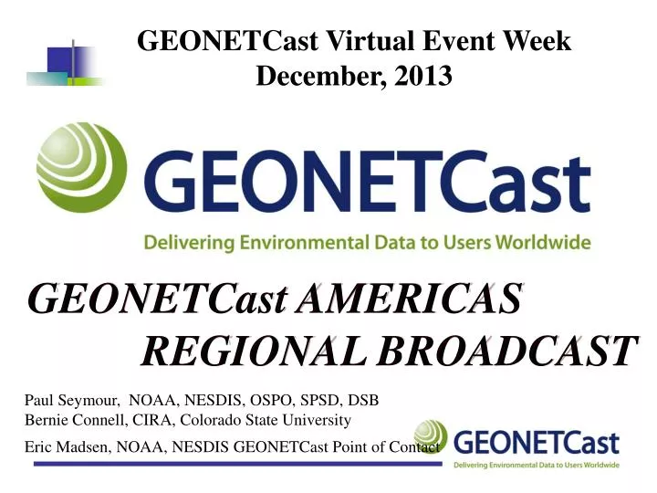
GEONETCast Virtual Event Week December, 2013 . GEONETCast AMERICAS REGIONAL BROADCAST. Paul Seymour, NOAA, NESDIS, OSPO, SPSD, DSB Bernie Connell, CIRA, Colorado State University. Eric Madsen, NOAA, NESDIS GEONETCast Point of Contact. GEONETCast - Global Coverage.

E N D
GEONETCast Virtual Event Week December, 2013 GEONETCast AMERICAS REGIONAL BROADCAST Paul Seymour, NOAA, NESDIS, OSPO, SPSD, DSB Bernie Connell, CIRA, Colorado State University Eric Madsen, NOAA, NESDIS GEONETCastPoint of Contact
GEONETCast Americas - Coverage • Regional component of GEONETCast • Provided by USA/NOAA • Coverage for North, Central, and South America and the Caribbean
GEONETCast Americas - Broadcast Coverage Area: Purple Isolines • 2 megabits per second data rate • Options to expand to 12 Megabits • Intelsat-21 (IS-21) geostationary satellite • Multiplexed C-band DVB-S transponder at 58 deg W • >99.5% availability
GEONETCast Americas System Other GEONETCast Systems Data Management System Server & Datacast Software Data Providers Internet OSPO EPA IP Encapsulator MPEG-2 Encoder NCDC Teleport NWS/GTS DVB-S/DVB-S2 Modulator User Receive Terminals RANET INT’L Web-enabled NOAA Access GEONETCast - System Architecture Intelsat Teleport in Ellenwood, Georgia, USA GEONETCast Americas Data Providers System Users
GEONETCastAmericas - Receive Station - Personal computer with client software - Satellite antenna: 1.8 m - 2.4 m depending on location - DVB-S (2) receiver card or box
GEONETCast Americas – Receive Station Users responsible for station purchase and operation • Standard commercial off-the-shelf components • Estimated user costs ~$2000-$5000 US • Personal computer - ~$500 • Client datacasting software - $400 one-time license • 1.8 to 2.4 meter antenna depending on location including LNB - $1000-2000 • DVB-S (S2) receiver - ~$100 • No recurring subscription costs for Kencast • Installation costs vary by location
GEONETCast Americas - Content • Product broadcast channels • Separate broadcast channels by data provider • Users can choose channels they wish to receive • Training Channel and Alert Channel Included • Product formats • There is no restriction on the format of products
GEONETCast Americas Providers • Brazil National Institute for Space Research (INPE) • Derived regional products including fire monitoring, lightning, rainfall nowcasting, UV Index, vegetation, GOES imagery based products in GEOTIFF format • NASA/USAID SERVIR Project • MODIS fire images over Guatemala and short-term rainfall model forecasts More info on Wednesday! Global GOES IR 10.7µm – geotiff format true color RGB + fire spots rainfall
GEONETCast Americas Providers • Argentina National Space Activities Commission (CONAE) • Sea height and significant wave height and direction. • More products being considered. • National Meteorological Institute of Costa Rica • Flash Flood Alert Products • WRF model output for Central America Zones for sea height and significant wave height and direction information WRF model 250 hPa streamlines
GEONETCast Americas Providers • U.S. Environmental Protection Agency (EPA) • Hourly animated air quality maps of ozone and particulates • NOAA/National Climate Data Center (NCDC) • North American Drought Monitor Air Quality Product
GEONETCast Americas Providers • NOAA/National Environmental Satellite Data and Information Service (NESDIS) and USAID/NOAA RANET Project • Chlorophyll concentration, vegetation index and health, snow cover and depth, total ozone, total precipitablewater • Environmental products, Alerts, Watches and Warnings • European Organisation for the Exploitation of Meteorological Satellites (EUMETSAT) • GEONETCast Product Navigator, satellite winds from Advanced Scatterometer (ASCAT METOP A and B) Caribbean chlorophyll concentration Total Ozone Analysis using SBUV/2 and TOVS (TOAST) ASCAT METOP-B winds
Potential Providers • International Center for the Investigation of the El Niño Phenomenon (CIIFEN) • Monthly Eastern Pacific Ocean Analyses, Seasonal Western South American Forecast • Caribbean Institute for Meteorology and Hydrology • Caribbean channel for natural disaster preparedness and response. NCEP Forecast from RANET Broadcast FOZNT23 KNHC 121458 FFNT3 OFFSHORE WATERS FORECAST FOR THE SW AND TROPICAL N ATLANTIC AND CARIBBEAN SEA NWS TPC/NATIONAL HURRICANE CENTER MIAMI FL 1130 AM EDT SUN JUL 12 2009 More info from Barbados on Wednesday!
New Products for 2014 • GOES-East Full Disk Imagery in GEOTIFF format • Visible • Water Vapor (6.5 µm) • Infrared (10.7 µm)
GEONETCast Americas – Training Channel • Recordings of the Monthly Virtual Sessions under WMO VLab from CIRA / NOAA / Barbados / Costa Rica • Training is directly relevant to the meteorology and hydrology community • New initiative with VLab Management Group and with the Committee on Earth Observation Satellites (CEOS) Working Group on Capacity Building & Data Democracy • Development of distance learning courses to be sent through GNC-A October 2013 session
Disaster Charter • GEONETCast Americas and EUMETCastapproved for use as auxiliary data distribution systems by the International Charter “Space and Major Disasters.” • Brazilian Center for Monitoring and Alerts of Natural Disasters (CEMADEN) to use portable GNC-A Receive stations for disaster response where Internet is unavailable. • Ongoing efforts: work with the GEONETCast Americas Implementation Group and regional partners on establishing the use of GEONETCast by the disaster management community to receive data from the International Charter More info on Wednesday!
Capabilities for Disaster Response • Only need power for the computer and receive card / box • No internet connection needed • Ability to add data to the GNC broadcast on a ad-hoc basis – no format restriction • Ability to add data prepared within or outside of the region of interest • GEONETCast stations can be portable!
User Engagement Each region works directly with its Users • In Europe there are over 3560 EUMETCast stations; • In Africa, there are about 358 EUMETCast stations; • In the Asia/Pacific region, there are approx 2600 CMACast stations; • In the Americas there are about 121 including 99 EUMETCast and GNC-A 22 stations deployed.
Why are there many EUMETCast stations? • In 2002, Meteosat-8 was launched. • Data rebroadcast failed • Solution:a commercial satellite provider to rebroadcast the data– EUMETCast • In 2005, Meteosat-9 was launched. • The majority of Meteosat data users (over 1200 at that time) chose to remain with EUMETCast • Additions to EUMETCast data stream: • Metop-A (2006) and Metop-B (2012) • Future additions: Meteosat Third Generation (MTG)
Why are there many CMACast stations and few GEONETCast-A stations? • China upgraded to CMACast in 2008 • Combined FENGYUNCast and PCVSAT services. • US relies on NOAAPort, GOES GVAR, POES, HRPT, LRIT re-broadcast, APT, and the Internet • GEONETCast currently distributes products, not“raw” data.
What’s available? GEONETCast Product Catalog with associated metadata • Same “look and feel” across regional systems • Distributed via GEONETCast broadcast AND viewable on the Internet. • GEONETCast Product Navigator on NOAA site: http://www.geonetcastamericas.noaa.gov/products/navigator/indexer.html • EUMETSAT Product Navigator: http://www.eumetsat.int/Home/Main/DataProducts/ProductNavigator/index.htm
Develop Partnerships To Fund Stations • GEONETCast Americas continues to work to develop new partnerships to fund user receive stations in the North, Central, and South America and the Caribbean • Current efforts include proposals to the World Bank / Caribbean Disaster Emergency Management Agency (CDEMA) to fund stations in key sites. More info on Wednesday from Barbados
GEONETCast Americas Product Suite We will… • Continue to work with partners to expand product suite • Meet requirements identified by regional met services using regional providers • Continue outreach to prospective users
GNC-A - Contacts and Links • Yana Gevorgyan – Yana.Gevorgyan@NOAA.Gov • Eric Madsen - Eric.Madsen@NOAA.Gov • Paul Seymour - Paul.Seymour@NOAA.Gov • Rich Coley - Rich.Coley@NOAA.Gov • www.geonetcastamericas.noaa.gov