Download
1 / 66
660 likes | 928 Views
Mount Baker. The Majesty. Mount Baker:. The Threat!. How is Mount Baker thought to have been formed?. Subduction Zone. What is a pyroclastic flow?. Courtesy: USGS. Which British Columbia Community is directly across the border from Sumas, Washington?. Abbotsford.

E N D
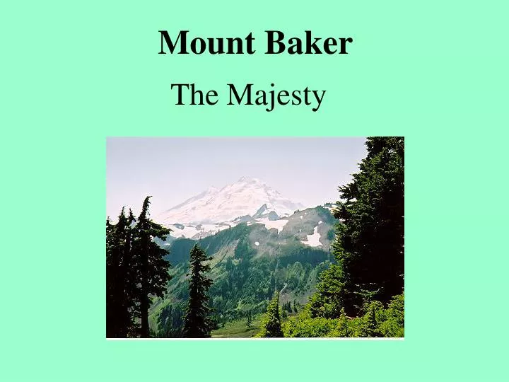
Mount Baker The Majesty
Mount Baker: The Threat!
How is Mount Baker thought to have been formed?
Which British Columbia Community is directly across the border from Sumas, Washington?
Abbotsford Read about the potential threat of Mount Baker to this community courtesy of the Geological Survey of Canada.
Mt. Shuksan Summit: 9038 ft. Located east of Mt. Baker - A non-volcanic peak
How many metres is 9038 feet?
Conversion Formulafeet to metres:multiply by 0.3048 9038 feet X 0.3048 = 2755 metres
Glacier Ranger Station - Located northwest of Mt. Baker (see earlier map) 730 year old Douglas Fir Diameter: 8 ft. 2 in. (2.45 metres)
Temperate Rainforest Annual Precipitation at Glacier Ranger Station: 66.63 inches
How many millimetres are there in 66.63 inches?
Conversion Formulainches to millimetres:multiply by 25.4 66.63 inches X 25.4 = 1692 mm
Recall that Vancouver Airport receives on average about 1000 mm of precipitation each year.Which process of precipitation accounts for the higher total at Glacier?
Orographic Precipitation Glacier is at a higher elevation than Vancouver Airport which is near sea level in Richmond. Consequently, for Glacier, there is more uplift of the onshore wind giving enhanced cooling and condensing of the air to form more clouds and precipitation.
Undercutting of the slope beside the road on Mount Baker Highway. What agents of erosion are responsible for this?
- Precipitation- Surface Water- Freeze Thaw Action- Gravity- Wind
Nooksack river Flows westward from the Mount Baker area.
Which volcanic hazard mentioned earlier would pose the greatest threat to the Nooksack?
Lahars i.e. mud flows
Whitewater rafting is very popular along portions of the Nooksack river.
Heather Meadows Visitor Centre Elevation: 4400 feet (1320 metres)
What process helped to produce the grooves and scratches evident on this exposed rock surface?
Mt. Hermann Notice the changes in vegetation with increased elevation.
Table Mountain Hermann saddle Upper Bagley Lake occupies a glacier carved basin known as a ____________.
A lake that occupies a cirque is called a _______.
Further down is Lower Bagley Lake and a dam.
Low lying heather dominates this alpine meadow area as do smaller coniferous trees. Why?
Increased elevation translates into a colder climate and a shorter growing season resulting in smaller vegetation. The low lying bushes survive winter due to the internal warmth of the earth and an overlying blanket of snow which acts as insulation. The conifers have adapted to the environment with a spiral shape and drooping branches to shed the weight of snow.
Basalt Columns What type of rock is basalt?
More basalt columns What type of plate is associated with basaltic rock?
Mt. Baker Oceanic Plate i.e. the Juan de Fuca plate
basalt columns This collection of angular rock fragments at the base of a slope is known as__________.