Download
1 / 25
250 likes | 626 Views
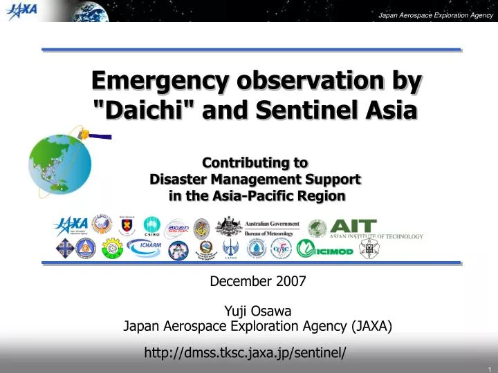
Emergency observation by "Daichi" and Sentinel Asia Contributing to Disaster Management Support in the Asia-Pacific Region December 2007 Yuji Osawa Japan Aerospace Exploration Agency (JAXA) http://dmss.tksc.jaxa.jp/sentinel/ Contents Disaster in our region What is the Sentinel Asia ?

E N D
Emergency observation by "Daichi" and Sentinel Asia Contributing to Disaster Management Support in the Asia-Pacific Region December2007 Yuji Osawa Japan Aerospace Exploration Agency (JAXA) http://dmss.tksc.jaxa.jp/sentinel/
Contents • Disaster in our region • What is the Sentinel Asia ? • "Daichi" Emergency Observation Flow and Disaster Information in Sentinel Asia • Expansion of Sentinel Asia
Natural DisasterDamages in Asia Total number during 1975- 2005 quoted from ‘ADRC-Natural Disasters Data Book-2005’ originated in CRED-EMDAT, 2005 Asia • Number of Disaster 37% 3107 World : 8319 44% • Economical Damage 55 Billion US$ World :125 Billion US$ • The Death Toll 57% 1251911 World : 2189116 • Victims 89% 47.5 Hundred Million World : 53.4Hundred Million
What should or could we do for it by utilizing cutting edge technology ?
Contents Disaster in our region What is the Sentinel Asia ? "Daichi" Emergency Observation Flow and Disaster Information in Sentinel Asia Expansion of Sentinel Asia
Philosophy • APRSAF (Space community) should contribute to disaster management in the Asia-Pacific region aiming at: • To improve safety in society by ICT and Space technology • To improve speed and accuracy for disaster preparedness and early warning • To minimize victims and social/economic losses • Step-by-step approach: • Step1: Utilization of earth observation satellite data for disaster management, which is called “Sentinel-Asia Project” (2006-2007) • Step2: Utilization of satellite communications system besides earth observation satellites (2008-2009) • Step3: Establishment of comprehensive disaster management support system (2010 and onwards ) • Voluntary initiative by participating organizations Framework • Cooperation among APRSAF, ADRC, Digital Asia and international organizations • Joint Project Team (JPT) consists of total 52 organizations including 44 agencies from 19 countries and 8 international organizations • JAXA established two project offices in Tokyo and Bangkok
Contents Disaster in our region What is the Sentinel Asia ? "Daichi" Emergency Observation Flow and Disaster Information in Sentinel Asia Expansion of Sentinel Asia
Flow of Emergency Observation in Sentinel Asia "Daichi" JAXA ADRC ADRC Members JPT Members Emergency Observation Request Emergency Observation Request Disaster Occurrence Feedback Disaster Information Archive Images Digital Camera Images "Daichi" Emergency Observation Images Support "Daichi" Images & Disaster Information JAXA Asia Branch (Bangkok) Sentinel Asia Web Site Support Disaster Management Agencies in Asian Countries
Emergency Observation by "Daichi" (1) Dec. 2006:Mudslide at Mt. Mayon, Philippinesactivated by International Disaster Charter, observed by AVNIR-2 (2) Feb. 2007: Flood in Jakarta, Indonesiarequested by LAPAN; observed by PALSAR (3) March 2007: Earthquake in West Sumatra, Indonesiarequested by LAPAN; observed by AVNIR-2(Cloudy) (4) April 2007: Earthquake in Solomon Islandsrequested by ACRES; observed by AVNIR-2/PALSAR (5) May 2007: Heavy Rainfall in Thailand requested by GISTDA; not accepted ( severe damage not reported and could not be foreseen) (6) May 2007: Snowstorm in Nepal requested by Dep of Water Induced Disaster Prevention; observed by AVNIR-2
Emergency Observation by "Daichi" (7) June 2007: Landslide in Bangladesh requested by Ministry of Flood and Disaster Management; observed by PALSAR (8) July 2007: Tropical Cyclone in Pakistan requested by Space and Upper Atmosphere Research Commission; observed by PALSAR (archived images) (9) July 2007: Volcano Eruption in Indonesia requested by LAPAN; observed by PALSAR (archived images) (10) July 2007: Earthquake/Landslide in Tajikistan requested by Committee of Emergency Situations; observed by AVNIR-2 and PALSAR (11) July 2007: Flood/Landslide in Indonesia requested by LAPAN; observed by PALSAR (12) July 2007: Flood in Bangladesh requested by Ministry of Flood and Disaster Management; observed by PALSAR
Emergency Observation by "Daichi" (13) September 2007: Earthquake in Indonesia requested by LAPAN; observed by AVNIR-2/PALSAR (14) September 2007: Flood in Thailand requested by Department of Water Resources (DWR) ; observed by PALSAR (15) October 2007: Flash Flood/Flood in Vietnam requested by Ministry of Natural Resources and Environment (MONRE) ; observed by PALSAR (16) November 2007: Tropical Cyclone in Bangladesh requested by ISRO; observed by PALSAR
Feedback from Users Images and information from Sentinel Asia are utilized as follows: (1)Defining areaaffectedby disaster, (2)Disaster management,rehabilitation activitiesanddisaster educations, (3)As a reference for the report to related governmentoffices or international organization in order to requestrelief activities, (4) Sent to media such as TV, Newspaper, Radio, and used to report to the public immediately, (5) Provided to Government agencies or Royal house, and received letter of appreciation from them.
Feedback from Users Comments: (1)Resolution of the image is very good and similar images, if available on request, would help make disaster preparedness plans especially for landslides, avalanche and floods. (2) The provided imagery in a timely manner is to aid coordination of natural disaster relief is essential. Sentinel Asia is an essential element of disaster management in Asia. Request: (1)Need standard process dataorGeoTiff data (by SpaceagencyorInstitute) NB JAXA is now providing JPEG image (2)Need not only images, but also detailed interpretationsand derived products for use specifically byDisastermanagementorganizations.
"Daichi"/PALSAR Imagesbefore (left) and during (right) Flood Flood in Vietnam in October-November 2007 "Daichi"/PALSAR Image around Da Nang City
L-band SAR’s spatial resolution and bandwidth • “Daichi” PALSAR has 30MHz bandwidth for 10m resolution. • It is enough resolution for distinguish the damaged area’s outline, but insufficient for detailed investigation. Higher resolution is required. • L-band SAR is quite useful for disaster in Asian region, e.g. earthquake, volcanic eruption and flooding. • Current RR allocates 85MHz bandwidth for L-band SAR (~3m res.). For higher resolution, doubling the current bandwidth is at least needed.
Capacity Building “1st Sentinel Asia system operation training” was held successfully with 12 attendees at the end of August 2007 at Bangkok by JAXA. “2nd Sentinel Asia system operation training” was held with 17 attendees at the end of November 2007 at Bangkok by JAXA. “Mini Project” is being carried out for 10 projects of 10 countries in 2007 by JAXA under cooperation with AIT
Contents Disaster in our region What is the Sentinel Asia ? "Daichi" Emergency Observation Flow and Disaster Information in Sentinel Asia Expansion of Sentinel Asia
4. Expansion of Sentinel Asia • Short-term plan • To increase satellite data providers: ISRO, GISTDA, etc... • To operation training for JPTM and ADRC members • Mid-term plan • To start step-2 in 2008 through to 2012 • For narrow band area in Asia, utilization of JAXA/WINDS (Wideband Internetworking engineering test and Demonstration Satellite) is expected, which will be launched in coming February.
Summary Sentinel AsiaSTEP1 has achieved its overall goals: The website of Sentinel Asia has operated at since October 2006. It has served as a good demonstrator project, toshare disaster-relatedinformationobtainedbyseveral earth observation satellites such as "Daichi", MTSAT-1R,Terra & Aqua It also demonstrates recent advances in web-mapping technologies and ICT systems Following findings are to be dealt with in STEP2: There are narrow band areas where it is hard to see Web-GIS information More robust and user-friendly website system is required Users request GeoTiff data/ Raw data (by SpaceagencyorInstitutes)and easily comprehensible interpretations from images(by Disastermanagementorganization)
Feedback from Users Images and information from Sentinel Asia are utilized as follows: (1)Defining areaaffectedby disaster, (2)Disaster management,rehabilitation activitiesanddisaster educations, (3)As a reference for the report to related governmentoffices or international organization in order to requestrelief activities, (4) Sent to media such as TV, Newspaper, Radio, and used to report to the public immediately, (5) Provided to Government agencies or Royal house, and received letter of appreciation from them.
Feedback from Users Comments: (1)Resolution of the image is very good and similar images, if available on request, would help make disaster preparedness plans especially for landslides, avalanche and floods. (2) The provided imagery in a timely manner is to aid coordination of natural disaster relief is essential. Sentinel Asia is an essential element of disaster management in Asia. Request: (1)Need standard process dataorGeoTiff data (by SpaceagencyorInstitute) NB JAXA is now providing JPEG image (2)Need not only images, but also detailed interpretationsand derived products for use specifically byDisastermanagementorganizations.
STEP1 Summary (Observations) On schedule accomplishment of the project Outreach to international community made Sentinel Asia widely known Web site visitors are gradually increasing Images and information from Sentinel Asia were utilized in many ways and Sentinel Asia is expected as an essential element of disaster management in Asia-Pacific Wildfire WG: Planned activities are being carried out including cooperation with end-users Flood WG: Planned activities are being carried out Sentinel Asia capacity building has started
STEP1 Summary (Finding) There are narrow band areas where it is hard to see Web-GIS information More robust and user-friendly website system is required Users request GeoTiff data/ Raw data (SpaceagencyorInstitutes)and easily comprehensible interpretations from images(Disastermanagementorganization)