Download
1 / 33
340 likes | 434 Views
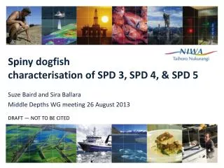
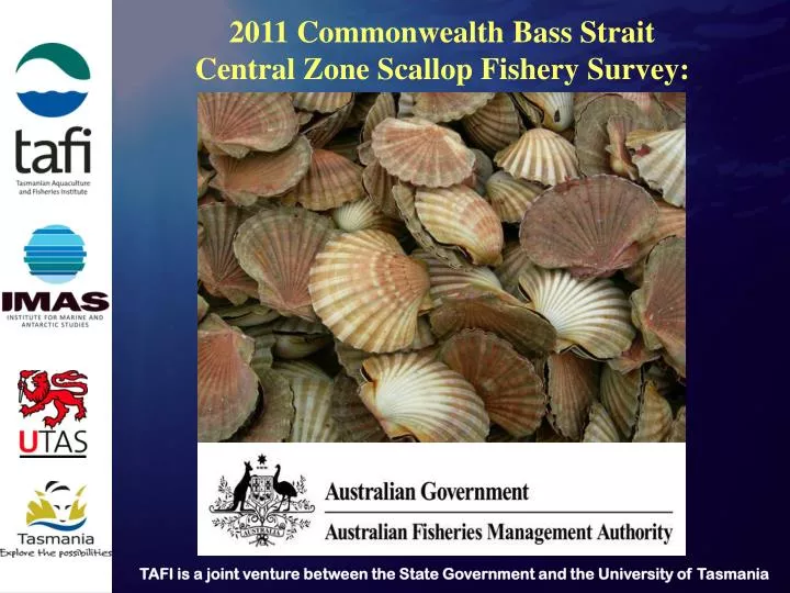
2011 Commonwealth Bass Strait Central Zone Scallop Fishery Survey:. 160 sample tows conducted during January 2011 survey. . Western Protected Zone. 5 main regions of scallops identified. These groupings will be used to describe results. . 2010 Open Zone. Viable Area 10.

E N D
2011 Commonwealth Bass Strait Central Zone Scallop Fishery Survey:
Western Protected Zone • 5 main regions of scallops identified. • These groupings will be used to describe results. 2010 Open Zone Viable Area 10 South Viable Area 10 2009 Open Zone
Oct / Nov 2010 vs January 2011 Black tows = January 2011 Grey tows = Oct / Nov 2010
Oct / Nov 2010 vs January 2011 Red = January 2011 Grey = Oct / Nov 2010
Oct / Nov 2010 vs January 2011 Red = January 2011 Grey = Oct / Nov 2010
Oct / Nov 2010 vs January 2011 Red = January 2011 Grey = Oct / Nov 2010
2010 Commonwealth Bass Strait Central Zone Scallop Fishery Surveys:
184 sample tows conducted outside 2009 and 2010 legislative open areas.
4 main regions of scallops identified: • NW of western protected zone • western protected zone • southern protected zone • W & SW of 2009 legislative open region
4 tows 2 tows
Biomass Estimates • 2 Key Questions: • Is the population of scallops in a survey region able to be harvested under the BSCZSF harvest strategy and fishery rules? In particular: • Are scallop abundances suitable for harvesting? • Does the population structure meet discard rate rules? • Can the data collected from discrete regions of the fishery be used to calculate biomass? In particular, is the spatial coverage of sample tows sufficient for meaningful biomass estimates?
Abundances too low for commercial harvest? Small number of tows covering small area Discard rate too high (48.6% in November 2010)
Abundances generally too low for commercial harvest? Higher abundance tows cover small area Discard rate too high (30%)
Western Protected Zone Abundances may be suitable for commercial harvest? Population structure meets discard rate rules (=15%) Acceptable spatial coverage of sample tows
Western Protected Zone biomass estimate Post Stratification
Western Protected Zone biomass estimate Post Stratification
Western Protected Zone biomass estimate Post Stratification 100m buffer Area = 8.9km2 250m buffer Area = 19.4km2 3) 500m buffer Area = 37.7km2 4) 1000m buffer Area = 66.8km2 5) 2000m buffer Area = 119.0km2 6) 5000m buffer Area = 291.3km2
Summary In general, more data is needed across the fishery Western Protected Zone (WPZ) currently meets opening criteria However, biomass figures are indicative only There may be a smaller cohort coming through in the WPZ that is currently under-represented in dredge samples