Download
1 / 33
400 likes | 766 Views
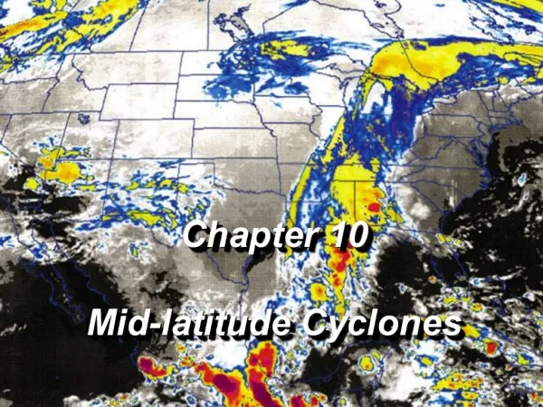
Classic Mid-latitude Cyclones. Classic Mid-Latitude Cyclones. History of Cyclone Research Revisiting the Classic Structure Air flow patterns Moisture patterns Cloud patterns Lifecycle of Classic Cyclones East Coast Cyclone Colorado Lee-side Cyclone Anticyclones Climatology

E N D
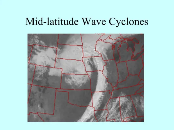
Classic Mid-latitude Cyclones M. D. Eastin
Classic Mid-Latitude Cyclones • History of Cyclone Research • Revisiting the Classic Structure • Air flow patterns • Moisture patterns • Cloud patterns • Lifecycle of Classic Cyclones • East Coast Cyclone • Colorado Lee-side Cyclone • Anticyclones • Climatology • Blocking Patterns M. D. Eastin
History of Cyclone Research • Early Development (pre-1900): • Early civilizations (e.g., Egypt, Maya, Vikings, Chinese, Polynesia) were known to monitor • local weather/climate patterns and pass this information from one generation to the next • through stories, art, religion, and architecture • Influenced agricultural (food) • Influenced movement and migration (nautical travel) • Influenced site selection for town/cities (access / stability) • Aristotle (Greek – 350 BC) is considered the “founder” of meteorology • Wrote Meteorologica where he described the hydrological cycle • Book served as the primary reference for centuries • Pomponius Mela (Roman – 25 AD) formalized a climate zone system • Varahamihira (India – 500 AD) wrote Brihatsamhita - first formal description of the • seasonal cycle and the formation of clouds/rain • Al-Dinawari (Muslim – 900 AD) wrote Book of Plants - first formal description of • the application of meteorology to agriculture M. D. Eastin
History of Cyclone Research • Early Development (pre-1900): • True scientific progress began in the 15th century and accelerated in the 17th century • Basic instrumentation was first developed • Standardized rain gauge (Korea – 1441 AD) • Anemometer (Italy – 1450 AD) • Thermometer (Italy – 1607 AD) • Barometer (Germany – 1611 AD) • Hygrometer (France – 1783 AD) • Regular meteorological observation networks were developed • Italy – 1654 AD • United States – 1849 AD • England – 1854 AD • India – 1875 AD • Scandinavia – 1881 AD • Japan – 1883 AD M. D. Eastin
History of Cyclone Research • Early Development (pre-1900): • True scientific progress began in the 15th century and accelerated in the 17th century • Development and application of math / physics to the atmosphere • General circulation → Edmond Halley (1686) • → George Hadley (1735) • → William Ferrel (1855) • Use of Calculus → Isaac Newton (1687) • → Leonhard Euler (1755) • Theories regarding atmospheric processes were first described • Vertical pressure gradient Pascal (1648) • Kinetic theory of (ideal) gases Bernoulli (1738) • Oxygen discovered Lavoisier (1777) • Heat capacity Dalton (1808) • First law of thermodynamicsClausius (1850) - credited • Second law of thermodynamics Carnot (1824) - credited • Dry / moist adiabatic lapse rates Espy (1841) M. D. Eastin
History of Cyclone Research • “Bergen School” of Meteorology (1900-1920): • Originally based in Leipzig, Germany • Moved to Bergen, Norway to escape WW1 • Not a real school or university – it was a research center • A “school of thought” upon which modern meteorology is based • Developed “polar front theory” • Started by VilhelmBjerknes– Norwegian physicist and mathematician • Wrote a paper outlining a vision for numerical weather • prediction that included a closed set of governing equations • (the current set) and the methods needed to integrate the • equations forward in time using human “computers” • 1905 Received a large grant from the Carnegie Institute to hire • numerous “computers” and pursue atmospheric research • Tor Bergeron • Carl-Gustav Rossby • Sverre Petterssen • WalfridEkman M. D. Eastin
History of Cyclone Research • “Bergen School” of Meteorology (1900-1920): • Published the book Dynamic Meteorology and • Hydrography Part 1: Statics, which included: • Units (such as the millibar) • Hydrostatic equation • Concept of geopotential height • Concept of isobaric charts • Utility of atmospheric soundings (from kites) • Published the book Dynamic Meteorology and • Hydrography Part 2: Kinematics, which included: • Utility of streamlines • Methods to compute vertical motion • (from the continuity equation) • Analyses isolating regions of confluent • flow and temperature contrast (“fronts”) • Emphasized the surface development • of cyclones Surface Analysis – 5 January 1907 M. D. Eastin
History of Cyclone Research Developments after 1920: 1928 Carl-Gustav Rossby was invited to develop the first university training program for meteorology at the Massachusetts Institute of Technology (MIT) 1930sJet streams and jet streaks were discovered Development of the upper-air sounding network (weather balloons) Recognition that upper-level waves play a critical role in cyclogenesis 1940s Development of weather radar (WWII) Baroclinic theory of cyclogenesis developed 1950s First numerical weather models run on “modern” computers Multiple synoptic-mesoscale observational studies of the structure and evolution of frontal zones and jet streaks 1960s First meteorological satellites launched (Tiros-I) Detailed cloud patterns incorporated into cyclone theory 1980s Utility of the PV framework demonstrated Renewed appreciation for diabatic processes in synoptic cyclogenesis Several field programs established to collected comprehensive datasets M. D. Eastin
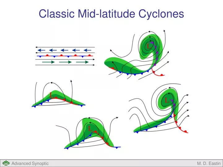
Classic Air Flow Patterns • Air Flow Patterns: System Relative • Most cyclone systems move faster than the low-level flow (so system-relative low-level • flow approaches from the east), but slower than the upper-level flow (so system relative • upper-level flow leaves toward the east) • As a result of the baroclinic instability process, three distinct “conveyor belts of air” develop
Classic Air Flow Patterns • Air Flow Patterns: System Relative • Most cyclones move east faster than • the low-level flow, but slower than the • upper-level flow. As a result…. • Warm-moist air enters the cyclone • from the east at low-levels south of • the center in the warm sector • (called the “warm conveyor belt”) • This air often rises along the cold and • warm fronts, is deflected northward • by mid-level flow, and eventually • deflected eastward by the strong • upper-level westerlies • Finally, the air originating in the warm • conveyor often exists the system • northeast of the center • Warm air rises and moves poleward • as expected from baroclinic instability L From Bluestein (1993) M. D. Eastin
Classic Air Flow Patterns • Air Flow Patterns: System Relative • Most cyclones move east faster than • the low-level flow, but slower than the • upper-level flow. As a result…. • Cold-moist air enters the from the east • at low-levels, but north of the cyclone • center and north of the warm front • (called the “cold conveyor belt”) • A portion of this air gradually rises • through the mid-levels and advected • equatorward (around the north side) • forming the comma head & low-level • wrap-around stratus clouds • Eventually the cold-conveyor air is • deflected eastward by the upper-level • flow and exits the system to northeast • of the center L From Bluestein (1993) M. D. Eastin
Classic Air Flow Patterns • Air Flow Patterns: System Relative • Most cyclones move east faster than • the low-level flow, but slower than the • upper-level flow. As a result…. • Cold-dry air enters the from the west • at upper and middle levels, south of • the cyclone center and west of the • cold front (called the “dry tongue jet”) • This air initially sinks to the middle and • lower levels (forming the dry slot and • cold front) and is deflected northward • by the flow within the mid-level trough • A portion of this air enters the comma • head, is forced upward and deflected • eastward by mid-level flow, and exits • to the northeast • Cold air sinks and moves equator as • expected from baroclinic instability L From Bluestein (1993) M. D. Eastin
Classic Moisture Patterns • Moisture Patterns (U.S. Perspective): • In most cases, the warm-conveyor belt • originates over the Gulf of Mexico at • low-levels, and is warm and very moist • (recall your thermodynamics) • In most cases, the cold-conveyor belt • originates over the North Atlantic at • low-levels, and is cool and less moist • (compared to the warm conveyor) • In most cases, the dry-tongue-jet • originates over Canada at upper • levels, and is cold and dry • Since moisture is often more important than • temperature for development of convection, • several names have been attached to this • critical “moisture conveyor belt”: • Moisture plumes • Atmospheric rivers • Pineapple express (from the Pacific) Water-Vapor Image 850mb Moisture and Winds M. D. Eastin
Classic Cloud Patterns • Cloud Patterns: • In the early stages (Area 1) of cyclone • development the dense cloud layer is primarily • confined to a narrow region along the cold front, • and a broad regions north of the warm front but • east of the cyclone center • Often called the “baroclinic leaf” • As the cyclone further develops (Area 2), • the warm, moist air that is ascending begins • to wrap around the poleward side (a result of • the baroclinic instability process), and the • cloud system begins to takes the shape • of a “comma” • The classic “comma cloud” L L From Bluestein (1993) M. D. Eastin
Classic Cloud Patterns • Cloud Patterns: • At the same time the comma cloud forms, the • cold-dry air that is descending begins to wrap • around the equatorward side (again, a result • of the baroclinic instability process), producing • a cloud free region (Area 3) • Often called the “dry slot” or “dry tongue” • As the cyclone develops, some warm, moist • air originating at low-levels east of the cyclone • is often wrapped completely around to the • equatorward side, but remains below the • descending air of the dry slot, forming a • shallow layer of stratus clouds (Area 0) • Often called the “wrap-around moisture” L L From Bluestein (1993) M. D. Eastin
Classic Cloud Patterns • Cloud Patterns: • A very nice (but large ~9 MB) infrared satellite animation of cyclone development from • the baroclinic leaf stage to a fully occluded system: • http://www.umanitoba.ca/environment/envirogeog/weather/leafanim.html M. D. Eastin
Classic Air Flow, Moisture & Cloud Patterns • Air Flow, Moisture, and Cloud Patterns in the PV Perspective • Recall the four distinct PV anomalies associated with developing cyclones… • They are consistent with the classic airflow, moisture, and cloud patterns !!! M. D. Eastin
Lifecycle of an East-Coast Cyclone Example Case: QG Perspective Evolution at 850 mb Solid Contours = Heights Dashed Contours = Thickness (Temperature) Note the strong WAA/CAA patterns Note the cyclone motion Blue box denotes period of most rapid development From Boyle and Bosart (1986) M. D. Eastin
Lifecycle of an East-Coast Cyclone Example Case: QG Perspective Evolution at 300 mb Solid Contours = Heights Dashed Contours = Isotachs Circles mark the 850mb cyclone center Note the trough evolution and tilt Blue box denotes period of most rapid development From Boyle and Bosart (1986) M. D. Eastin
Lifecycle of an East-Coast Cyclone • Example Case: QG Perspective • A diagnosis of the QG omega and • QG height-tendency equations were • performed to determine the relative • contributions of the vorticity and • temperature advection terms to the • total system vertical motion • Diagnostics were performed just prior • to and during the period of most rapid • system development (blue box) Vorticity Advection Temperature Advection L L Vorticity Advection Temperature Advection QG Diagnosis Omega (ω) at 500 mb Solid Contours = Rising motion Dashed Contours = Sinking motion Rising motion was due primarily to changes in vorticity advection with height over the surface cyclone (L) L L From Boyle and Bosart (1986) M. D. Eastin
Lifecycle of an East-Coast Cyclone • Example Case: QG Perspective • A diagnosis of the QG omega and • QG height-tendency equations were • performed to determine the relative • contributions of the vorticity and • temperature advection terms to the • total system vertical motion • Diagnostics were performed just prior • to and during the period of most rapid • system development (blue box) Vorticity Advection Total QG estimated χ L L Temperature Advection Observed χ QG Diagnosis Height Tendency (χ) at 900 mb 4 March 00Z Solid Contours = Height falls Dashed Contours = Height rises Height falls resulted from roughly equal contributions L L From Boyle and Bosart (1986) M. D. Eastin
Lifecycle of an East-Coast Cyclone • Example Case: QG Perspective • A diagnosis of the QG omega and • QG height-tendency equations were • performed to determine the relative • contributions of the vorticity and • temperature advection terms to the • total system vertical motion • Diagnostics were performed just prior • to and during the period of most rapid • system development (blue box) Vorticity Advection Total QG estimated χ L L Temperature Advection Observed χ QG Diagnosis Height Tendency (χ) at 900 mb 4 March 12Z Solid Contours = Height falls Dashed Contours = Height rises Height falls resulted from primarily vorticity advection L L From Boyle and Bosart (1986) M. D. Eastin
Lifecycle of a Colorado Lee-side Cyclone • Typical Cyclogenesis: • Form along the lee-side of the Rocky Mountains • due to a combination of downslope westerly flow • superimposed beneath the PVA region of an • upper-level short-wave trough • Lee cyclones never develop from downslope flow • alone (i.e., without upper-level forcing) • The cyclone initially moves southeastward due to • low-level WAA to the east, upper-level PVA to the • east, and downslope flow to the south 0 hours 6 hours From Bluestein (1993) M. D. Eastin
Lifecycle of a Colorado Lee-side Cyclone • Typical Cyclogenesis: • As the lee cyclone moves away from the mountains: • Strong CAA develops west of the center • The combined CAA and WAA induce the • the baroclinic instability process, and the • cyclone begins to rapidly intensify • The downslope flow and “southern forcing” • vanishes, and the cyclone begins to • move east • As the cyclone continues to intensify, the strong • WAA and CAA shift the warm front northeast of the • center and the cold front to the southwest • Storm motion begins to turn to the northeast 12 hours 18 hours From Bluestein (1993) M. D. Eastin
Lifecycle of a Colorado Lee-side Cyclone • Typical Cyclogenesis: • Many lee cyclones pass • over the Chicago area • (the “windy city”) • Most have reached maturity • and have begun the • occlusion process by the • time they have reached • the Great Lakes 24 hours 36 hours 42 hours 30 hours From Bluestein (1993) M. D. Eastin
Anticyclones – Climatology • Where do Surface AnticyclonesForm? • More frequent in the winter than the summer • Occurs further south during the winter and • further north in the summer • 1. In the southern Plains from Texas to Kansas up through North Dakota • 2. In the northern (Canadian) Rockies • These two locations are related to strong • cold air advection to the west of developing • Colorado leeside-lows and Alberta Clippers • (as the cyclones move east) 2 1 From Zishka and Smith (1980) M. D. Eastin
Anticyclones – Climatology • Where do Surface AnticyclonesMove? • Most surface anticyclones are short waves • and move east (progress) with the mean flow • Initial motions may be southerly (due to • topographic influences) but mature anticyclones • almost always move southeasterly • Related to motion toward maximum surface • pressure increases (via QG theory) • CAA maximum is often to the southeast • An upper-level NVA maximum is often • to the southeast From Zishka and Smith (1980) M. D. Eastin
Anticyclones – Climatology Where do Surface AnticyclonesDie? 1. Many do not decay until well off the East Coast over the subtropical-central Atlantic when they merge with the “Bermuda High” Related to “occlusion” and being cut-off from their source of cold-dry (polar) air 2. Over the central Rockies 3. Over the central and southern Appalachians Both locations are related to flow over (down) topography, since downslope flow creates surface lows (or weakens surface highs) 1 2 3 From Zishka and Smith (1980) M. D. Eastin
Anticyclones – Blocking Patterns • The Lack of Motion: • Waves no longer progress (move east) through a latitude belt • Stationary long waves dominate the hemisphere’s circulation • Often associated with large, intense, and stationary anticyclones • Occur year-round – most often in April – least often in September • Pattern persists for 10 or more days • Produce extreme weather → Hot and dry under anticyclones (possible drought) • → Cool and wet under cyclones (possible flooding) • Three Primary Types: Split Flow Block Omega Block Stationary Ridge From Bluestein (1993) M. D. Eastin
Anticyclones – Blocking Patterns Split-Flow Block M. D. Eastin
Anticyclones – Blocking Patterns Omega Block M. D. Eastin
Anticyclones – Blocking Patterns Stationary Ridge M. D. Eastin
References Bluestein, H. B, 1993: Synoptic-Dynamic Meteorology in Mid-latitudes. Volume II: Observations and Theory of Weather Systems. Oxford University Press, New York, 594 pp. Bosart, L. F., 1981: The Presidents Day snowstorm of 18-19 February 1979: A subsynoptic-scale event. Mon. Wea. Rev., 109, 1542-1566. Boyle, J. S., and L. F. Bosart: 1986: Cyclone / anticyclone couplets over North America. Part II: Analysis of major cyclone event over the eastern United States. Mon. Wea. Rev., 114, 2432-2465. Brennan, M. J., G. M. Lackmann, and K. A. Mahoney, 2008: Potential vorticity (PV) thinking in operations: The utility of non-conservation. Weather and Forecasting, 23, 168-182 Browning, K. A., 1986: Conceptual Models of precipitation systems. Wea. Forecasting, 1, 23-41. Hoskins, B. J., 1990: The theory of extra-tropical cyclones. Extra-tropical cyclones: The Erik Palmen Memorial Volume, C. W. Newton and E. O. Holopainen, eds, American Meteorological Society, 129-153. Hoskins B. J., and P. J. Valdes, 1990: On the existence of storm-tracks. J. Atmos. Sci., 47, 1854-1864. Miller, J. E., 1946: Cyclogenesis in the Atlantic coastal region of the United States. J. Meteor., 3, 31-44. Newton, C. W., 1956: Mechanism of circulation change during a lee cyclogenesis. J. Meteor., 13, 528-539. Petterssen, S., 1956:, Weather Analysis and Forecasting 2nd, ed. McGraw-Hill, 428 pp. Petterssen, S., and S. J. Smebye, 1971: On the development of extra-tropical cyclones. Quart J. Roy. Meteor. Soc., 97, 457-482. Sanders, F., 1988: Life history of mobile troughs in the upper westerlies. Mon. Wea. Rev., 116, 2629-2648. Zishka, K. M., and P. J. Smith, 1980: the climatology of cyclones and anticyclones over North America and surrounding oceans environs for January and July, 1950-1977. Mon. Wea. Rev., 108, 387-401. M. D. Eastin