Download
1 / 26
260 likes | 398 Views
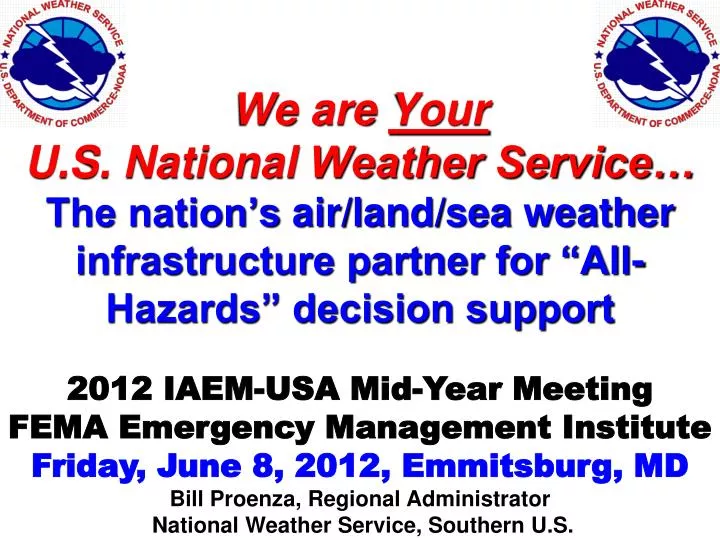
We are Your U.S . National Weather Service… The nation’s air/land/sea weather infrastructure partner for “All-Hazards” decision support. 2012 IAEM-USA Mid-Year Meeting FEMA Emergency Management Institute Friday, June 8, 2012 , Emmitsburg , MD Bill Proenza , Regional Administrator

E N D
We are Your U.S. National Weather Service… The nation’s air/land/sea weather infrastructure partner for “All-Hazards” decision support 2012 IAEM-USA Mid-Year Meeting FEMA Emergency Management Institute Friday, June 8, 2012, Emmitsburg, MD Bill Proenza, Regional Administrator National Weather Service, Southern U.S.
National Weather Service: only six regions with 4 verylarge CONUS regions. Alaska Region Eastern U.S. Central U.S. Western U.S. Southern U.S. w/ 27% of NWS offices Pacific Region Hawaii & Guam Puerto Rico & Virgin Islands
Your U.S. National Weather Service… Born in1870 by President Grant ‘s executive order and an Organic Act of 1890, codified as amended in section 313 of title15 of the federal statutory code (United States Code) missions the National Weather Service to issue and distribute warnings of environmental hazards. In summary the National Weather Service (NWS) provides weather, hydrologic, and climate forecasts and warnings for the United States, its territories, adjacent waters and ocean areas, for the protection of life and property and the enhancement of the national economy. NWS data and products form a national information database and infrastructure which can be used by other governmental agencies, the private sector, the public, and the global community. In addition, the National Weather Service supports the Emergency Alert System and provides, in coordination with the Federal Emergency Management Agency, public dissemination of critical pre-event and post-event information of all hazards, including natural disasters and terrorist events. The National Weather Service all-hazards support authority emanates primarily from the National Response Framework as authorized by The Homeland Security Act of 2002, codified predominantly as amended in sections 101 to 557 of title 6 of the United States Code, and The Robert T. Stafford Disaster Relief and Emergency Assistance Act, codified as amended sections 5121 to 5206 of title 42 of the United States Code.
YourU.S. National Weather Service clearly has the Congressionally mandated authority to issue environmental warnings for the United States YourNational Weather Service (NWS) directly provides 24x7 products, services, data gathering and dissemination/distribution, bulletins, outlooks, forecasts and warnings from its WFOs, RFCs, ROCs, Tsunami Centers, CWSUs, guidance & prediction centers for air, land, sea, climate and space services! Attribution is imperatively important in our representative form of government to properly fund the NWS based on performance & mission!
NWS Regional Warning Statistics • Source: NWS Headquarters Interactive Product Database • By “Product” – counts are based on TOR, SVR, FFW, SMW, & CFW • By “County or Zone” – counts are based on WSW, NPW & Hurricane Strikes • Available Periods of Record: • TOR, SVR, FFW: 01/01/86 – 12/31/10 • SMW: 10/01/01 – 12/31/10 • NPW, WSW, CFW: 10/01/06 - 12/31/10 and Hurricane Strikes: 1900 - 2009 • WSW Warnings (Blizzard, Ice Storm, Lake Effect Snow, Wind Chill, Winter Storm) • NPW Warnings (Dust Storm, Excessive Heat, Freeze, Hard Freeze, High Wind)
Severe Weather Disasters since 1980, States with most disasters shown in black • US Billion Dollar Disasters for the 1980-2010 Period • plus in 2011: • Tornado outbreaks and flash floods are the biggest killers. • Tropical Cyclones and storm surges add to these billion dollar events.
The USA had 8386 Tornadoes in 6 years. We are uniquely tornado vulnerable ! 5 (2003 – 2008) 20 5 AK - 3 30 4 4 221 16 6 42 263 29 3 182 230 88 40 RI - 1 66 10 381 DE - 2 10 360 86 62 161 8 413 10 195 MD - 43 261 161 771 429 224 163 29 228 320 HI - 7 301 64 PR - 4 249 379 369 870 212 351 We are a confrontational ………….battleground: continental vs tropical air. e.g. ’04: 1817; ‘08: 1690
F2+ Tornado Days, 1961-2010 DataThe true shape of the USA’s tornado “alley” is really an “L” not just a north-south area! reference: NWS/Storm Prediction Center
Deadly Flash Floods • Nashville, TN May 1-3, 2010 • 10-16 inches of rain in 48 hours • 31 fatalities • $2.3 billion in damages • Arkansas June 11, 2010 • 4-7 inches of rain in 24 hours most fell in about 6 hours • 20 fatalities • $9 million in damages • River rose 20 feet in just a few hours • South Texas July 2010 • Tropical moisture from Hurricane Alex and TD#2 caused more than 50 inches of rain over 10 days (in Mexico, Rio Grande Basin) • $70 million in damages (preliminary estimate)
Largest area of extreme drought is in the Southeastern US and TX/NM !
We are certainly geographically placed to be hurricane vulnerable ! The Atlantic Basin has had over 1400 tropical cyclones since 1851
2012 Atlantic Basin Tropical Cyclone Seasonal Trend • First the climatology (1981-2010): 12 named storms (39mph), 6 hurricanes (74mph), 3 major hurricanes (111mph). • NWS: released May 24th:9-15 named, 4-8 hurricanes, and 1-3 major hurricanes. • CSU (Bill Gray): updated June 1: 13 named, 4 hurricanes, and 2 major hurricanes. • Accuweather: holding at 12 named storms, 5 hurricanes and 2 major hurricanes.
NWS Regional Warning Statistics • Source: NWS Headquarters Interactive Product Database • By “Product” – counts are based on TOR, SVR, FFW, SMW, & CFW • By “County or Zone” – counts are based on WSW, NPW & Hurricane Strikes • Available Periods of Record: • TOR, SVR, FFW: 01/01/86 – 12/31/10 • SMW: 10/01/01 – 12/31/10 • NPW, WSW, CFW: 10/01/06 - 12/31/10 and Hurricane Strikes: 1900 - 2009 • WSW Warnings (Blizzard, Ice Storm, Lake Effect Snow, Wind Chill, Winter Storm) • NPW Warnings (Dust Storm, Excessive Heat, Freeze, Hard Freeze, High Wind)
Annualized United States Severe Weather Deaths30 Year Average (1979-2008 NWS Storm Data) • Flash Floods & River Flooding 93 (flash floods alone: 73) • Severe Thunderstorms 115 Lightning (58) Tornadoes (57) • Hurricanes & Surge 48 Total avg. annual deaths: 256
Recent Earthquake & Tsunami Deaths • Indian Ocean 9.3 Earthquake & Tsunami, Dec 26, 2004: 230,000 deaths (14 countries) • Haiti 7.0 Earthquake & Tsunami, Jan 12, 2010: 316,000 deaths (USGS) • Tohoku, Japan 9.0 Earthquake & Tsunami, Mar 11, 2011: 19,711 missing and dead (UNESCO IOC Bulletin 29, 9/30/11)
Since 1842: Caribbean (PR, USVI & Neighbor Nations) with only 1/6 the area had six (6) times more tsunami deaths than northeastern corner of the “Pacific Rim” (Alaska, Hawaii, west coasts of Canada & US)! 1842-2010: 3510+ deaths 1842-2010: 579 deaths http://www.srh.noaa.gov
NWS ‘90s Modernization, Tripled Tornado Warning Lead Times but improvement pace mostly has leveled-out in last decade WFOs become fully Functional (12 mins) Pre-local Forecast Offices and pre-radar (4 mins) Doppler radars Installed (6 mins)
Better All-Hazards Decision Support with critical Emergency Response Meteorologists “ER-Mets” at ROC Regional Operations Center in Ft. Worth WFO in Tampa, FL WFO in New Orleans WFO in Baltimore/Wash. WFO in Charleston, WV NWS Headquarters in Silver Spring, MD Staffing “pilot” projects for a Weather-Ready Nation
Radar Improvement and its Next Generation • Dual-Pol Radar (Currently being installed) • Finer resolution of storm structure & pinpointing tornadoes. • Finer rainfall estimates & flash-flood lead-times. • Phased Array (10 yrs) • 30 second complete “volume scans” adding precious minutes to warning lead-times ! • Higher resolution on velocity data, storm structure imaging, precipitation intensity
EMWIN: Emergency Management Weather Information Network ! • Minimal costs! PC, dish and receiver (under $2000) • Nomonthly fees whatsoever ! • Speed and Reliability (via GOES satellite) • Updated Info Received Instantly- 24 / 7 • Portable - Mobile (work, home or road) 1 meter dish • Software – programmable to receive your needs • Alarm Capable- Visible & Audible • Retransmission - Automatically retransmittable National Weather Service EMWIN info: http://www.nws.noaa.gov/emwin/winven.htm
WFO staff members who worked shifts during tornado outbreak period (April 25-30, 2011) with less than 10-hour rest ! Number of Personnel Listed by Southern Region WFO
“Research shows us that giving people the chance for even an additional one hour of rest during critical periods in a schedule can improve work performance and reduce the potential for fatigue.” ----- FAA Administrator, 2011 • There will be a minimum of two controllers on-duty at all shift assignments even during less active late night shifts. • Traffic controllers will no longer be able to switch to an unscheduled midnight shift following only a day off. FAA Responds to 2011 air traffic safety concerns with rest policy changes:
What is “ER-MET”?The Emergency Response MeteorologistThis NWS initiative provides EMs faster 24x7 decision-support with all hazards weather information from your nearby WFO or having an ER-MET deployed to your event’s command site!
NWS hears EMs… -advocating more National Weather Service branding …not only essential to annual budget support but also for a warning credibility that builds our national resiliency. -the “fair-weather” staffing levels at the nation’s network of NWS warning offices’ can be vulnerable to our mission. Both NWS technology infusion and the 3-person ER-MET add-on staffing is needed at all WFOs for a weather-ready national resiliency. -questioning us why is NWS so underfunded ? …despite demonstrated life saving warnings and cost/beneficial performances ? …and, despite what was a $22 million FY-12 increase in NWS appropriations for FY12 ?
A Weather-Ready Nation… ..avoids having to learn from tragedy ! Bill Proenza, Regional Administrator U.S. National Weather Service, Southern Region bill.proenza@noaa.gov Office: 817-978-1000 Questions, comments ?