Download
1 / 15
150 likes | 281 Views
Madden/Julian Oscillation: Recent Evolution, Current Status and Forecasts. Update prepared by Climate Prediction Center / NCEP August 29, 2005. Outline. Overview Recent Evolution and Current Conditions Madden Julian Oscillation Forecast Summary. Overview.

E N D
Madden/Julian Oscillation: Recent Evolution, Current Status and Forecasts Update prepared by Climate Prediction Center / NCEP August 29, 2005
Outline • Overview • Recent Evolution and Current Conditions • Madden Julian Oscillation Forecast • Summary
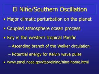
Overview • During mid-March the MJO became active and completed two cycles around the global tropics that lasted until mid-May. • An eastward propagating oceanic Kelvin wave initiated by persistent westerly anomalies near the date line in February reached the South American coast in April. There has been no additional oceanic Kelvin wave activity. • The MJO remains weak. Convective anomalies across most of the equatorial global tropics are weak. Low-level easterly anomalies persist across the western Pacific while low-level westerly anomalies persist across the eastern Pacific. • The MJO is expected to remain weak for the next 1-2 weeks. • Potential benefits/hazards in the global tropics, however, still include an enhanced chance of tropical cyclone development for weeks 1 and 2 in the Atlantic Basin. Currently, powerful Hurricane Katrina is making landfall along the central Gulf Coast and will track inland. Across the western Pacific, Super Typhoon Talim and TD 14W are forecast to strengthen. Meanwhile, above average rainfall will persist across west-central Africa during week 1 & 2. In addition, there is an increased chance of above average rainfall across Southeast Asia during week 1.
850-hPa Vector Wind Anomalies (m s-1) Easterly anomalies remain across the western Pacific. Note that shading denotes the magnitude of the anomalous wind vectors. Westerly anomalies persist in the eastern Pacific.
Low-level (850-hPa) Zonal (east-west) Wind Anomalies (m s-1) Weaker-than-average easterlies (orange/red shading). Stronger-than-average easterlies (blue shading). Eastward propagating anomalies existed from mid-March until mid-May. Time During June through early July, easterly anomalies dominated the western equatorial Pacific In early August, a period of westerly anomalies were evident in the western Pacific. Anomalies remain weak during late August Longitude
Outgoing Longwave Radiation (OLR) Anomalies (7.5°S-7.5°N) Drier-than-average conditions (orange/red shading) Wetter-than-average conditions (blue shading) Time The MJO was strong from late March through mid-May but has been very weak during June, July and August. Current anomalies of either sign are weak across most of the equatorial global tropics. Longitude
Outgoing Longwave Radiation (OLR) Anomalies (2.5°N-17.5°N) Drier-than-average conditions (orange/red shading) Wetter-than-average conditions (blue shading) A period of enhanced convection north of the equator in the far western Pacific was evident during late July and early August. Time During mid-August, suppressed convection north of the equator stretched from Indonesia into the western Pacific. Longitude
Anomalous OLR and 850-hPa Wind: Last 30 days Enhanced convection developed across the eastern Pacific and central America during mid-August. Easterly anomalies in the western Pacific north of the equator have shifted west during August.
200-hPa Velocity Potential Anomalies (5°S-5°N) Positive anomalies (orange/red shading) indicate unfavorable conditions for precipitation. Negative anomalies (blue shading) indicate favorable conditions for precipitation. Eastward propagating upper-level convergence and divergence is evident from March through Mid-May indicative of the strong MJO during this period. The MJO has been weak since June. Regions of upper level divergence and convergence have generally been stationary with a eastward shift in late July and early August. Time Longitude
200-hPa Vector Winds and Anomalies (m s-1) Anticyclonic flow aloft across the Gulf of Mexico Note that shading denotes the magnitude of the anomalous wind vectors.
Heat Content Evolutionin the Eq. Pacific Through 2004 and 2005 there were several cases of eastward-propagating oceanic Kelvin waves (indicated by dashed black lines in the figure). Each Kelvin wave was initiated when the easterlies weakened over the equatorial Pacific in association with Madden-Julian Oscillation (MJO) activity. During February 2005, a strong Kelvin wave (initiated by persistent westerly anomalies near the date line unrelated to the MJO) developed and continued to strengthen during March and reached the South American coast during early April. Heat content has become above average in the western Pacific during July and August. Time Longitude
Empirical Forecast Based on the Real-time Multivariate MJO index Weak MJO activity is forecast for the next 6-10 day period.
Potential Benefits/Hazards –Week 1 2 1 3 4 5 Super Typhoon Talim is forecast to track west towards Taiwan and southeast China. TD 14W will slowly strengthen in the western Pacific. Powerful Hurricane Katrina will track inland and weaken. Increased chance of tropical cyclone development across the Atlantic Basin. Increased chance of above average rainfall across west-central Africa. Increased chance of above average rainfall across Southeast Asia.
Potential Benefits/Hazards – Week 2 1 2 Increased chance of tropical cyclogenesis across the Atlantic Basin. Increased chance of above average rainfall across west-central Africa.
Summary • During mid-March the MJO became active and completed two cycles around the global tropics that lasted until mid-May. • An eastward propagating oceanic Kelvin wave initiated by persistent westerly anomalies near the date line in February reached the South American coast in April. There has been no additional oceanic Kelvin wave activity. • The MJO remains weak. Convective anomalies across most of the equatorial global tropics are weak. Low-level easterly anomalies persist across the western Pacific while low-level westerly anomalies persist across the eastern Pacific. • The MJO is expected to remain weak for the next 1-2 weeks. • Potential benefits/hazards in the global tropics, however, still include an enhanced chance of tropical cyclone development for weeks 1 and 2 in the Atlantic Basin. Currently, powerful Hurricane Katrina is making landfall along the central Gulf Coast and will track inland. Across the western Pacific, Super Typhoon Talim and TD 14W are forecast to strengthen. Meanwhile, above average rainfall will persist across west-central Africa during week 1 & 2. In addition, there is an increased chance of above average rainfall across Southeast Asia during week 1.