Download
1 / 27
270 likes | 295 Views
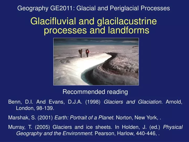
Geography GE2011: Glacial and Periglacial Processes Glacifluvial and glacilacustrine processes and landforms. Recommended reading Benn, D.I. And Evans, D.J.A. (1998) Glaciers and Glaciation. Arnold, London, 98-139. Marshak, S. (2001) Earth: Portrait of a Planet . Norton, New York, .

E N D
Geography GE2011: Glacial and Periglacial Processes Glacifluvial and glacilacustrine processes and landforms Recommended reading Benn, D.I. And Evans, D.J.A. (1998) Glaciers and Glaciation. Arnold, London, 98-139. Marshak, S. (2001) Earth: Portrait of a Planet. Norton, New York, . Murray, T. (2005) Glaciers and ice sheets. In Holden, J. (ed.) Physical Geography and the Environment. Pearson, Harlow, 440-446, .
1. Introduction • Structure of lecture • Sources of water in glaciers • Drainage routeways • Glacial runoff regime • Glacifluvial erosion • Glacifluvial deposition • Glacial lakes NB Glacifluvial = fluvioglacial Nigardsbreen, Norway, June 2004
2.Sources of water on glaciers • Surface sources: • Surface melt of snow and ice • Rainfall runoff • Lake discharge Basal and internal sources: • Melt of basal ice by geothermal heat • Frictional melt at glacier bed • Internal friction • Advective heat flux from meltwater • Subglacial groundwater
3. Drainage routeways • Supraglacial streams • Moulins and crevasses • Englacial channels and conduits • Marginal & sub-marginal channels • Subglacial routeways: • Sheet flow (< 1mm thick) • Channels • Linked cavities • Braided ‘canals’ • Proglacial streams Supraglacial stream Cold-ice glaciers do not have internal drainage routeways: supraglacial, marginal and proglacial routeways only. Subglacial stream
Drainage routeways (continued)…. Supraglacial runoff and ponding Moulin (glacial sinkhole)
Drainage routeways (continued)…. Ice-marginal stream draining into a proglacial lake Subglacial stream emerging at a portal at the glacier terminus
Drainage routeways (continued)…. Left: ice-marginal stream draining Mackensen Glacier, arctic Canada Above: sub-marginal drainage at Schei Glacier, arctic Canada Left: subglacial stream emerging from Nigardsbreen, Norway
4. Glacial runoff regime Discharge of the Schei River, arctic Canada, June to August Warmer air temperatures Diurnal discharge fluctuations Rainstorms Low air temperature in late July - low discharge No flow before late June Nival flood Only 2-3 months of runoff, but numerous flood events due to diurnal melt of snow and ice, and flashy response to rainstorms
Jokulhlaup: Glacial outburst flood, usually caused by breaching of an ice dam or moraine dam. Jokulhlaup on Sverdrup River, arctic Canada: discharge >2500 m3 s-1 Left: jokulhlaup caused by volcanic eruption melting ice cap, Iceland
5. Glacifluvial erosion • Meltwater streams are important geomorphological agents: • Hydrologic regime - numerous short-lived flood events. • Abundant readily-entrained glacigenic sediment (till, etc) - • high sediment load and effective bed abrasion. • Subglacial streams flow rapidly under hydrostatic pressure. Glacifluvial erosion forms meltwater channels:
Marginal, submarginal and subglacial meltwater channels Submarginal channel, Skye Subglacial channel, Lewis
Subglacial chutes Moulin Form when meltwater drops down a moulin then flows laterally across the glacier bed: Subglacial chutes at the foot of the Lomond Scarp
Col channels Form when a supraglacial or englacial stream is superimposed on to the underlying topography by ice-sheet downwastage:
Lake overflow channels Channels cut by drainage of a glacier-dammed lake across a col: Col channel, Strathrory, Easter Ross
Proglacial channels Formed by meltwater flowing from glacier termini. Many present rivers flow in former proglacial channels. Abandoned proglacial meltwater channel, Sør-Illabreen, Norway.
6. Glacifluvial deposition Characteristics of glacifluvial deposits are similar to those of alluvial deposits: 1. Often stratified (bedded) due to changing flow conditions: Glacifluvial deposits, Barrie, Southern Ontario
2. Clasts in glacifluvial deposits are usually rounded by abrasion
Glacifluvial deposits are a major source of sand and gravel for concrete, roads and other construction industries.
6.1 Depositional landforms 6.1.1 Ice-contact glacifluvial landforms Origin of ice-contact glacifluvial landforms(from Strahler and Strahler, 2005)
Esker: course of a subglacial stream, infilled by glacifluvial sand and gravel. Kame: glacifluvial sands and gravels dumped from an englacial or supraglacial position
Kame terrace Proglacial outwash plain (sandur) Kame terrace formed at former glacier margin, Ellesmere Island, arctic Canada
Kettle holes (kettles) are enclosed depressions formed by: Burial of blocks of stagnant glacier ice under glacifluvial or glacial sediments during glacier retreat. Slow melting of buried ice to form an enclosed hollow. Developing kettle hole, Iceland Ancient kettle hole, Glen Ling, Scotland
6.1.2 Proglacial glacifluvial landforms: sandar (outwash plains) A sandur (plural sandar) is a glacifluvial floodplain. Sandur plain (outwash plain) - topographically unconstrained (e.g. southern Iceland): Valley sandur (outwash train) - forms a valley fill in mountain areas:
Characteristics of sandar • Braided channel network • Rapidly-changing flow - frequent avulsion • Downstream fining of gravel. • Sandar deposits laid down during rapid glacier retreat often form kettled sandar (pitted sandar). • Fluvial incision into sandar creates outwash terraces.
7. Glacial lakes (ice-dammed lakes) Form where glacier ice forms a barrier to drainage: • Range in size from small ponds to inland seas: Glacial Lake Agassiz (North America) covered 2,000,000 km2. • Various locations: • Marginal lakes in ice-free tributary valleys • Trunk-valley lakes dammed by tributary valley glaciers • Glacier confluence lakes • Proglacial lakes.
Landforms and deposits associated with former ice-dammed lakes • Shorelines formed at lake margins - usually indicate lake drainage via a outflow channel across a col. • Raised deltas, where streams entered the former lake. • Glacilacustrine deposits: fine-grained rhythmites containing dropstones. Glacial lake dammed by Mackensen Glacier, Ellesmere Island: a trunk valley lake dammed by a glacier crossing a major valley.
Shorelines Site of glacial lake End moraine The ‘parallel roads’ of Glen Roy: shorelines formed at three levels when a glacier dammed the mouth of the valley 12000 years ago

![Glaciation [ Date] Today I will: - Locate areas of g laciated u plands on a map](https://cdn1.slideserve.com/2466874/slide1-dt.jpg)