Download
1 / 16
160 likes | 297 Views
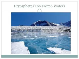
SAR/InSAR Cryosphere Breakout Session. Oct 20, 2004. Big Questions. Understand glaciers and ice sheets sufficiently to predict their role in sea level rise. How does sea ice respond to and influence global climate change and biological processes?

E N D
SAR/InSAR Cryosphere Breakout Session Oct 20, 2004
Big Questions • Understand glaciers and ice sheets sufficiently to predict their role in sea level rise. • How does sea ice respond to and influence global climate change and biological processes? • How do changes in the cryosphere affect human activity? • How much water is stored as seasonal snow and how is it changing? • How much carbon is exchanged between the permafrost and the atmosphere?
Science Activities with Existing Systems/Archives SAR-derived surface motion and imagery currently support: • Studies aimed at understanding processes such as ice sheet and sea ice dynamics. • Baseline measurements such as glacier discharge, sea ice motion and extent. • Studies to develop snow cover and permafrost algorithms.
Access to Existing Archive and Systems • Room for improvement, but overall pretty good for polar regions (with notable exceptions). • Poor for mid-latitude regions
Planned Systems Planned systems such as Radarsat-2 and TerraSAR X could build upon current capabilities. Current and planned systems could begin to build time series of observations.
Plans for cooperative use of satellites nearing deployment? • No firm agreements identified. • Potential for continued RADARSAT-1 operations beyond RADARSAT 2 launch. • Future agreements for planned systems desperately needed • especially over the next 5-10 years before a US mission is launched. • No approved missions beyond 2011!
Limitations of current and planned systems • Inadequate systematic coverage of the Arctic and the Southern Oceans. • Reduces sea ice motion monitoring and climate time series. • Planned and existing systems are not optimized for InSAR. • Problematic for important areas of Greenland and Antarctica. • Very limited mountain glacier coverage.
Science goals satisfied with a new InSAR mission: ECHO Baseline (8-day repeat, polar-orbiting, tightly-controlled orbit, L-band, left-right looking) • All ice sheetand glacier objectives related to surface motion. • Would provide coverage in areas where current/planned systems are problematic (some of which are the largest contributors to sea level change). • Frequent coverage for characterizing outlet glacier variability. ECHO+ (Fully calibrated, ScanSAR, power/storage for full Arctic and Southern Ocean Coverage) • Meets sea ice motion research objectives.
Desired Additional Capabilities • Near real-time access for operational ice monitoring. • Dual or Quad polarization might enhance some science objectives.
Conclusions • No Data No Science • No Funding No Science • No dedicated mission diminished science
Solutions • Current • Cryospheric science has benefited from pre-arranged agreements, polar ground stations, data management facilities. • Short term • Develop new cooperative agreements • Long term • Dedicated “ECHO+” series of missions backed by cooperative agreements. • Comprehensive arrangements with international partners to fulfill cryospheric objectives • No opportunities exist yet.
Sea Ice • How does sea ice respond to and influence global climate change ? • How does sea ice moderate and modulate surface fluxes? • Ice albedo feedback • thermohaline circulation • Moisture/energy/boundary layer exchange • How are the mass balance and extent changing? • How do spatiotemporal changes in sea ice affect biological processes and human activities?
Glaciers and Ice Sheets Understand glaciers and ice sheets sufficiently to predict their role in sea level rise. • What is the current mass balance and its contribution to sea level rise? • What processes (e.g., fast flow, ice shelf melt) control ice sheet discharge and how are they affected by environmental change? • Do recently observed changes in discharge normal variability or do they indicate a longer-term trend? • How is the global distribution of alpine glaciers changing?
Snow Cover • How much snow is there? Where is it? How does it influence the climate? • How much water is stored as seasonal snow? • What is the thermal capacity and resistance of snow cover on land and sea ice? • How is snow cover changing over space and time.
Permafrost • What is the current distribution of permafrost? • How does this distribution respond to climate change? • How much carbon is exchanged between the permafrost and the atmosphere?
Programmatic Limitations of current and planned systems • No access (including funding) to planned systems and data volumes needed. • No acquisition plans designed to meet science objectives.