Download
1 / 14
140 likes | 351 Views
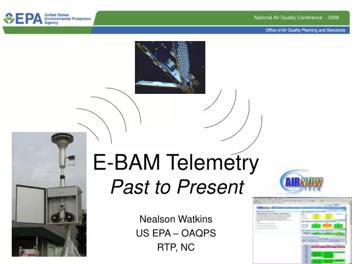
E-BAM Telemetry Past to Present. Nealson Watkins US EPA – OAQPS RTP, NC. In response situations, people want data!. The EBAM is widely used in “response” activities EBAM data from fire/smoke monitoring and emergency response are in high demand with lots of visibility

E N D
E-BAM TelemetryPast to Present Nealson Watkins US EPA – OAQPS RTP, NC
In response situations, people want data! • The EBAM is widely used in “response” activities • EBAM data from fire/smoke monitoring and emergency response are in high demand with lots of visibility • Data quality, control and ownership is often a major concern • The top priority is obtaining, transmitting, and displaying data for health & safety decision making purposes
Original EBAM Telemetry System • Met One partnered with AIRSIS to allow EBAMs to move data via satellite • Data is stored by AIRSIS and shared through AIRSIS web applications • ORBCOM is the original satellite network used by AIRSIS • The associated telemetry package is the AQEB-2000 • This modem is comprised to two pieces that attach to the EBAM
Problems with ORBCOM • Through experience, AIRSIS and EBAM users discovered several issues in using ORBCOM for near-real time data transfer: • Poor performance at high latitudes • Latency: the time of transfer from EBAM to satellite(s) to AIRSIS was often inconsistent and slow • Missed reporting: as opposed to the latency issue; data sometimes wouldn’t make it into the system queue at all
Introducing the “Iridium” network • Due to ORBCOM issues, AIRSIS engaged Iridium in 2007, and entered into an agreement at the first of 2008 • Iridium allows for consistently fast transfers, anticipated to be less than 20 seconds • Requires only one piece of hardware on the EBAM • Should have less problems in higher latitudes • All new EBAMs from Met One now have Iridium units (if you order the telemetry system option)
Take-home Notes for EBAM users • AIRSIS still supports ORBCOM hardware and data submissions • AIRSIS is may offer a deal for $1000 to upgrade from ORBCOM to Iridium hardware • New Iridium hardware for the EBAM currently costs approximately $2400
Iridium Satellite Airtime • There are 3 flavors of airtime plans: • 4 month plan: actually 120 days of the year, a user can submit data (used in 24 hour increments); $40 activation, $600 for airtime • 8 month plan: same concept as the 4 month plan, but has 240 days; $40 activation, $1200 for airtime • 12 month plan, same concept; $40 activation, $1800 for airtime • AIRSIS will aid customers in tracking their airtime usage (like a cell-phone plan) through the year
Data Handling & Storage • AIRSIS airtime plans come with password protected web access • AIRSIS can work with customers to migrate data to customized websites, such as the Forestry Service website at: http://www.satguard.com/usfs/ • AIRSIS can also automatically migrate data into AIRNow-Tech
AIRNow-Tech Connection • In 2005, AIRNow-Tech was enabled to receive AIRSIS data • “Connection” was broken in 2007 as Iridium system was being investigated • The linkage is being re-established now (anticipated April launch) • Once re-established EBAM data can be directed, at will of the EBAM operator, through AIRSIS to AIRNow-Tech
Mobile Networking • AIRNow-Tech has the capability to handle temporary and mobile data sources • Temporary sites can be displayed tabular or in Navigator • The temporary site feature was first used in Hurricane Katrina response efforts • Data needs to be tied in with GPS coordinates for each data point
AIRNow-Tech Capabilities • Beyond viewing the tabular EBAM data online, users can visualize their data by using AIRNow-Tech Navigator: • View EBAM data overlaid with meteorology (SLT data and NWS data) • View EBAM data with existing air quality data • View known fire locations and smoke plumes derived from the Hazard Mapping System (HMS) • Overlay HYSPLIT trajectories
HMS smoke plumes with forward HYSPLIT trajectories Forward HYSPLIT trajectories from fire locations. Labels indicate a trajectory’s path after each consecutive hour. Fire locations are denoted by red triangles Toggle through previous or future hours and days to view changes in air quality, fire locations, and trajectory parcel locations
Thanks to AIRSIS and Sonoma Technologies for their assistance on ensuring that we had the latest information on this topic. Questions?