Download
1 / 16
160 likes | 458 Views
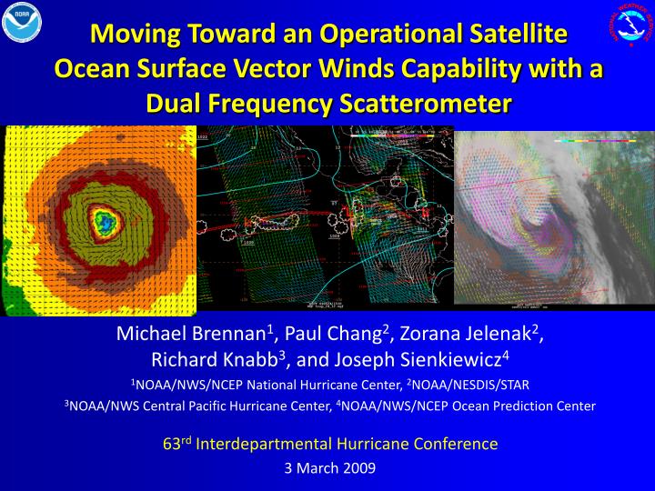
Moving Toward an Operational Satellite Ocean Surface Vector Winds Capability with a Dual Frequency Scatterometer. Michael Brennan 1 , Paul Chang 2 , Zorana Jelenak 2 , Richard Knabb 3 , and Joseph Sienkiewicz 4 1 NOAA/NWS/NCEP National Hurricane Center, 2 NOAA/NESDIS/STAR

E N D
Moving Toward an Operational Satellite Ocean Surface Vector Winds Capability with a Dual Frequency Scatterometer Michael Brennan1, Paul Chang2, Zorana Jelenak2, Richard Knabb3, and Joseph Sienkiewicz4 1NOAA/NWS/NCEP National Hurricane Center, 2NOAA/NESDIS/STAR 3NOAA/NWS Central Pacific Hurricane Center, 4NOAA/NWS/NCEP Ocean Prediction Center 63rd Interdepartmental Hurricane Conference 3 March 2009
Satellite Ocean Vector Winds and NWS Operations • Satellite ocean vector winds are an important tool for tropical cyclone (TC) and marine analysis and forecasting at NCEP Centers and WFOs • Useful for analysis of TC intensity, location, and structure – however limited by resolution and rain contamination • Critical for detection of and warning for hurricane-force extratropical cyclones and mesoscale wind events • Used by coastal WFOs to determine regions of swell generation – limited for coastal and nearshore applications by land mask and resolution
Where We are Now • QuikSCAT aging rapidly • Multiple failures have pressed backup systems into operation • Several single points of failure now exist – science telemetry transmitter, spare battery, power control unit • ASCAT data available and used in NWS operations • Retrievals have reduced coverage (~60%) and twice as coarse spatial resolution compared to QuikSCAT • While less sensitive to rain, ASCAT shows low bias at high wind speeds compared to QuikSCAT • NOAA still searching for long-term operational ocean vector winds solution • XOVWM best addresses requirements but deemed too costly for NOAA to do alone
NOAA/NASA/JAXA Partnership • Japanese Space Agency (JAXA) planning GCOM-Carbon cycle (GCOM-C) and GCOM-Water cycle (GCOM-W) series to succeed ADEOS and Aqua missions • 13-year mission; three satellites in series, each with 5-year lifetime, 1-year overlap with follow-on satellites for calibration • GCOM-W1 planned for launch late 2011, GCOM-W2 2016 • Since June 2008 NOAA, NASA/JPL, and JAXA have been discussing potential partnership • U.S. would provide Dual Frequency Scatterometer (DFS) on GCOM-W2 mission • Three meetings held between NOAA-JPL-JAXA • 1st meeting: JAXA specified spacecraft constraints within which GCOM-W scatterometer should be designed • 2nd meeting: DFS accepted as a baseline for GCOM-W2 • 3rd meeting: Joint Science Team and Research and Operational Users Working Group (ROUWG) established
Dual Frequency Scatterometer (DFS) HH VV • Ku-band (H-pol and V-pol) • C-band (H-pol) • Mitigates rain contamination • Instrument design constrained by GCOM-W2 bus and ASMR instrument designs • 1.8 to 2-m antenna • Basic resolution 10 km • 1800-km wide swath (identical to QuikSCAT) • AMSR onboard with DFS provides opportunity to improve surface products from both Slice resolution 16km x 3km 25-34km x 3km
DFS Design and Capabilities • C-band channel retrievals much less affected by rain • DFS will have H-pol C-band channel at both incidence angles • Experience with ASCAT and DFS simulations show that adding C-band channel will yield substantial improvements over QuikSCAT retrievals in rain DFS has capability to provide accurate retrievals in nearly all weather conditions, including category 1 and 2 hurricanes
DFS Expected Performance • Highest resolution of DFS 10 km compared to 12.5 km for QuikSCAT • DFS will improve wind retrieval accuracy over QuikSCAT by at least 20% • Increased power, number of looks, frequency diversity, larger aperture size • At high wind speeds, DFS can improve accuracy up to 50% • Small-scale wind maxima in TCs still cannot be resolved, but rain contamination mitigated • No significant improvement in the distance to the coast achievable between QuikSCAT and DFS
DFS vs. QuikSCAT and XOWVMSimulated Retrievals based on Katrina (2005) QuikSCAT DFS XOVWM “Truth” • DFS better captures true wind signal where QuikSCAT high winds are tied to rain • DFS accurately depicts hurricane-force wind radii and retrieves winds into cat 2 range, but not into cat 3 range • DFS cannot identify small scale wind maxima seen by XOVWM H5 H4 H3 H2 H1 50 TS
DFS vs. QuikSCAT and XOWVMKatrina Simulated Retrievals • DFS captures true wind signal well into hurricane-force range • DFS shows underestimation of winds ≥ 80-85 kt (not seen in XOVWM) • Significant improvement over QuikSCAT QuikSCAT DFS XOVWM Retrieved Wind Speed “True” Wind from WRF simulations
DFS vs. QuikSCAT and XOWVMCoastal Retrievals – Shelikof Strait, Alaska QuikSCAT DFS XOVWM • DFS provides retrievals slightly closer to the coast compared to QS • Work underway that could provide retrievals from QuikSCAT and DFS within 6 km of the coast • DFS does not shows large improvement seen in coastal XOVWM retrievals • Higher resolution of DFS does capture smaller-scale wind features not seen by QS
Statements of DFS ImpactTropical Cyclones • Identification of well-defined surface circulation to determine TC formation • Begin watch/warnings/advisory process earlier, especially when no aircraft recon available (eastern Atlantic, most Pacific TCs) • Better estimate of initial motion • Important for subjective analysis and forecast and for initiation of model guidance • Directional ambiguity issue less of a factor • More confidence in automated solution • No more manual ambiguity analysis?
Statements of DFS ImpactTropical Cyclones (continued) • Accurate estimates of TC intensity from tropical depression to category 2 hurricanes • Differentiate tropical depressions from tropical storms, and tropical storms from hurricanes with greater certainty, particularly where/when aircraft reconnaissance not available • More accurate analysis of 34-kt, 50-kt, and 64-kt wind radii in all TCs • Critical to placement and timing of coastal watches and warnings and definition of ship avoidance areas • Can provide important information on TC climatology, especially in basins with no aircraft recon
Statement of DFS ImpactMarine • Improved wind field structure across broad spectrum of marine weather phenomena • Extratropical cyclones, subtropical cyclones, tropical waves, fronts, squall lines, areas of convection, ITCZ, gap wind events • More accurate and higher resolution retrievals in most weather conditions will improve quality of warnings • Better analysis of 34-kt, 48-kt, and 64-kt wind radii in extratropical cyclones • Improved identification of wave and swell generation areas – benefits coastal high surf forecasts/warnings
DFS Timeline • Phase A project formulation activities need to begin early in FY10 • Pre-phase A funding for concept development would continue through September 2009 • January 2016 GCOM-W2 launch date and May 2014 DFS flight instrument need date require that project be funded to start Phase B preliminary design activities early in FY11 (October 2010) • Other international partnership tasks must be supported at front end: • GCOM-W mission definition review (JAXA plan date Dec. 2009) is important milestone in the JAXA budget approval process • DFS interface requirements must be defined in advance of the GCOM-W spacecraft contractor source selection (July 2010)
Moving Forward • JAXA Partnership included in FY 11-15 NOAA program decisions for Ecosystem, Climate, W&W, C&T, and Satellite goals • NOAA/NWS needs to support active participation in JAXA/NOAA Research and Operational Users Working Group (ROUWG) to ensure best operational capability