Download
1 / 27
290 likes | 440 Views
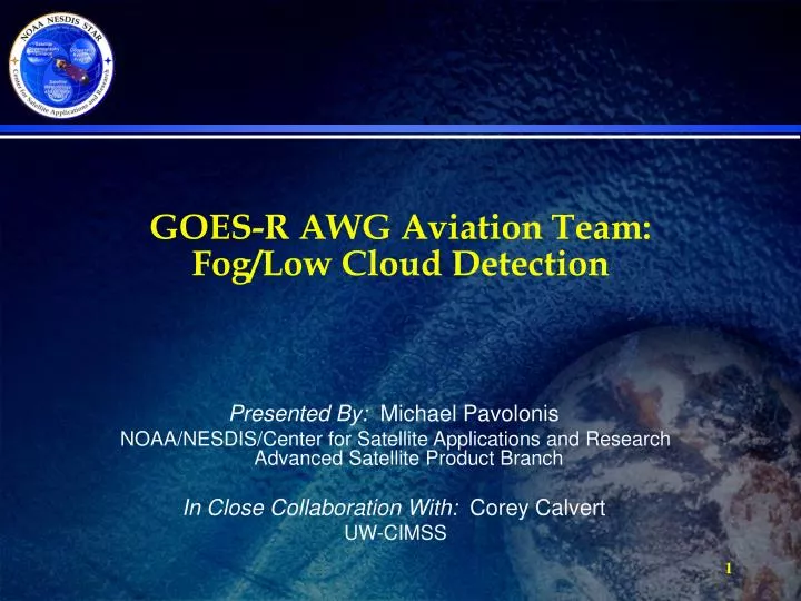
GOES-R AWG Aviation Team: Fog/Low Cloud Detection. Presented By: Michael Pavolonis NOAA/NESDIS/Center for Satellite Applications and Research Advanced Satellite Product Branch In Close Collaboration With: Corey Calvert UW-CIMSS. Outline. Aviation Team Executive Summary

E N D
GOES-R AWG Aviation Team: Fog/Low Cloud Detection Presented By: Michael Pavolonis NOAA/NESDIS/Center for Satellite Applications and Research Advanced Satellite Product Branch In Close Collaboration With: Corey Calvert UW-CIMSS
Outline • Aviation Team • Executive Summary • Algorithm Description • ADEB and IV&V Response Summary • Requirements Specification Evolution • Validation Strategy • Validation Results • Summary
Aviation Team Co-Chairs:Ken Pryor and Wayne Feltz Aviation Team K. Bedka, J. Brunner, W. MacKenzie J. Mecikalski, M. Pavolonis, B. Pierce W. Smith, Jr., A. Wimmers, J. Sieglaff Others Walter Wolf (AIT Lead) Shanna Sampson (Algorithm Integration) Zhaohui Zhang (Algorithm Integration) 3
Executive Summary • This ABI Fog/Low Cloud detection algorithm generates two Option 2 products (fog/low cloud mask and depth) • ABI channels 2, 7, and 14 are directly utilized in the algorithm. Many other channels (e.g. 10, 11, 15) are used indirectly through the cloud phase algorithm output. • Software Version 3 was delivered in March. ATBD (80%) and test datasets are scheduled to be delivered in June 2010 • The algorithm uses spatial and spectral information to identify fog/low stratus clouds. The algorithm is capable of both day and night detection. Fog/low cloud depth is calculated for pixels positively identified by the fog mask • Validation Datasets: Surface observations of ceiling over CONUS and spaceborne lidar are used to validate the fog/low cloud mask. SODAR data from the San Francisco Bay areaand spaceborne lidar are used to validate the fog depth. • Validation studies indicate that both products are in compliance with the 100% accuracy specification
What Is Fog? • Aviation based fog/low cloud definition • Visual flight rules - ceiling > 3000 ft (914 m) • Marginal visual flight rules 1000 ft (305 m) < ceiling < 3000 ft (914 m) • Instrument flight rules - 500 ft (152 m) < ceiling < 1000 ft (305 m) • Low instrument flight rules - ceiling < 500 ft (152 m) The GOES-R fog detection algorithm aims to identify clouds that produce MVFR, IFR, or LIFR conditions.
Algorithm Summary • Input Datasets: 1). ABI channels 2, 7,14, 2). GOES-R cloud mask, phase, and daytime optical properties, 3). Solar zenith angle, 4). Clear sky radiances and transmittances, 5). NWP forecast data (GFS), 6). Fog/low cloud probabilty LUT’s • A naïve Bayes probabilistic model is used to determine the probability of MVFR (or lower cloud base conditions) • The required yes/no fog mask is set by applying an objectively determined probability threshold • An estimate of fog depth (geometrical thickness) is derived using empirical relationships
Fog/Low Cloud Detection • Daytime predictors (only applied to cloudy, non-cirrus pixels): • 3.9 μm reflectance • Surface temperature bias • 3x3 spatial uniformity of 0.65 μm reflectance • Boundary layer RH from NWP • Nighttime predictors (only applied to non-cirrus pixels, includes clear sky): • 3.9 μm pseudo-emissivity • Surface temperature bias • Boundary layer RH from NWP • Surface based observations of ceiling were used to train the naïve Bayes probabilistic model. • The class conditional probabilities are stored in LUT’s
Impact of Satellite/NWP Fusion • When boundary layer relative humidity information from the GFS is used as a predictor in the Bayes classifier, the maximum achievable skill score (Peirces’s skill score) increases significantly • This analysis also shows that the Bayes approach (with or without BL RH) is more skilled than the traditional nighttime BTD approach With NWP RH as predictor (0.52) Without NWP as predictor (0.46) Traditional BTD technique (0.43)
Estimating Fog Depth Daytime LWP: from cloud team LWC: assumed to be 0.06 g/m3 (Hess et al., 2009) Nighttime emsac: atmospherically corrected 3.9 μm pseudo-emissivity A, B: linear regression coefficients
Fog/Low Cloud Detection Processing Schematic INPUT: ABI data, cloud phase output, cloud optical properties output, and ancillary data Use Bayes model to determine the probability that any given pixel contains fog/low cloud Compute yes/no mask from probability Calculate fog/low cloud depth Generate quality flags Output Fog/Low Cloud Products
Example Output Fog Mask Fog Depth Anchorage Anchorage Kodiak Island Kodiak Island Anchorage Anchorage AWIPS Screenshot Kodiak Island Kodiak Island MVFR Prob Cloud Type
Example Output http://cimss.ssec.wisc.edu/geocat Probability of MVFR Probability of IFR
Algorithm Changes from 80% to 100% • Incorporated GFS boundary layer relative humidity into probabilistic model • Fine tuned satellite metrics used in daytime fog detection • Metadata output added • Quality flags standardized
ADEB and IV&V Response Summary • The ADEB suggested that we use boundary layer RH in the algorithm – as described earlier, we did integrate boundary layer RH into the algorithm • The ADEB suggested that we characterize the performance for ice fog conditions (results of this will be shown in the validation section) • All ATBD errors and clarification requests have been addressed.
Requirements and Product Qualifiers Low Cloud and Fog C – CONUS FD – FullDisk M - Mesoscale
Validation Approach Validation sources: 1). Ceiling height at standard surface stations 2). CALIOP cloud boundaries 3). Special SODAR equipped stations 4). Fog focused field experiments Validation method: Determine fog detection accuracy as a function of MVFR probability; Directly validate fog depth
Surface Observation-Based Fog Detection Validation Comparisons to surface observations indicate that the 70% accuracy specification is being satisfied Peirces’s Skill Score Accuracy Day (0.51) Night (0.59) Combined (0.59) Day (75%) Night (83%) Combined (81%)
CALIOP-Based Fog Detection Validation Accuracy Comparisons to CALIOP indicate that the 70% accuracy specification is being satisfied Peirces’s Skill Score Daytime Accuracy: 90% Nighttime Accuracy: 91% Overall Accuracy 91% Overall skill: 0.61
SODAR-based Fog Depth Validation Comparisons with SODAR/ceilometer derived fog depth indicate a bias of ~30 m. More data points will be added to this analysis in the future. Daytime Nighttime
CALIOP-based Fog Depth Validation The GOES-R fog depth product was also compared to cloud depth information derived from CALIOP. A bias of -403 m was found.
FRAM-ICE RPOJECT SITEYellowknife, NWT, Canada INSTRUMENTS FD12P and Sentry Vis Tower 3 Tower 4 Tower 1 Tower 2
GOES-R Fog/Low Stratus Detection Over Yellowknife • This is a daytime scene covering the same area around Yellowknife, NWT and Great Slave Lake • The SW corner of this scene is shown to contain a large amount of thin, overlaying cirrus clouds (circled areas) • It should be noted that all the clouds in this scene were classified by the GOES-R cloud type algorithm as either mixed phase or ice clouds, which should be the case during an ice fog event Yellowknife Cirrus overlapping low clouds Yellowknife Yellowknife
Summary • The GOES-R ABI fog/low cloud detection algorithm provides a new capability for objective detection of hazardous aviation conditions created by fog/low clouds • The GOES-R AWG fog algorithm meets all performance and latency requirements. • Improved ABI spatial and temporal resolution will likely improve detection capabilities further • The 100% ATBD and code will be delivered to the AIT this summer. • Prospects for future improvement: 1). Incorporate additional NWP fields (e.g. wind). 2). Incorporate radar data. 3). Working on incorporating high spatial resolution surface elevation map 4). Correct for thin cirrus clouds 5). Use data fusion techniques and Bayes classifier to create all weather MVFR and IFR probabilities