Download
1 / 37
370 likes | 475 Views
Update on the Coastal Radar and the Regional Modeling System Cliff Mass, David Ovens, Phil Regulski, Jeff Baars, Richard Steed, Mark Albright, David Carey. Northwest Weather Workshop March 21, 2009. Weather Radar on the Washington Coast: An Update.

E N D
Update on the Coastal Radar and the Regional Modeling SystemCliff Mass, David Ovens, Phil Regulski, Jeff Baars, Richard Steed, Mark Albright, David Carey Northwest Weather Workshop March 21, 2009
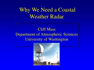
The Problem: Inland radar are too far from the coast and blocked by coastal mountains.
Now With Two New Radars
The Big News:2 million dollar earmark for the radar Senator Maria Cantwell secured a line item in the 2009 Omnibus Bill signed by President Obama last week. 2 million dollars set aside for a coastal radar.
What Kind of Radar? The ideal radar would be a high-powered, long-range S-band (10-cm wavelength) radar, similar to the current NWS Nexrad radars, but updated and more modern in design. Should be dual polarized, as the Nexrads will be in a few years, for precip type and precip intensities. The cost: list price is 4-4.5 million, plus installation costs (land, utilities, site surveys). 6 million is a good estimate. So we are short.
We have an idea of the advantages of such a radar, because one was in place for a research experiment…IMPROVE I, in January-February 2001.
dBZ Reflectivity from S-Pol radar at Westport 0031 UTC 2 Feb 2001 at 0.5 degree elevation
Next Steps The NWS will be playing a more active role in the acquisition now. There will be a community meeting on the coast later this year, sponsored by Senator Cantwell’s office, with high level NWS representation. Site surveys and land acquisition might be able to start this year. The NWS and Cantwell’s office are working on the missing funding…no solution yet.
Supported by the Northwest Modeling Consortium…the regional modeling effort centered at the UW has been Running the MM5 at 36 and 12km resolution twice day Running the WRF model at 36, 12 km and 4-km resolution twice a day out to 72h. Running an extended WRF run at 36 and 12 km resolution out to 180 h. Running TWO high resolution regional ensemble systems to provide probabilistic forecasts and data assimilation Gathering all local weather observations from dozens of networks. Plus quality control. Running a wide range of weather applications dealing with air quality, hydrology, transportation weather and fire weather.
2008 was the year for the WRF transition • During the past ten years we have mainly used the MM5—the Penn. State/NCAR mesoscale model version 5. • During the past two years we have run the replacement model—the Weather Research and Forecasting Model--WRF—in parallel. • In April 2008, we made the switch.
Major Changes to the NW Modeling System On April 15, 2008 • The largest and most extensive series of changes in many years, including: • Expansion of the 12-km WRF-GFS domain • Expansion of the 4-km WRF-GFS domain • 4km starts 6 hr earlier and goes to 72h • Dropping of MM5-GFS • Replacement of MM5 with WRF for extended run. • Running MM5-ETA very early, prior to starting WRF-GFS • Moving of all graphics/applications to WRF • Doubling of processors used (24 to 48) • Converted all graphics.
Domain Changes • The 12-km domain was expanded both westward and to the south (includes SF Bay area) • A major expansion of the 4-km domain to include Yellowstone and Northern California.
Snow: Mixed Success Did well with mountain snows Often missed light snows Generally alerted forecasters to snow potential periods. Good on SE side of Olympics Significant timing errors for some events. Seattle school cancellation debacle.
Upcoming Changes/Improvements Regional Data Assimilation Warm start to model. Improvements in model physics. New version of WRF coming out with some significant enhancements.