Download
1 / 53
530 likes | 604 Views
Field Completion It could be as insubstantial as memory-but did we once navigate by the moon across the Braidwood Plains collecting names and entering them carefully by lamplight crowding in on the silver night ’ s map; Yaouk, Gillamatong, Tantawanglo, Yarrangobilly, Numbugga,

E N D
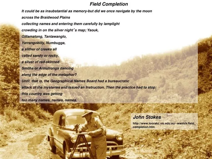
Field Completion It could be as insubstantial as memory-but did we once navigate by the moon across the Braidwood Plains collecting names and entering them carefully by lamplight crowding in on the silver night’s map; Yaouk, Gillamatong, Tantawanglo, Yarrangobilly, Numbugga, a slither of creeks all called sandy or rocky, a sliver of red-skinned Smiths or Armstrongs dancing along the edge of the metaphor? Until, that is, the Geographical Names Board had a bureaucratic attack of the mysteries and issued an Instruction. Then the practice had to stop; this country was getting too many names, names, names, John Stokes http://www.toorakc.vic.edu.au/~warrick/field_completion.htm
Program • Field expedition • Briefing for Field Expedition – 3.30 to 5.00pmSunday 17 October 2004 • Desk Audit – 9.00 to 10.30Monday 18 October • Office Processing – 20 October 2004 • Session1 - Processing fieldwork data – 9.00 to 10.30 • Session 2 – Preparing for a Board Meeting – 11.00 to 12.30 • Session 3 – Presenting to a Board – 1.30 to 3.00 Presented By Greg Windsor
Perform field trip - Verify names collected in desk audit - Collect new names Contact local authorities FIELD REVISION/COMPLETION PROCESS Establish scope of work Research names Plan field trip Carry out desk audit Collate findings Collate names on field completion sheet for verification Present findings - Nomenclature Authority Mapping Agency
1:100,000 MAP SCALE
1:25,000 MAP SCALE
Administrative Boundaries: • LGA • Parish • County • Suburb • Catchments
Placename Type Co-ordinate Height Description Historical information Validation comments Source information Metadata Field Completion Sheet - Exercise. What information do we need to collect in the field:
Name Designation Variant Name Parish Latitude Longitude Heights Remarks FIELD COMPLETION SHEET GAZETTEER OF NAMES LGA: …………………………………………………………………………………………. MAP: ………………………………………… COUNTY: …………………………….. Name Designation Variant Name Parish Latitude Longitude Height Remarks Page …. of ….. 1 1 Bathurst Regional Council Bathurst 8831-3-S Bathurst Perthville Village Perth Apsley -33 29 00 149 33 00 690m Signposted, recommended Greg Windsor 17 October 2004 Officer: …………………….. Date: ……………………..
Name Designation Variant Name Parish Latitude Longitude Heights Remarks • Take extra notes on history, descriptions, metadata • Remember to reference your material
Database Exercise 2. What feature types should we use in our database: REVISION
Topographic Map Specifications Geographical Names Act 1966 NSW Government Database Exercise 2. What feature types should we use in our database: REVISION
GEOGRAPHICAL NAMES ACT 1966 No. 13 Reprinted under the Reprints Act 1972 • 2 - Definitions • "Place" means any geographical or topographical feature or any area, district, division, locality, region, city, town, village, settlement or railway station or any other place within the territories and waters of the State of New South Wales but does not include any road, any area (within the meaning of the Local Government Act 1993) or area of operations of a county council (within the meaning of that Act), any electoral district or subdivision under the Parliamentary Electorates and Elections Act 1912, any school or any place or place within a class of places to which the provisions of this Act do not apply by virtue of the regulations. Database Exercise 2. What feature types should we use in our database: REVISION
The Desk Audit • Thorough research must take place before embarking on the field trip. • All possible placenames must be collected for later verification in the field.
Sources of Information for the Desk Audit • Travel guides • History books over the local area • Historical manuscripts • Government websites • Maps and charts • Don’t forget Google • Surveyor’s (Explorer’s) field notes.
Name Designation Variant Name Parish Latitude Longitude Heights Remarks FIELD COMPLETION SHEET GAZETTEER OF NAMES LGA: …………………………………………………………………………………………. MAP: ………………………………………… COUNTY: …………………………….. Name Designation Variant Name Parish Latitude Longitude Height Remarks Page …. of ….. 1 1 Bathurst Regional Council Bathurst 8831-3-S Bathurst Not recommended to complete these fields during the desk audit Perthville Village Perth Apsley -33 29 00 149 33 00 690m Signposted, recommended Greg Windsor 17 October 2004 Officer: …………………….. Date: ……………………..
Field Trip Preparation Exercise: Conduct desk audit over the Perthville area and collate names:
Source: Field Verification Manual, Dept Lands, 2004 Planning The Field Verification Task - A Check List • Material to produce or collect from the validator: • Field sheets • Screen dumps and 1:10 000 enlargements (as required for specific queries) • Check with operator and validator if checks of specific area features are needed
A copy of the current topographic map and the maps that adjoin it NSW Road Directory Field code list Field notebook Mobile phone GPS Safety vests Pens, pencils, highlighters, erasers, pencil sharpeners Map board and bulldog clip Map scale ruler (Map Sales) Clip board A4 writing paper, Post-it note pad Source: Field Verification Manual, Dept Lands, 2004 Other Items Required For The Task
Binoculars Compass LPI name badge LPI business cards Letter of introduction Hat, sunscreen, chap stick Product information, map catalogues Source: Field Verification Manual, Dept Lands, 2004 Other Items Required For The Task
Your supervisor should organise either a survey officer or a colleague to accompany you. Book a suitable vehicle (with flashing light and 'Caution' signs, if necessary) Book accommodation as soon as possible Ensure availability of meals while in the field (e.g., from accommodation provider) Contact organisations that you will visit or who otherwise may assist - NP&WS, Forestry, Rural Fire Brigade, local government, local LPI surveyor. Make appointments where appropriate. Inform local police of your intended movements a week in advance Source: Field Verification Manual, Dept Lands, 2004 Arrangements That Need To Be Made
Plan your verification task to minimise the amount of travelling - avoid doubling back over the same ground Carry out validation and collect data Note changes on field sheets and enter details into a field book Check for positions, names and spelling on enlargements and Tag Reports Ensure you keep to any appointments you have made Talk to local organisations, farmers, school bus and mail contractors Use GPS for positioning of new features Mark exact positions on field sheets to ensure update can be done accurately Source: Field Verification Manual, Dept Lands, 2004 Performing The Field Verification Task
Field Trip Exercise 1: Sort out the logistics of how field completion is to be carried out:
Field Trip Exercise 2: Conduct field completion over the Perthville area:
Placename Research • Thorough research must take place after the field trip to: • To establish the history of the name • To establish the origin of the name • To establish the meaning of the name • To establish the status of the name so as to make further recommendations to the Nomenclature Authority
Sources of Information • Travel guides • History books over the local area • Historical manuscripts • Government websites • Maps and charts • Don’t forget Google • Surveyor’s (Explorer’s) field notes.
Referencing Material • Basic Components of a reference include: • Author • Publication Name • Chapter / Page details • Publisher • Publication Place • Publication Date
Recording Oral Traditions • Oral traditions should be documented if they are used to support naming proposals • This documentation should be referenced • Lineage or provenance of the tradition should also be documented
Research Exercise: Research the placenames collected from the fieldtrip; Consider the history, origin and meaning of the names collected. Consider the name’s status. Are they currently used? Should they be made official? Are they variant names? Remember to reference all your work.
Notes Perthville was previously called Perth and Queen Charlottes Vale What Do We Do With All This Information? Field Sheet
Database Geographical Names Agenda NSW Government GIS What Do We Do With All This Information?
Collate Findings Exercise: 1.Compile all unique placename information on a data entry sheet and enter this information into the Placename Database: 2. Compile all unique placename information on the supplied spreadsheet ready for migration into Arcview GIS. 3. Compile an agenda for a Nomenclature Authority with the names collected from Perthville, taking care to list all relevant information, and make recommendations on what you think should happen with these names.