Download
1 / 28
280 likes | 572 Views
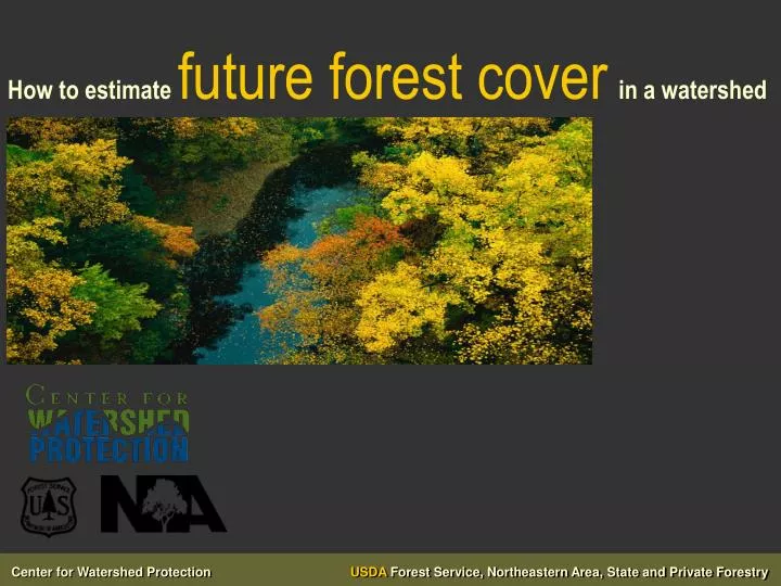
How to estimate future forest cover in a watershed. “ Watershed forestry is the use of forests and the practice of forestry to protect, restore, and sustain water quality, water flows, and the health and function of watersheds.” (WFAP federal register). “Urban Watershed Forestry”.

E N D
“Watershed forestryis the use of forests and the practice of forestry to protect, restore, and sustain water quality, water flows, and the health and function of watersheds.” (WFAP federal register) “Urban Watershed Forestry” “Urbanis ….well….urban - developed and developing areas”
Watershed Benefits of Forest Cover • reduce stormwater runoff • improve air quality • reduce stream channel erosion • provide habitat for terrestrial and aquatic wildlife • improve soil and water quality • reduce summer air and water temperatures
Link Between Forest Cover and Stream Health • Stream health rating of Excellent requires no more than 6% IC and at least 65% riparian forest cover (Goetz et al, 2003) • Stream health rating of Good requires no more than 10% IC and at least 60% riparian forest cover (Goetz et al, 2003) • Watersheds with at least 65% forest cover usually had a healthy aquatic insect community (Booth, 2000)
Urban Watershed Forestry Goals and Objectives: Protect • Protect priority forests • Prevent forest loss during development and redevelopment • Maintain existing forest canopy Enhance • Enhance forest fragments Reforest • Plant trees during development and redevelopment • Reforest public land • Reforest private land
Urban Watershed Forestry Manual Series • part 1: Methods forConserving forest cover in a watershed • part 2: Conserving & Planting Trees at Development Sites • part 3: Urban Tree Planting Guide www.forestsforwatersheds.org
Planning Methods for Increasing Forest Cover in a Watershed Step 1. Conduct a Watershed Leaf-Out Analysis Step 2. Develop forest cover goals and objectives for the watershed Step 3. Identify existing forest and reforestation opportunities Step 4. Conduct a field assessment of existing forest and reforestation opportunities Step 5. Prioritize existing forest and reforestation opportunities Step 6. Develop recommendations for meeting forest cover goals
The Leafout Analysis • GIS-based method to estimate future forest cover in a watershed • Local governments /watershed groups can use method to: • evaluate the effect of different watershed protection scenarios on future forest cover • set numeric forest cover goals • develop watershed protection recommendations • Leafout Analysis spreadsheet available at: www.forestsforwatersheds.org
GIS data needs for Leafout Analysis • Watershed boundary • Property boundaries and parcel data • Hydrology and roads • Current forest cover • Zoning • Protected parcels– conservation easements, conservation or parkland zoning • Land cover coefficients • Recent aerial photos may also be helpful
Leafout Analysis Assumptions • Full buildout of the watershed will occur based on allowable zoning (e.g., no rezoning) • Current forest cover on developed land, protected lands (and agricultural lands with future agricultural zoning) will remain the same with the future buildout • Future forest cover on buildable land can be predicted by using forest cover coefficients
Leafout Analysis Caveats • Intended for use as a planning exercise, not a precise predictor of future forest cover. • Does not account for tree removal or mortality (other than that related to land development) • Default values are provided but use local data where available • Measures forest cover not urban tree canopy
Forest cover vs. tree canopy Tree canopy: layer of leaves, branches and stems that cover the ground when viewed from above. Forest cover: area of land that is classified as forest. Graphic source: Goetz et al 2003
Leafout Analysis Steps • Calculate current forest cover in the watershed • Identify buildable and unbuildable parcels • Calculate the area of each zoning category for buildable land • Multiply buildable land in each zoning category by the corresponding forest cover coefficients • Calculate current forest cover on unbuildable land • Sum future forest cover on buildable and unbuildable land
Step 2: identify buildable and unbuildable parcels Parcels intersect with buildings so they are selected as “developed” parcels No buildings. Parcels not selected
Step 2: other parcels to consider “unbuildable” • Parcels that are permanently protected from development by easement or other conservation measure (e.g., conservation zoning) • Lands currently in agricultural use that also have future Agricultural zoning
Step 2: results Watershed boundary Unbuildable land Buildable land
Step 3: calculate the area of each zoning category for buildable land
Step 3: additional data requirements • Calculate current forest cover on: • Buildable very low density residential (e.g., x du/acre), open urban, and agricultural lands • Why? • Forest cover on VLDR and Open Urban land varies based on pre-development forest cover • Assumption that most agricultural lands will keep existing forest if zoned agricultural in the future
Step 4: multiply the buildable land in each zoning category by the corresponding forest cover coefficients • Forest cover coefficients represent the fraction of a particular land use that is covered by forest • Forest cover coefficients vary by land use and potential natural vegetation (and by pre-development forest cover for some land use types)
Predicting Future Forest Cover on Very Low Density Residential and Open Urban Land
Step 6: sum future forest cover on buildable and unbuildable land + Future forest cover on buildable land (estimated using land cover coefficients): 600 acres Current forest cover on unbuildable land: 639 acres
Leafout Analysis SpreadsheetCompiles result of the Leafout steps • Input watershed data
Leafout Analysis Spreadsheet • Fill in the requested values in the Input Watershed Data tab (these are derived from GIS analysis) • Go to the See Future Forest Cover Results tab to view the estimated future forest cover and % loss • Set an initial forest cover goal and select from four urban watershed forestry practices in the Select Management Practices tab • Go to the Re-Evaluate Future Forest Cover tab to see the effect of the selected practices on future forest cover • Revisit the Select Management Practices tab and make changes if desired • Use the Finalize Management Practices tab to summarize your final forest cover goal, management practices and timeframe for implementation
Urban Watershed Forestry Practices • Options in the Leafout Spreadsheet: • Conserve forest on individual parcels through purchase /easement • Adopt a local forest conservation ordinance for new development • Implement reforestation projects on public lands • Initiate an outreach/incentive program focuses on tree planting for private landowners • A complete list of urban watershed forestry practices in available in the manual series