Download
1 / 60
600 likes | 753 Views
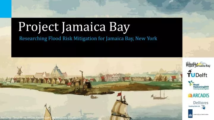
Project Jamaica Bay. Researching Flood Risk Mitigation for Jamaica Bay, New York. Painting : “Gezicht op Nieuw-Amsterdam”, by Johannes Vingboons. Hurricane Sandy. Source: 3Di. Motivation. Damage projections NYC 1/100 year storm ̴$2 billion 1/500 year storm

E N D
Project Jamaica Bay ResearchingFlood Risk Mitigationfor Jamaica Bay, New York Painting: “Gezicht op Nieuw-Amsterdam”, by Johannes Vingboons
Hurricane Sandy Source: 3Di
Motivation Damageprojections NYC • 1/100 year storm • ̴$2 billion • 1/500 year storm • ̴$5-11 billion • ̴75% of expectedannualdamageoccursaround Jamaica Bay Analysis Introduction Methodology Wrap Up ConstructedMarshIslands FR Mitigation Perimeter Motivation Team Consortium Results
Team • Marc Kruis: HydraulicStructures • Janbert Aarnink: Ports andWaterways • Kaj van der Valk: HydraulicStructures • Guido Evers: Flood Risk • Robert de Boer: Coastal Engineering Analysis Introduction Methodology Wrap Up ConstructedMarshIslands FR Mitigation Perimeter Motivation Team Consortium Results
Consortium • Delft University Of Technology • Bas Jonkman • ARCADIS • Edgar Westerhof • Royal HaskoningDHV • Mathijs van Ledden • Deltares • Ap van Dongeren • Netherlands Consulate General NYC • Arjan Braamskamp Analysis Introduction Methodology Wrap Up ConstructedMarshIslands FR Mitigation Perimeter Motivation Team ConsortiumResults
Results Starting point “Open Jamaica Bay” • Implement a system approach • Restoration of marshislandsimprovesecologyandcouldimprovesustainability but hardlyaffectsflood risk mitigation • Shallowing the channels is preferredregardingbothflood risk mitigationandsustainability Analysis Introduction Methodology Wrap Up ConstructedMarshIslands FR Mitigation Perimeter Motivation Team ConsortiumResults
Research Questions • Which measures at the perimeter could be applied to improve flood protection of the Jamaica Bay area? • What is the best way to improve the marsh islands in Jamaica Bay and what are the effects on flood risk mitigation? Analysis Introduction Methodology Wrap Up ConstructedMarshIslands FR Mitigation Perimeter Research QuestionsRoad Map
Road Map • Situation Analysis • CombiningSimilarAreas • SelectingMeasures • Simplified Approach • Delft3D Model • Evaluation Analysis Introduction Methodology Wrap Up ConstructedMarshIslands FR Mitigation Perimeter Research Questions Road Map
Area Description • Assets: • Residential Area • National Park • Recreational Area • JFK Airport • Infrastructure Source: US National Park Service Analysis Introduction Methodology Wrap Up ConstructedMarshIslands FR Mitigation Perimeter Area DescriptionBoundaryConditions Delft3D Model
Area Description • Low Lying Area Source: USGS (left); FEMA (right) Analysis Introduction Methodology Wrap Up ConstructedMarshIslands FR Mitigation Perimeter Area DescriptionBoundaryConditions Delft3D Model
Area Description • DegradingMarshIslands • Between 1924 and 1999, nearly 50% of marshislandsdisappeared Source: DEP Analysis Introduction Methodology Wrap Up ConstructedMarshIslands FR Mitigation Perimeter Area DescriptionBoundaryConditions Delft3D Model
BoundaryConditions • Requirements • 1/100 year storm • Projectedlifetime: 50 years design for 2065 • Multipurpose design • 1/100 year water conditionsfrompreliminaryworkmaps (FEMA) • Storm surge in bay ≈ 3.8m • Wave height in bay ≈ 1m • 0.65m Sea level rise (IPCC) • Sandy wind speeds Analysis Introduction Methodology Wrap Up ConstructedMarshIslands FR Mitigation Perimeter Area DescriptionBoundaryConditionsDelft3D Model
Delft3D Model • Developed by Deltares in Delft, the Netherlands • High resolution Delft3D model to evaluate marsh island alternatives • Two model simulations: • Tidal movement • Storm surge Sandy model • Boundaries forced by large-scale basin model in ADCIRC of hurricane Sandy Source: FEMA Analysis Introduction Methodology Wrap Up ConstructedMarshIslands FR Mitigation Perimeter Area DescriptionBoundaryConditionsDelft3D Model
Flood Risk Mitigation Perimeter • Floodprotectionmeasuresfor the Atlantic side • Floodprotectionmeasuresfor the bay perimeter Analysis Introduction Methodology Wrap Up ConstructedMarshIslands FR Mitigation Perimeter MeasuresAtlantic SideMeasures Bay
MeasuresAtlantic Side • Combiningaesthetics, ecologyandsafety • Design height: 6 to 8 meters Analysis Introduction Methodology Wrap Up ConstructedMarshIslands FR Mitigation Perimeter MeasuresAtlantic SideMeasures Bay
Measures Bay • Bay side: Rockaway Peninsula Analysis Introduction Methodology Wrap Up ConstructedMarshIslands FR Mitigation Perimeter MeasuresAtlantic Side Measures Bay
Measures Bay • JFK Airport Analysis Introduction Methodology Wrap Up ConstructedMarshIslands FR Mitigation Perimeter MeasuresAtlantic Side Measures Bay
Measures Bay: Living Shorelines • Applynaturalbasedinfrastructure at Howard Beach andCanarsie • Effects: • Improvingecology • Reduce impact on levee apply softer revetments • Erosioncontrol • Focus: usevegetationtodissipate wave energy Analysis Introduction Methodology Wrap Up ConstructedMarshIslands FR Mitigation Perimeter MeasuresAtlantic Side Measures Bay
Measures Bay: Living Shorelines Wave energy dissipationbyvegetation • Representvegetationbyan array of verticalandrigidcylinders Assumptions: • Constant water depth • Linear wave theory is valid • Non-breakingwaves Analysis Introduction Methodology Wrap Up ConstructedMarshIslands FR Mitigation Perimeter MeasuresAtlantic Side Measures Bay
Measures Bay: Living Shorelines Appliedvegetation • Spartinaalterniflora • Intertidal wetlands • Stem diameter ≈ 0.01 m • Density: 100 – 600 stems/m2 Source:USDA-NRCSPlants Database Analysis Introduction Methodology Wrap Up ConstructedMarshIslands FR Mitigation Perimeter MeasuresAtlantic Side Measures Bay
Measures Bay: Living Shorelines Canarsie Area Design water level: +5m NAVD88 95m availablespace, 2m elevationdifference Gentleslope Steepslope Analysis Introduction Methodology Wrap Up FR Mitigation Perimeter ConstructedMarshIslands MeasuresAtlantic Side Measures Bay
Measures Bay: Living Shorelines Resultsfor wave heightreduction Gentleslope ̴40% reductionSteepslope ̴75% reduction Analysis Introduction Methodology Wrap Up ConstructedMarshIslands FR Mitigation Perimeter MeasuresAtlantic Side Measures Bay
Measures Bay: Living Shorelines ConclusionsCanarsie area • Largerdensityof vegetationresultsin more reduction • The steeper the living shorelineslope, the better the wave energy is dissipated Steepslopeis preferred • Steepsloperequires more soil more expensive Analysis Introduction Methodology Wrap Up ConstructedMarshIslands FR Mitigation Perimeter MeasuresAtlantic Side Measures Bay
Measures Bay: Living Shorelines Howard Beach area More spaceavailable Gentleslope ( ̴75% reduction) Analysis Introduction Methodology Wrap Up ConstructedMarshIslands FR Mitigation Perimeter MeasuresAtlantic Side Measures Bay
Measures Bay: Living Shorelines Results • Vegetationcanbeusedtoreduce wave height • Higherdensityresults in larger wave reduction Recommendations • Additionalempiricalandanalytical research: heterogenousmaterial • Additionalstudy of the dissipationbytrunksandleaves of trees • Study the dissipationduetobreaking waves • Studyhybridsolutions Analysis Introduction Methodology Wrap Up ConstructedMarshIslands FR Mitigation Perimeter MeasuresAtlantic Side Measures Bay
ConstructedMarshIslands Marsh islands study • Effects of marsh island restoration: • Create ecological value • Mitigation for expanding city • Possible flood risk mitigation • Focus: • Improve sustainability tidal basin • Research effectiveness for flood risk mitigation • Modeled with usual tidal movement & Sandy conditions Analysis Introduction Methodology Wrap Up ConstructedMarshIslands FR Mitigation Perimeter SustainabilityMitigation
Sustainability of tidalbasin Theory • System with 3 areas • Outer delta • Basin • Inlet • Sediment balancein system • Related through tidal prism Analysis Introduction Methodology Wrap Up ConstructedMarshIslands FR Mitigation Perimeter SustainabilityMitigation
Sustainability Theory tidal prism Mechanism I Mechanism II Analysis Introduction Methodology Wrap Up ConstructedMarshIslands FR Mitigation Perimeter SustainabilityMitigation
Sustainability Shallowing the inlet • Goal: influence cross-sectional area and tidal prism • Theory: tidal prism reduction • Delft 3D results • Blue: current situation • Red: ½ inlet depth • Green: ¼ inlet depth • Possible erosion marsh islands or adjacent coasts Analysis Introduction Methodology Wrap Up ConstructedMarshIslands FR Mitigation Perimeter SustainabilityMitigation
Sustainability Theory tidal prism Mechanism I Mechanism II Analysis Introduction Methodology Wrap Up ConstructedMarshIslands FR Mitigation Perimeter SustainabilityMitigation
Sustainability Shallowingtidal channels • Goal: influence tidal channel volume and tidal prism • Theory: tidal prism reduction • Delft 3D results • Blue: current situation • Red: 1 navigation channel 7m depth. Rest of channels: 2m depth • Green: all channels 1m depth • Accretion marsh islands or adjacent coasts Analysis Introduction Methodology Wrap Up ConstructedMarshIslands FR Mitigation Perimeter SustainabilityMitigation
Sustainability Restore and expand marsh islands on tidal flats • Goal: influence tidal prism • Theory: tidal prism reduction • Delft 3D results • Blue: current situation • Red: expanded and extra islands (tidal flats) • Some erosion possible of marsh islands or adjacent coasts Analysis Introduction Methodology Wrap Up ConstructedMarshIslands FR Mitigation Perimeter SustainabilityMitigation
Sustainability Restore and expand marsh islands (partly) in tidal channels • Goal: influence tidal prism and channel volume • Theory: tidal prism reduction • Delft 3D results • Blue: current situation • Red: expanded and extra islands (tidal flats) • Green: expanded and extra islands (partly in tidal channels) • In right proportions: accretion marsh islands or adjacent coasts Analysis Introduction Methodology Wrap Up ConstructedMarshIslands FR Mitigation Perimeter SustainabilityMitigation
Storm SurgeMitigation Shallowing inlet Peak Sandy Currentsituation ½ depthinlet ̴15% reduction ¼ depthinlet ̴20% reduction Analysis Introduction Methodology Wrap Up ConstructedMarshIslands FR Mitigation Perimeter SustainabilityMitigation
Storm SurgeMitigation Shallowing inlet Peak Sandy • Blue: current situation • Red: ½ inlet depth • Green: ¼ inlet depth Analysis Introduction Methodology Wrap Up ConstructedMarshIslands FR Mitigation Perimeter SustainabilityMitigation
Storm SurgeMitigation Shallowingchannels in bay Peak Sandy 1m deepchannels ̴15% reduction Currentsituation Shallowedchannels ̴5% reduction Analysis Introduction Methodology Wrap Up ConstructedMarshIslands FR Mitigation Perimeter SustainabilityMitigation
Storm SurgeMitigation Shallowingchannels in bay Peak Sandy • Blue: current situation • Red: 1 navigation channel 7m depth. Rest of channels: 2m depth • Green: all channels 1m depth Analysis Introduction Methodology Wrap Up ConstructedMarshIslands FR Mitigation Perimeter SustainabilityMitigation
Storm SurgeMitigation Create high marsh islands Peak Sandy Createdislands on flats ̴0% reduction Creatingislands in channels ̴3% reduction Currentsituation Analysis Introduction Methodology Wrap Up ConstructedMarshIslands FR Mitigation Perimeter SustainabilityMitigation
Storm SurgeMitigation Create high marsh islands Peak Sandy • Blue: current situation • Red: expanded and extra islands (tidal flats) • Green: expanded and extra islands (partly in tidal channels) Analysis Introduction Methodology Wrap Up ConstructedMarshIslands FR Mitigation Perimeter SustainabilityMitigation
Storm SurgeMitigation Create submerged wetlands Peak Sandy Created wetlands 0.5m above MSL ̴1% reduction Currentsituation Analysis Introduction Methodology Wrap Up ConstructedMarshIslands FR Mitigation Perimeter SustainabilityMitigation
Storm SurgeMitigation Create submerged wetlands Peak Sandy • Blue: current situation • Red: submerged islands Analysis Introduction Methodology Wrap Up ConstructedMarshIslands FR Mitigation Perimeter SustainabilityMitigation
MarshIslands Results: flood risk mitigation • Creating islands in the bay hardly has an effect on storm surge mitigation (probably does have positive effect on waves) • Shallowing the inlet results in highest surge reduction Results: sustainableJamaica Bay • Reducing tidal channel volume gives best results • Islands can be created to improve ecological value and create a sustainable system Analysis Introduction Methodology Wrap Up ConstructedMarshIslands FR Mitigation Perimeter SustainabilityMitigation
MarshIslands Recommendations • Expandandimprove Delft3D model toimplement sediment transport • Research feasibility of proposedmeasures • Benefit Cost Analysis of proposedmeasures • Research impacts of shallowingchannels on water quality Analysis Introduction Methodology Wrap Up ConstructedMarshIslands FR Mitigation Perimeter SustainabilityMitigation
General Recommendations • Research andinclude water quality impacts • Expandingandimproving Delft3D model (including sediment transport and/or water quality) • Additional research on the effect of vegetation on wave height Analysis Introduction Methodology Wrap Up ConstructedMarshIslands FR MitigationPerimeter RecommendationsResults
Results Starting point “Open Jamaica Bay” • Implement a system approach • Restorationof marshislandsimprovesecologyandcouldimprovesustainability but hardlyaffectsflood risk mitigation • Shallowing the channels is preferredregardingbothflood risk mitigationandsustainability Analysis Introduction Methodology Wrap Up ConstructedMarshIslands FR Mitigation Perimeter RecommendationsResults
Project Jamaica Bay ResearchingFlood Risk Mitigationfor Jamaica Bay, New York Painting: “Gezicht op Nieuw-Amsterdam”, by Johannes Vingboons
Construction Coir logs • Elders east • Coir logs used to contain dredge material and mitigate wave impact • 17 ha • 190,400 cubic meter • $13,000,000 • Although succeeded in wetland creation. Coir logs application needs improvement. Source: USACE Analysis Introduction Methodology Wrap Up ConstructedMarshIslands FR Mitigation Perimeter SustainabilityMitigationConstruction
Construction Heightening of existingmarsh • Rainbowing or dredging pipe using sand berm • Elders West • 16 ha • 230,900 cubic meters • $17,200,000 • Same construction used for recent restoration of Yellow Bar Hassock, Black Wall and Ruler Bar Source: Great LakesDredgeandDock Company Source: USACE Analysis Introduction Methodology Wrap Up ConstructedMarshIslands FR Mitigation Perimeter SustainabilityMitigationConstruction
Construction Geotextile tubes • Tubes can be applied in marine-like environment, such as breakwaters, groynes or levee. • Tubes are constructed from synthetic material, like polypropylene • Filling • Containment: tube retains fill material, but allows water to permeate through textile • Densified material serves as structural mass. Anchor tube and scour apron are used to provide stability in marine environment. Source: TenCate Source: Galveston Bay Estuary Program Analysis Introduction Methodology Wrap Up ConstructedMarshIslands FR Mitigation Perimeter SustainabilityMitigationConstruction