Download
1 / 44
450 likes | 620 Views
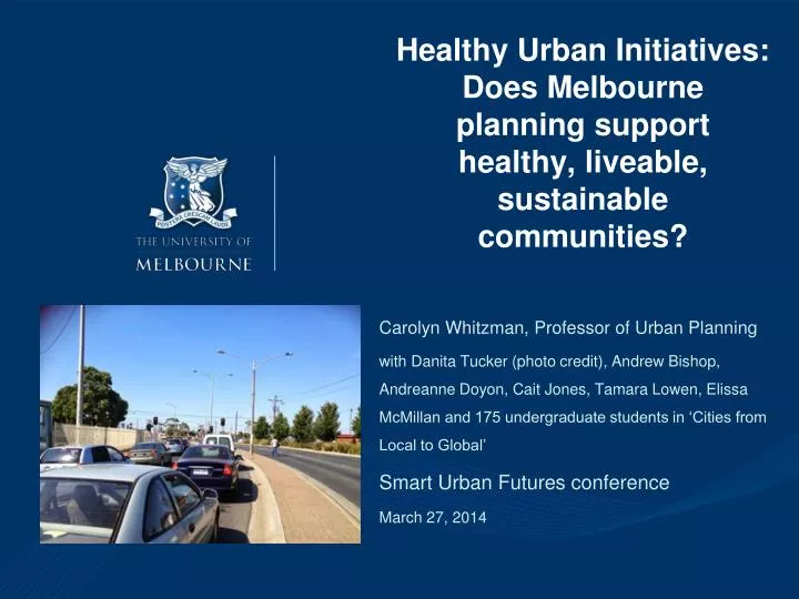
Healthy Urban Initiatives: Does Melbourne planning support healthy, liveable, sustainable communities?. Carolyn Whitzman, Professor of Urban Planning

E N D
Healthy Urban Initiatives: Does Melbourne planning support healthy, liveable, sustainable communities? Carolyn Whitzman, Professor of Urban Planning with Danita Tucker (photo credit), Andrew Bishop, Andreanne Doyon, Cait Jones, Tamara Lowen, Elissa McMillan and 175 undergraduate students in ‘Cities from Local to Global’ Smart Urban Futures conference March 27, 2014
Outline of Talk • Is Melbourne the world’s most liveable city for everyone? • How has metro Melbourne planning tried to improve liveability? Has it worked? • Is the current direction of metropolitan planning assisting outer suburbs to improve liveability? – case study: Wyndham • What next?
Liveability (Herald-Sun, Peter Newton, 2010) • Growing popularity in international (Pacione, 1990) and national (PIA, 2004) planning discourse • Melbourne #1 in Economist liveability ranking, but also very high in ecological footprint (Newton, 2010) • Also, huge variation within metropolitan region
What is liveability? (Photos: J. Perkovic, C. Edwards) Australian Major Cities Unit (2010): ‘Liveable cities are socially inclusive, affordable, accessible, healthy, safe and resilient to the impacts of climate change. They have attractive built and natural environments. Liveable cities provide choice and opportunity for people to live their lives, and raise their families, to their fullest potential.’
Socially Inclusive? (Grattan Institute – youth 15-24 out of work and school, 2013)
Accessible? Resilient to Climate Change? Vulnerability to increases in mortgage and petrol (Dodson and Sipe, 2008) Access to jobs within a 60 minute public transport trip (Grattan Institute, 2013, based on SGS data)
Melbourne: a two track city? • Ministerial Advisory Committee for the Metropolitan Planning Strategy (Oct. 2012): “Concern was expressed about the potential emergence of ‘two Melbournes’ – a successful and ‘choice rich’ inner core and a fringe with fewer choices – and the growing distance between where people could afford to live and where jobs were located”
Planning for liveability and health in Victoria • 2001: Environments for Health • 2002: Melbourne 2030 – Direction 1 – a more compact city • 2002: Planning for Health and Wellbeing project (Planning Institute of Australia- Victoria chapter; VicHealth) • 2004: Healthy by Design (Heart Foundation) • 2008: A State of Liveability (Victorian Competition and Efficiency Commission) • 2012: Inquiry in Environmental Design and Public Health (Legislative Council)
Environments for Health • Introduced in 2001: state government policy to improve local government planning for positive health outcomes through better integration of Council Plans, Municipal Public Health Plans, and Municipal Strategic Statements
Planning for Health and Wellbeing Project (2002-present) • Professional development for planners and public health practitioners, as well as presentations at conferences and websites: 1,000+ people at 24 events 2003-05; 12 papers on planning for health at PIA national congress 2005 • Subjects in planning courses at RMIT and Melbourne • Advocacy, including monthly column in Planning News, work on legislative change (eg., Clause 56 of the Victorian Planning Provisions on residential subdivisions – more on that later!): eg., 22 articles 2003-05 • Advisory Committee included 5 key state departments (planning, transport, health and human services, education, and community development), as well as 2organizations representing local government • Model for national project 2006 onwards
Healthy by Design/ Healthy Spaces and Places • A Planners’ guide to environments for active living (Heart Foundation, 2004) • Included ‘Matrix of Like Design Considerations’, showing how shade, physical activity, personal safety, access, and road user safety could be linked • Led to Healthy Spaces and Places A national guide to designing places for healthy living (Heart Foundation with PIA and ALGA, 2009) • Includes website with good practices and national roll-out of professional development seminars
Other Victorian Initiatives • VictoriaWalks: social marketing and advocacy for walking, housed at VicHealth (victoriawalks.org) • Safe Speed Interest Group: Heart Foundation with several local governments • Food Secure Urban Design (Heart Foundation) • Spaces for Active Play: Heart Foundation with several local governments (won PIA Award 2011) • Sellandra Rise: prototype outer suburban development with health features (VicHealth, PIA, Stocklands)
Yay! But… (Whitzman 2007a) • Impact evaluation of Planning for Health and Wellbeing: 2 striated random surveys of 200 /1000 planners in Victoria, with representative numbers of rural versus urban planners, and planners working in state and local government versus private consultancies– 2002 (before project commenced) and 2005 • 18% had attended a workshop or session on planning for health, and 44% said they regularly read the Planning News column
Why are planners talking the talk, but not walking the walk? (Whitzman 2007a) • Powerlessness: “Planners don’t have much influence” “It needs to be in the legislation”, “What we need to do is give it the strength of legislation”; “It’s not highlighted in the planning scheme”, “It’s not in the policies”, “It must be legislated by the State” • Overwork: “It’s just another strategic issue we’re not really connected with”, “overwhelmed by statutory responsibilities” • Wrong focus: planning for health does not adequately address “equity issues”
Barriers to Planning for Health – planner interviews (in Whitzman 2007a) • “I may have seen [Healthy by Design] but it’s hard to enforce those rules on a developer again if there is no statutory requirement to… they are not going to do it by their own free will” (Smith 2006: 36) • “We’re so snowed under with the number of applications and people ringing us up every day – where’s my application, I’m in a hurry for this one, I’ve got a builder standing by – all that sort of thing that you do tend to push them through a bit” (Smith 2006: 36) • “I’ve just found out today that health have a document I didn’t know even existed [Municipal Public Health Plan]… it’s probably in the library and if you know it’s there you can get it, but for someone like me who is relatively new, I don’t know those documents exist” (Smith 2006: 37)
Plan Melbourne • Released in ‘draft’ form October 2013 • The 5th 30-50 year metropolitan strategy in 5 decades (1971, 1984, 1995, 2002, 2013) – no metropolitan strategy has outlasted a change in state government • Focuses on decentralization into knowledge economy ‘clusters’ near unis/hospitals
20 Minute Neighbourhood (Melbourne Review) • A concept within Plan Melbourne A measurable neighbourhood based strategy where ‘quality, reliable basic services must be provided for all’ within 20 minutes active transport - walking, transit or cycling - distance
20 Minute Complete Neighbourhoods - Portland (photo credits: City of Portland) • Portland has neighbourhood level infrastructure plans to promote: • ‘a variety of housing options, grocery stores and other commercial services, quality public schools, public open spaces and recreational facilities, affordable achievable transportation options, and civic amenities. An important element of a complete neighbourhood is that it is built at a walkable and bikeable human scale and meets the needs of all ages and abilities.’ (Portland Plan 2012) • From 45% of residents now to 80% in 2035
Testing out a 20 minute ‘knowledge cluster’ with undergraduate students (photo: C. Whitzman) • March-May 2013: 175 students • Assignments at 3 scales: • Local: active transport and use of public space – fieldwork, essay • Metropolitan: integrated planning for housing, jobs and services – fieldwork, essay • Global: transferability of international good practices to Melbourne – poster • Decided to focus in on Wyndham ‘knowledge cluster’ for all assignments
Partnership with Wyndham (DPCD, 2010; VEC 2011; DPTLI, 2013 )
Wyndham Context • 541.6 km², population density of 3.3 people/ha (.id, 2013) • 2011-12: 7.1% annual population increase, 235 newcomers/week, 5,000 new dwellings a year (ABS, 2013; Wyndham City, 2013a: 5). • 2011: 168,552, 2031:332,000, 2051: 460,000(.id, 2013). • 15% of households spend more than 30% of their gross household income on mortgage repayments, as compared to the state average of 10% (ABS, 2013).
Wyndham Issues(top: Herald Sun, bottom2: Age) • Only 3 train stations and poor bus service – road congestion, long commutes and car dependence • Unemployment rate 6.3%, metropolitan average 5.5% (.id, 2013) • ‘the greatest challenge will be the capacity of Wyndham City to keep up with the demand for infrastructure and services, and to maintain and build the sense of community needed to assure the safety and wellbeing of people’ (Wyndham City Health, Wellbeing and Safety Plan, 2010-13)
Methods • 175 students carried out two 2 hour fieldwork shifts in Wyndham, in 8 locations within a one km radius of Hopper’s Crossing and Werribee stations, 3-7 p.m. • Thu-Fri, March 21-22 • Walkability audit (SPACES) • Head counts • Thu-Fri, April 18-19, 3-7 p.m. – street survey (n=804) • Walkability index calculated by assigning numerical value to 10 of 37 items on SPACES tool: including ‘negotiability of path for pram/wheelchair’, ‘types of features present’, ‘crossing type’, and ‘presence of crossing aid’
Findings: Walkability and Use of Public Space • While the immediate vicinities of Werribee and Hoppers Crossing Stations vary in terms of traffic and built environment, the high level of car use in and around these two train stations are major impediments to walking and cycling to and from train stations
Walkability: Werribee (Watton and Synott Streets, Werribee – D Tucker) • Immediate vicinity of Werribee Station (Station Place) retains elements of traditional ‘town centre’ pedestrian orientation • 3 streets away, ‘the Princes Highway [known as Synnot Street in Werribee Centre] facilitated 1135 cars [in one hour], meanwhile a mere 11 people were seen walking and only 7 buses’ (Ellie Dewan, student)
Accessing Werribee Station • Bus services only operate 2-3 services/ hour • Car parks immediately south, west and east of the station • Very little higher density housing located near the station. • The only option for most nearby residents is to drive to the station and town centre, which diminishes safety for pedestrians and cyclists. ‘A vet science student… rode on the footpath… as she felt it was too dangerous to ride on the road… [as did] Sam, a teenager’ (Loretta Dridan, student).
Walkability: Hopper’s Crossing • Hopper’s Crossing was much worse than Werribee, dominated by 60 km roads with few crossings
Walkability: Hopper’s Crossing • Proposed ‘National Employment Cluster’– the Werribee campus of Mercy Hospital, a local high school, and regional campuses of the University of Melbourne and Victoria University- are unsafe to access via active transport • One researcher took 15 minutes to legally cross traverse a 200 metre stretch between the station and Hopper’s Lane • The observations suggested a large number of students and medical workers were illegally jaywalking across Princes Highway to reach the station.
Road User Counts, Hopper’s Lane • One student, observing Hopper’s Lane at 4 p.m.: ‘Two buildings that claimed to be hospitals were as lifeless as mortuaries. And a university but no students to be seen anywhere… where were the people?’ (Calvin Ze Hao Yong)
Destinations and Distances • The street survey asked about proximity to employment, schools, and services in terms of travel times, and also about priorities for local infrastructure improvement – 804 residents typical of age/ income • Most important reason for moving to Wyndham
Wyndham: reported travel time to work • 74% work outside home • Long commutes are caused as much by poor train service and road congestion as they are by distance: ‘’It takes you 45 minutes to get to Laverton?!’ I asked the… resident, hardly believing the 8km morning commute could take so long. Upon completion of my surveys at Hopper’s Crossing, I realized however that he was one of the lucky ones’ (Alexander Pritte).
Wyndham: Access to Schools • A little less than 30% of respondents reported that they have school aged children. • 46% < 20 minutes for youngest child to walk • 15% > 40 minutes • 16% child had never walked or cycled to school
Wyndham: access to community services in 20 minute walk (1 km)
Wyndham: access to community services • This absence of local employment and adult education is particularly concerning because of the high levels of refugees and new migrants with poor English language skills settling in Wyndham: ‘I meet a man at Hopper Crossing train station on his way to English language lessons in nearby Werribee. He is a recent arrival from Sri Lanka, housed by the Red Cross, unemployed and unqualified.’ (student James Dear).
What Does Wyndham need? (Transmilenio, Bogota; Monash campus) • Transport: better busways and links to trains • Employment and Services: ‘Lack of community services to some extent is a proxy for lack of local jobs since community services have become the biggest source of employment growth’ (Liu Bochu) – particularly, tertiary/ health services linked to transport • More housing near train stations: especially for students, hospital workers, older people
What is Wyndham getting? • Despite 7,100 jobs nearby and “significant [employment] expansion plans”… “To encourage investment in the cluster, significant new infrastructure is planned (including the Sneydes Road interchange)… no mention of housing (p. 48, Plan Melbourne)
How Does Plan Melbourne stack up? • Integrated planning: talks about it (20 minute neighbourhoods, Metropolitan Planning Authority) but no concrete commitments • Active Transport: talks about it, but highway investment the only clear transport commitment • Linking jobs and services: but does little to address the social infrastructure gap
East West Link impact on ‘A Global City of Choice and Opportunity’ • The first and most concrete initiative (1.1) of Plan Melbourne is an “Integrated Economic Triangle” that includes: • East West Link • North East Link (‘completing’ ring road) • New Outer Ring Road, joining Geelong and Hume • Total cost? Priorities? It would cost $200 million to achieve basic bus service across Metropolitan Melbourne (VAGO, 2013) as opposed to $8-12 billion for EWL alone • Impact on health (heart disease, depression, road traffic accidents), liveability, ‘a global city of health and opportunity?’
Problem: growing gap between rhetoric and reality of planning (Yarra Campaign for Action on Transport) • National, state and local governments talk about the importance of liveability to economic prosperity, health and environmental sustainability • But major infrastructure funding is not following evidence or any vision or liveability, prosperity, or sustainability
What Next for Melbourne- action research • Future Melbourne Network – new initiative of former Ministerial Advisory Committee members, business, Masters of Urban Planning students… futuremelbournenetwork.org • Postgraduate Studio in East Werribee July-October 2014 – can we create affordable housing and walkability there? (Melbourne Planning Authority, Wyndham City) • Undergraduates are currently at Sunshine and Frankston stations, working with those councils, DPTLI, Victoria Walks, Bicycle Network Victoria) on access to jobs and services near those train stations • Getting to Yes project on affordable housing near jobs and services (search for ‘Getting to Yes Melbourne’)
What Next for Melbourne-action? • To promote liveability, Plan Melbourne needs to prioritize: • Active transport investment over a new freeway plan • Integrated planning that delivers accessible education and health services to every suburb as housing is built • A governance structure that is transparent, evidence-based and includes the public voice This is not what is in Plan Melbourne delivers for East Werribee – or the rest of the metropolis State government election November 2014…