Download
1 / 15
150 likes | 235 Views
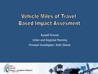
Vehicle Miles of Travel Based Impact Assesment. Russell Provost Urban and Regional Planning Principal Investigator: Ruth Steiner. The Issues. Climate Change California implemented AB32 & SB375 Requires regional transportation plans to provide for a 10% decrease in growth of VMT.

E N D
Vehicle Miles of Travel Based Impact Assesment Russell Provost Urban and Regional Planning Principal Investigator: Ruth Steiner
The Issues Climate Change California implemented AB32 & SB375 Requires regional transportation plans to provide for a 10% decrease in growth of VMT. Financial Burdens American Society of Civil Engineers says fixing the nation's transportation systems will cost some $2.2 trillion over the next five years
The Issues Sprawled Development Increased transportation costs “Households in highly sprawled areas devote about 20% more of their expenditures to transportation than do households in least sprawling areas.” – STPP Transportation Concurrency Florida Growth Management Act 1985 “…to establish an ongoing mechanism which ensures that public facilities and services needed to support development are available concurrent with the impacts of such development.” – 9J-5.0055
The Issues • Current methodologies to analyze the potential impact of proposed development on the transportation network • ITE Trip Generation • Internal capture and pass-by-reductions • Level-of-service-standards • Etc. • Research indicates methodologies need to be modified to be more sensitive to the context in which travel is taking place
RESEARCH OBJECTIVES • Produce a Vehicle Miles Travel (VMT) based draft methodology that will; • Closely reflect the impacts of specific types of land uses and their location within the region • Provide incentives for compact development that reduces the overall impact of development on the transportation network • Reflect Florida-specific travel behavior
Land Use and Transportation Intersection of land use planning and transportation planning Four guiding principles: Complementary mix of land uses Appropriate density and intensity of development High level of network connectivity Good urban design connecting complementary land uses
Land Use and Transportation Examining the role of the “D’s” Density Diversity Design Destinations Literature findings Neighborhood design: TND vs. conventional design. Proximity and balance of land use impacts trip generation rates. Jobs-housing balance in urban form and travel behavior
Methodology Roadway network Parcel data Travel Survey GIS Analysis GIS Analysis Trip Distance Land-use Descriptors Statistical Analysis Formula to calculate trip distance for different types of land use and trip purposes
Density • Residential • Number of residential units per acre • Commercial • Floor area ratios for particular land use categories
Operationalizing Diversity Entropy Land-use balance Proportion of area covered by each designated land-use types Dissimilarity Land-use mixing Extent to which different types of land-uses come in contact with one another Complementarity Extent to which the land-uses in contact with one another are complementary Diversity Entropy = 0.22 Low level of land-use balance Entropy = 0.82 High level of land-use balance
Design & Destinations Measuring the other “Ds” Measures of Design Miles of roadway per square mile Number of intersections per square mile Connected node ratio Measures of Destinations Presence of major regional “attractors” CNR = .72 CNR = .96
New Robust Travel Survey • At each origin / destination: • Household/Personal attributes • Demographics • Parcel level attributes • Land use (detailed and generalized) • Density (units/acre and FAR) • Area (parcel and buildings) • Neighborhood attributes • Percentage of each land use type • Connectivity indicators • Accessibility Measures • Regional Attributes • Trip Lengths!!!!!
Conclusions Next steps Database with trip distances and land use descriptors currently being examined Additional travel surveys to be examined Consensus among professionals and public agencies of a need for further research into the development of VMT-based impact fees
Conclusions This research is an important first step towards developing simple yet mathematically-sound operational procedures for implementing VMT-based traffic-impact assessment schemes How could it be used? Fee assessment vs. managing growth Alternative to concurrency?
Acknowledgements: • VMT-based Methodology: Center for Multimodal Solutions to Congestion Mitigation, Siva Srinivasan, Russell Provost, Lauren DeLarco, Abdulnaser Arafat, and Andy Duce