Download
1 / 41
410 likes | 574 Views
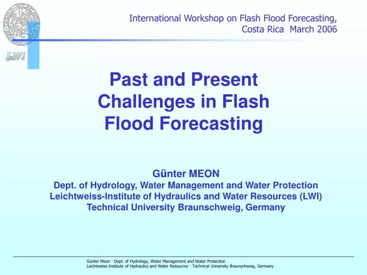
International Workshop on Flash Flood Forecasting, Costa Rica March 2006. Past and Present Challenges in Flash Flood Forecasting. G ü nter MEON Dept. of Hydrology, Water Management and Water Protection Leichtweiss-Institute of Hydraulics and Water Resources (LWI)

E N D
International Workshop on Flash Flood Forecasting, Costa Rica March 2006 Past and Present Challenges in Flash Flood Forecasting Günter MEON Dept. of Hydrology, Water Management and Water Protection Leichtweiss-Institute of Hydraulics and Water Resources (LWI) Technical University Braunschweig, Germany
Contents • General • Flash flood forecasting in the past • FF activities in Germany • FF activities in EC projects
1 General - Definitions • WMO (1974): “A flash flood is defined as a flood of short duration with a relatively high peak discharge” • U.S. NWS: “… a flood that follows the causative event within a few hours..” • WMO (1981, Report 18): “… a duration (time of concentration) of 6 hrs is proposed as a suitable break point between a FF and a “normal” flood… • Parker (ed., 2000): “ … too much water / too little time.. “
1 General - Definitions • Anquetin, Creutin e.a. (2004): • “…Flash floods produced by rainfall accumulations of: • more than 200 mm in less than 6 hours • over natural watersheds of 25 km2 to 2500 km2” • “.. Urban floods produced by shorter storms: • More than 50 mm in less than one hour • over built-up areas of 1 km2to 100 km2 “
2 FFF in the past – some remarks WMO (1981): “… in FFF the main requirement may be the quick identification of the fact that critical thresholds will be surpassed rather than the accurate determination of the magnitude and timing of the flood peak. Thus FFF does not necessarily have to be complex, and simple models may suffice .. “ “… FFF is one of the most difficult problems facing the hydrological and meteorological forecaster. It can be solved only by the joint efforts of the meteorologist and hydrologist…” “The key to successful FFF is organization ..” “.. Emphasis must also be given to the sociological aspects of FF warning programmes ..”
2 FFF in the past – some remarks • Doswell et al. (1996): • difficulty in accurately predicting FF producing storms because they are so rare • Forecasting, warnings and public preparedness for reducing casualties from tornadoes have improved steadily since the 1950 • However the “comparable system for FF has experienced less progress..” • Sokich (NOAA /NWS, 1999; in Parker, 2000): • Warning lead times for FF have increased by more than 40 minutes over the past ten years • Probability of detection has more than doubled
2 Actual research of FFF is hampered by … • The downscaling problem due to the incoherent space and time scales between atmospheric models and the FF triggering processes • The ungauged basin problem: small basins prone to FF are seldom gauged, must be modelled without calibration • The problem of (not) knowing the initial conditions of soil moisture and actual limits of soil retention control of runoff during extreme short term rainfall Combining radar detection of rain and distributed hydrological-hydraulic modelling provides considerable potential for monitoring and improving the FFF conditions
3 FF activities in Germany • Precipitation forecast • Project KONRAD: Short time forecast and warning system for thunderstorms (National German Weather Service DWD) • Hydrologic / hydraulic modelling • Flood forecast model NAXOS-PRAEDICT: adaption to flash flood forecast (Leichtweiss-Institute, Techn. Univ. Braunschweig) • Project PAI-OFF: process modelling and artificial intelligence for online flood forecasting in quickly responding catchments (Institute for Hydrology and Meteorology, Technical University Dresden, Germany) • FF management • Project URBAS: Forecast and management of urban flash floods (RIMAX Research Initiative of the German Ministry of Education and Research BMBF) •
3.1 Advances in precipitation forecast Project KONRAD (German Weather Service DWD) 16 Radar stations in Germany Complete scan every 15 minutes Low layer scan every 5 minutes Areal precipitation generated by overlay of station precipitation and radar images RADOLAN (Radar Online Calibration)
Project KONRAD (German Weather Service) “Convection development in radar products“Short -time thunderstorm forecast Method • Radar images are analysed every 5 minutes in the low layer with an angle of 0,8° and a range of about 100 km • Cell pixels have a resolution of 1 km². • KONRAD filters out the cores of thunderstorm cells; analysis and evaluation • Cell groups > 12 km² and > 23 mm/h are identified as thunderstorm cell cores cell core Prediction of travel paths, areal extension, stadium
Project KONRAD (German Weather Service) Legend for KONRAD Cell marks, Id Forecast of position, +60‘ Travel paths Warnings
Project KONRAD (German Weather Service) • KONRAD marks, traces and evaluates cell cores of summer storms • Travel paths can be extrapolated for forecasts • Travel paths + cell core warning • Continuous application used for forecasts • Immediate development of cell cores can be identified • Present limitations of KONRAD: • Recognition of winter thunderstorms (snow storms) • Continuous rainfall, e. g. 30mm/4h • Cyclones, tornadoes, whirlwinds • Freezing rain
3.2 Advances in hydrologic / hydraulic modelling (Flash) flood related research and model development NAXOS - PRAEDICT Leichtweiss-Institute for Hydraulic and Water Resources Technical University Braunschweig, Germany
GIS based conceptual catchment model NAXOS Model parameters generated with help of GIS (regionalized parameters) Sub-catchment and drainage network Landuse (vegetation cover, settlements, etc.) Soil groups and moisture conditions DEM (topography, slopes, etc.)
From catchment model NAXOS to forecast model PRAEDICT Regionalized model parameters for basin characteristics are imported into the forecast model; the sub-catchments are aggregated Forecast model PRAEDICT: Aggregation to 118 subbasins Catchment model NAXOS: 710 subbasins
Rising links of hydrographs, standardised to time of concentration Tc Runoff concentration time of flash floods in monsoon regions • 1. Hydrological approach(applicable in gauged basins) • the rising limbs of observed hydrographs were analysed for generation of time-area-graphs. • A new empirical travel time formula for the river network was found by use of the parameter drainage network density (DND)
Runoff concentration time of flash floods in monsoon regions • 1. Hydrological approach(applicable in gauged basins) • the rising links of observed hydrographs were analysed for generation of time-area-graphs. • A new empirical travel time formula for the river network was found by use of the parameter drainage network density (DND) Prevalent travel time formula related to channel length l and slope J New travel time formula related to channel length l, slope J and drainage network density (DND)
Rising links and assigned isochrones Runoff concentration time of flash floods in monsoon regions • 2. Hydraulic approach(applicable for ungauged basins) • With GIS-based catchment parameters • isochrones were generated • Travel time formulas were separated in overland flow und river network • Overland flow formulas are taken from literature (Kerby)
Runoff concentration time of flash floods in monsoon regions 2. Hydraulic approach(applicable for ungauged basins) Isochrones for the Ke Go catchment generated with the travel time formulas with NAXOS and GIS
Runoff concentration time of flash floods in monsoon regions Correlation between the hydraulic and the hydrologic computed time-area-graphs was very high. Finally the hydraulic approach was successfully verified in the Kolar catchment (Inda, 864 km²).
3.2 Advances in hydrologic / hydraulic modelling (Flash) flood forecasting with model system PAI-OFF (Process Modelling and Artificial Intelligence for Online Flood Forecasting) Institute for Hydrology and Meteorology Technical University Dresden, Germany
PAI-OFF (Schmitz e.a., 2005) • Methodology for online flood forecasting which combines: • the advantages of physically based, sophisticated modelling of the flood-relevant hydrologic process • the operational advantages of Artificial Neural Networks (ANN) Satisfies the most important requirements for flash flood forecasting, e.g.: • low computation time • complete robustness • simple operation • high predictive reliability
PAI-OFF Based on Schmitz e.a., 2005
PAI-OFF Based on Schmitz e.a., 2005
PAI-OFF Based on Schmitz e.a., 2005
PAI-OFF Based on Schmitz e.a., 2005
3.3 Advances in Flash Flood Management Prediction and management of flash floods in urban areas URBAS Hydrotec Engineering Consultants, Aachen, Germany funded by the Federal Ministry of Education and Research BMBF (Germany) as a part of RIMAX „Risk management of extreme flood events“ Internet: http://www.urbanesturzfluten.de Internet: http://www.rimax.de
Project URBAS • Challenge • Climate change studies indicate growing frequency and intensity of flash floods in Western Europe • Little is known about the character of flash floods (spatial distribution, frequency, typical damage) in urban areas • Urban FFF and warning systems are currently not satisfactory • Flood protection and coping strategies referring to river flooding cannot be applied to flash floods
Project URBAS (2005) Prediction and management of flash floods in urban areas Germany case studies Green: already Red: candidates Source: Hydrotec, 2006 Source: Hydrotec, 2006
Project URBAS • Objectives and Results • Close analysis of case studies in 15 German municipalities • Investigation of meteorological parameters, runoff and damage of urban flash floods • Hydro-meteorological investigation of precipitation and runoff using modern technologies such as the German Radar Network (KONRAD) from the German Weather Service (DWD) and high-resolution 2-D-runoff simulation models • Improvement of forecast tools, recommendations for early warning, loss mitigation measures, disaster control etc. • Development of innovative, feasible actions and mitigation measures for local authorities • Practicability • Valuable results for insurance industry, affected citizens and authorities, disaster control, urban planners and civil engineers
Project URBAS Picture left hand side: KONRAD – tool for thunderstorm cell tracking Picture right hand side: Flash flood in Lohmar (Northrhine Westfalia) Source: Hydrotec, 2006
4 Flash flood activities in EC projects • 1. Project HYDROPTIMET (Exchange between hydrologists and meteorologists in the west mediterranean area, optimization of the hydrometeorological forecast tools) • Project NEDIES (Natural and environmental disaster information exchange: including guidelines on flash flood prevention and mitigation) • Project FLOODsite
Integrated flood risk analysis and management methodologies Largest ever EC research project on floods 36 institutions from 13 countries Project administrator: HR Wallingford www.floodsite.net
Project Task 1, Sub-Theme 1.1: Flash flood hazards • Report on meteorological factors • physical processes and key hydrological parameters identified • hydrological model under development
Project ……… Task 15: Radar and satellite observation of storm rainfall for flash-flood forecasting in small to medium basins Task 16: Real-time guidance for flash flood risk management ……. TASK 23: …. Flash flood basins, establishment of a risk management strategy for flash floods
Project ……… Task 24: Pilot areas for FFFW • Four Hydrometeorological Observatories (HO) • Catalunya • Cévennes Vivarais • Ardennes • Adige