Download
1 / 37
370 likes | 511 Views
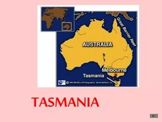
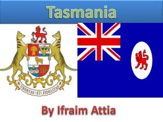
Tasmania. Offer Mrs. pensri puttha. Member Group. Mr.Wisarut Wonghajuk M.4/9 No.15. Mr.Borapot Pharakarn M.4/9 No.10. Mr.Titiyakorn Wongnukool M.4/9 No.25. Miss.Tipanun Jantaphak M.4/9 No.26. Miss.Suvaporn Jantapim M.4/9 No.40.

E N D
Offer Mrs. pensriputtha
Member Group • Mr.WisarutWonghajuk M.4/9 No.15 • Mr.BorapotPharakarn M.4/9 No.10
Mr.TitiyakornWongnukool M.4/9 No.25 • Miss.TipanunJantaphak M.4/9 No.26 • Miss.SuvapornJantapim M.4/9 No.40
Term 1 Academic year 2013 PathumthepWittayakarn school
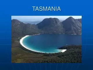
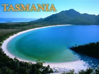
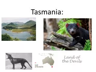
Tasmania (State of Tasmania). • Tasmania is an island state located in the southern part of Australia. Tasmania is the smallest state. Surrounded by a number of small islands which are King Island and Flinders Island is important. Hobart is the capital city of the state. Located on the mainland state of Victoria, about 240 kilometers and is composed of the city. The combination of culture and architecture . Which reflects the UK in the period before. Terrain is mostly mountains and highlands. Beautiful scenery. It has been dubbed. Switzerland. Australia is a city of peace, so outdoor activities are very popular. The climate in the state of Tasmania is the coast sea. In summer the average temperature is about 11-21 ° C and 4-11 ° C in winter
Tasmania • Tasmania (abbreviated as Tas and known colloquially as "Tassie") is an island state, part of the Commonwealth of Australia, located 240 kilometres (150 mi) to the south of the Australian continent, separated by Bass Strait. The state includes the island of Tasmania, the 26th largest island in the world, and the surrounding 334 islands. The state has a population of 507,626 (as of June 2010[update]), of whom almost half reside in the greater Hobartprecinct. Tasmania's area is 68,401 square kilometres (26,410 sq mi), of which the main island covers 62,409 square kilometres (24,096 sq mi).
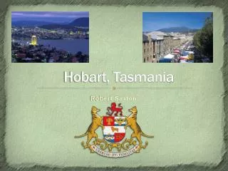
Tasmania is promoted as the natural state, the "Island of Inspiration",and A World Apart, Not A World Away owing to its large and relatively unspoiled natural environment. Almost 45% of Tasmania lies in reserves, national parks and World Heritage Sites. The island is 364 kilometres (226 mi) long from its northernmost to its southernmost points, and 306 kilometres (190 mi) from west to east. • The state capital and largest city is Hobart, which encompasses the local government areas of City of Hobart, City of Glenorchy, and City of Clarence, while the satellite town of Kingston (part of the Municipality of Kingborough) is generally included in the Greater Hobart area. • Tasmania is promoted as the natural state, the "Island of Inspiration",andA World Apart, Not A World Away owing to its large and relatively unspoiled natural environment. Almost 45% of Tasmania lies in reserves, national parks and World Heritage Sites. The island is 364 kilometres (226 mi) long from its northernmost to its southernmost points, and 306 kilometres (190 mi) from west to east.
The northernmost terrestrial point of the state of Tasmania is Boundary Islet, a nature reserve in Bass Strait which, due to a quirk of history, is shared with the state of Victoria. • The subantarcticMacquarie Island and its surrounding islands are also under the administration of Tasmania as a nature reserve and part of the Huon Valley Council local government area. The Bishop and Clerk Islets, about 37 km south of Macquarie Island, are the southernmost terrestrial point of the state of Tasmania, and the southernmost internationally recognised land in Australia • The northernmost terrestrial point of the state of Tasmania is Boundary Islet, a nature reserve in Bass Strait which, due to a quirk of history, is shared with the state of Victoria.
Etymology • The state is named after Dutch explorerAbel Tasman, who made the first reported European sighting of the island on 24 November 1642. Tasman named the island "Anthony van Diemen's Land" after his sponsor Anthony van Diemen, the Governor of the Dutch East Indies. The name was later shortened to Van Diemen's Land by the British. It was officially renamed Tasmania in honour of its first European discoverer on 1 January 1856. Tasmania was sometimes referred to as "Dervon", as mentioned in The Jerilderie Letter written by the notorious Australian bushrangerNed Kelly in 1879. The colloquial expression for the state is "Tassie" (pronounced "Tazzie"). This name is often used in advertising campaigns, for example by the Bass Strait ferry, Spirit of Tasmania. Tasmania is also colloquially shortened to "Tas" (pronounced "Taz"), especially when used in business names and website addresses. TAS is also the Australia Post abbreviation for the state. The name for Tasmania in Palawakaniis "Lutriwita".(source?)
History Tessellated pavement, a rare rock formation on the Tasman Peninsula
The island is believed to have been joined to the mainland of Australia until the end of the last glacial periodapproximately 10,000 years ago. Much of the island is composed of Jurassicdolerite intrusions (upwellings of magma) through other rock types, sometimes forming large columnar joints. Tasmania has the world's largest areas of dolerite, with many distinctive mountains and cliffs formed from this rock type. • The central plateau and the southeast portions of the island are mostly dolerite. Mount Wellington above Hobart is a good example, showing distinct columns known as the Organ Pipes. In the southern midlands as far south as Hobart, the dolerite is underlaid bysandstone and similar sedimentary stones. In the southwest, Precambrianquartzites was formed from very ancient sea sediments and form strikingly sharp ridges and ranges, such as Federation Peak or Frenchmans Cap.
In the northeast and east, continental granitescan be seen, such as at Freycinet, similar to coastal granites on mainland Australia. In the northwest and west, mineral-rich volcanic rock can be seen at Mount Read near Rosebery, or at Mount Lyell near Queenstown. Also present in the south and northwest is limestonewith magnificent caves. • The quartzite and dolerite areas in the higher mountains show evidence of glaciation, and much of Australia's glaciated landscape is found on the Central Plateau and the Southwest. Cradle Mountain, another dolerite peak, for example, was a nunatak. The combination of these different rock types offers incredible scenery, much of it distinct from any other region of the world. In the far southwest corner of the state, the geology is almost completely quartzite, which gives the mountains the false impression of having snow-capped peaks year round.
Indigenous people Picture of the last four full-blood Tasmanian Aboriginesc.1860s. Truganini, the last to survive, is seated at far right.
Tasmania was first inhabited by the Tasmanian Aborigines. Evidence indicates their presence in the region, later to become an island, at least 35,000 years ago. Rising sea levels cut Tasmania off from mainland Australia about 10,000 years ago. • By the time of European contact, the Aboriginal people in Tasmania had nine major ethnic groups. At the time of British settlement in 1803, the indigenous population was estimated at between 5,000 and 10,000 people. Through the introduction of infectious diseases to which they had no immunity, war, persecution, and intermarriage, the population dwindled to 300 by 1833. Almost all of the indigenous population was relocated to Flinders Islandby George Augustus Robinson.
A woman named Truganini (1812–1876) is generally recognised as the last full-blooded Tasmanian Aborigine. Strong evidence suggests that the last survivor was another woman, Fanny Cochrane Smith, who was born at Wybalena and died in 1905. • European arrival Tasmania in the late 19th century
The first reported sighting of Tasmania by a European was on 24 November 1642 by the Dutch explorer AbelTasman. Tasman landed at today's Blackman Bay. In 1773, Tobias Furneaux was the first Englishman to land in Tasmania at Adventure Bay. A French expedition led by Marc-Joseph Marion du Fresne also landed at Blackman Bay in 1772. • Captain James Cook landed at Adventure Bay in 1777—with young William Bligh aboard. Bligh returned in 1788 (HMS Bounty) and again in 1792 (HMS Providence), with young Matthew Flinders aboard. Numerous other Europeans made landfalls, adding a colourful array to the names of topographical features. Matthew Flinders and George Bass first proved Tasmania to be an island in 1798–99. • The first settling of Tasmania was by the British at Risdon Cove on the eastern bank of the Derwent estuary. In 1800, the French sent an expedition led by Commander Baudin to explore the South Seas, The reason for the expedition was suspected to be to try to establish a French colony on the coast of NewHolland. In response to this, the Lady Nelson and the whalerAlbion commanded by Lieutenant JohnBowen, sailed from Port Jackson on 31 August 1803, and he arrived in the Derwent on Sunday, 12 September in the Albion. The Lady Nelson had arrived five days before, on 7 September. 12 September is regarded as the birthday of the colony (now state) of Tasmania. Lieutenant Bowen chose Risdon Cove on the left bank of the Derwent a few miles above Hobart. Among the settlers were 21 male convicts and an overseer and three women, besides the officers and two free settlers. About two months later, the colony had increased to 100 people. An alternative settlement was established by Captain David Collins 5 kilometres (3.1 mi) to the south in 1804 in Sullivans Cove on the western side of the Derwent, where fresh water was more plentiful. The latter settlement became known as Hobart Town or Hobarton, later
shortened to Hobart, after the British Colonial Secretary of the time, Lord Hobart. The settlement at Risdon was later abandoned. • The early settlers were mostly convicts and their military guards, with the task of developing agriculture and other industries. Numerous other convict-based settlements were made in Van Diemen's Land, including secondary prisons, such as the particularly harsh penal colonies at Port Arthur in the southeast and Macquarie Harbour on the West Coast. In the 50 years from 1803 to 1853, around 75,000 convicts were transported to Tasmania. Van Diemen's Land was proclaimed a separate colony from New South Wales, with its own judicial establishment and Legislative Council, on 3 December 1825.
Colony of Tasmania • The Colony of Tasmania (more commonly referred to simply as "Tasmania") was a British colony that existed on the island of Tasmania from 1856 until 1901, when it federated together with the five other Australian colonies to form the Commonwealth of Australia. The possibility of the colony was established when the Westminster Parliament passed the Australian Colonies Government Act 1850, granting the right of legislative power to each of the six Australian colonies.
The Legislative Council of Van Diemen's Land drafted a new constitution which they passed in 1854, and it was given Royal Assent by Queen Victoria in 1855. Later in that year the Privy Council approved the colony changing its name from "Van Diemen's Land" to "Tasmania", and in 1856, the newly elected bicameral parliament sat for the first time, establishing Tasmania as a self-governing colony of the British Empire. • The Colony suffered from economic fluctuations, but for the most part was prosperous, experiencing steady growth. With few external threats and strong trade links with the Empire, the Colony of Tasmania enjoyed many fruitful periods in the late 19th century, becoming a world-centre of shipbuilding. It raised a local defence force which eventually played a significant role in the Second Boer War in South Africa, and Tasmanian soldiers in that conflict won the first two Victoria Crosses awarded to Australians. Tasmanians voted in favour of federation with the largest majority of all the Australian colonies, and on 1 January 1901 the Colony of Tasmania became the Australian state of Tasmania.
Recent history • The state was badly affected by the 1967 Tasmanian fires, in which there was major loss of life and property. In the 1970s, the state government announced plans to flood environmentally significant Lake Pedder. As a result of the eventual flooding of Lake Pedder, the world's first greens party was established; the United Tasmania Group.
In 1975, the Tasman Bridge collapsed when the bridge was struck by the bulk ore carrier MV Lake Illawarra. This made crossing the Derwent River at Hobart almost impossible. • National and international attention surrounded the campaign against the Franklin Dam in the early 1980s. • On 28 April 1996, in the incident now known as the Port Arthur massacre, lone gunman Martin Bryant shot and killed 35 people (including tourists and residents) and injured 21 others. The use of firearms was immediately reviewed, and new gun ownership laws were adopted nationwide, with Tasmania's law one of the strictest in Australia.
In April 2006, the Beaconsfield Mine collapse was triggered by a small earthquake. One person was killed and two others were trapped underground for 14 days. • The Tasmanian community has for some time been divided over the issue of the proposed Bell Bay Pulp Mill to be built in the Tamar Valley. Proponents argue that jobs will be created, while opponents argue that pollution will damage both the Bass Strait fishing industry and local tourism. • In January 2011, wealthy philanthropist David Walsh opened the Museum of Old and New Art (MONA) in Hobart to international acclaim. Within 12 months, MONA became Tasmania's top tourism attraction.
Port Arthur Parliament House, Hobart.
The form of the government of Tasmania is prescribed in its constitution, which dates from 1856, although it has been amended many times since then. Since 1901, Tasmania has been a state of the Commonwealth of Australia, and the Australian Constitution regulates its relationship with the Commonwealth and prescribes which powers each level of government enjoys. • Politics • Main articles: Governors of Tasmania and Parliament of Tasmania • Tasmania is a State in the Australian federation. Its relationship with the Federal Government and Parliament are regulated by the Australian Constitution. Tasmania is represented in the Senate by 12 senators, on an equal basis with all other states. In the House of Representatives, Tasmania is entitled to five seats, which is the minimum allocation for a state guaranteed by the Constitution—the number of House of Representatives seats for each state is otherwise decided on the basis of their relative
populations, and Tasmania has never qualified for five seats on that basis alone. Tasmania's House of Assembly use a system of multi-seat proportional representation known as Hare-Clark. • At the 2002 state election, the Labor Party won 14 of the 25 House seats. The Liberal Party saw their percentage of the vote decrease dramatically, and their representation in the Parliament fell to seven seats. The Greens won four seats, with over 18% of the popular vote, the highest proportion of any Green party in any parliament in the world at that time.
Geography Topography of Tasmania
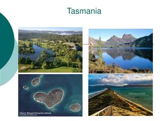
Dove Lake and Cradle Mountain, Central Tasmanian Highlands Wineglass Bay, in Freycinet National Park Tasmania's landmass of 68,401 km2 (26,410 sq mi) is located at 42°S 147°E42°S 147°ECoordinates:
The Derwent River flows south and reaches the coast at Hobart; the Tamar River flows north from Launceston; the Mersey River also flows north to the North West coast at Devonport, and the Franklin and Gordon Rivers flow west and meet the coast at Strahan. The South Esk River is the longest river in Tasmania. It starts in the mountains at Fingal and flows through Avoca, Evandale, Longford, Hadspen and finally Launceston. The river is dammed at Launceston's Trevallyn Dam and used for the city's hydroelectricity. Although most of the water is dammed at Lake Trevallyn, some flows on into the Cataract Gorge, where it becomes a tributary to the Tamar Estuary, and the outflow from the power station also joins the Tamar River downstream of Launceston.
Climate Russell Falls, in Mount Field National Park Moulting Lagoon and Great Oyster Bay with the Freycinet Peninsula in the distance
Tasmania has a cool temperate climate with four distinct seasons. Summer lasts from December to February when the average maximum sea temperature is 21 °C (70 °F) and inland areas around Launceston reach 24 °C (75 °F). Other inland areas are much cooler, with Liawenee, located on the Central Plateau, one of the coldest places in Australia, ranging between 4 °C (39 °F) and 17 °C (63 °F) in February. Autumn lasts between March and May and experiences changeable weather, when summer weather patterns gradually take on the shape of winter patterns.
Tasmania became known as the 'Apple Isle' because for many years it was one of the world's major apple producers. Apples are still grown in large numbers, particularly in southern Tasmania, and have the distinction of being the first approved by the Japanese government for import, due to their verifiable pest-free status. • Ecology
Ferns in Hellyer Gorge, to the northeast of Savage River National Park. Although Tasmanian devils are nocturnal, they like to rest in the sun. Scarring from fighting is visible next to this devil's left eye.
Geographically and genetically isolated, Tasmania is known for its unique flora and fauna. Tasmania has extremely diverse vegetation, from the heavily grazed grassland of the dry Midlands to the tall evergreen eucalypt forest, alpineheathlands and large areas of cool temperate rainforests and moorlands in the rest of the state. Many flora species are unique to Tasmania, and some are related to species in South America and New Zealand through ancestors which grew on the super continent of Gondwana, 50 million years ago. The island of Tasmania was home to the Thylacine, a marsupial which resembled a wild dog. Known colloquially as the Tasmanian Tiger for the distinctive striping across its back, it became extinct in mainland Australia much earlier because of competition by the dingo, introduced in prehistoric times. • Owing to persecution by farmers, government-funded bounty hunters and, in the final years, collectors for overseas museums, it appears to have been exterminated in Tasmania. The Tasmanian devil became the largest carnivorous marsupial in the world following the extinction of the thylacine in 1936, and is now found in the wild only in Tasmania.
Demography • Tasmania's population is unusually homogeneous. The state receives relatively little immigration, and an estimated 10,000 or fewer "founding families" in the mid-19th century are the ancestors of about 65% of its residents. As of 1996more than 80% of Tasmanians were born in the state and almost 90% were born in Australia, New Zealand, Great Britain, and Ireland. The homogeneity makes it an attractive location to study population genetics. As of 2008, Tasmania is the only state in Australia which has an above-replacement total fertility rate. Tasmanian women have an average of 2.24 children each. This is also the highest TFR recorded in Tasmania after 1975.