Download
1 / 16
170 likes | 362 Views
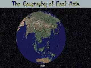
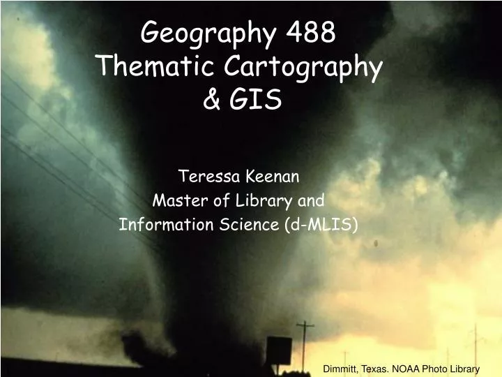
Geography 488 Thematic Cartography & GIS. Teressa Keenan Master of Library and Information Science (d-MLIS). Dimmitt, Texas. NOAA Photo Library. From Points to Polygons & Beyond: Mapping the Historical Record. Tornadoes F-Scale Physical Damage Tennessee Tornado Trivia.

E N D
Geography 488Thematic Cartography & GIS Teressa Keenan Master of Library and Information Science (d-MLIS) Dimmitt, Texas. NOAA Photo Library
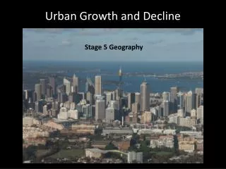
From Points to Polygons & Beyond:Mapping the Historical Record • Tornadoes • F-Scale • Physical Damage • Tennessee Tornado Trivia Geog. 488 Union City OK 1973.NOAA Photo Library,
Characteristics of Tornadoes • Violent Windstorm • Twisting • Funnel Shaped Cloud • Cool air overrides a layer of warm air • Derived from Spanish verb “tomar” = to turn Geog. 488 Lakeview, Texas in 1977. NOAA Photo Library, NOAA Central Library
Tornadoes can rotate clockwise as well as anti-clockwise. Tornadoes cause houses to explode from changes in air pressure. The best place to be during a tornado is generally in the southwest corner of the basement. TRUE! Most in the US spin counter-clockwise. Some spin clockwise & a few have been seen to change from anticyclonic to cyclonic! False!Homes are damaged by strong winds & flying debris not air pressure changes. False! Current advice is to move to a protected interior room on the lowest floor of the building. Test Your Twister IQ? Geog. 488 White Deer, Texas, USA. Photo by Jimmy Deguara and David Croan
Fujita Scale • Tetsuya (Ted) Fujita (1920-1998) • Introduced in 1971 • Accepted by National Weather Service 1973 • Allen Pearson • Path length & width • Measures Intensity • Empirically derived from structural damage • Directly derived with high resolution Doppler radar wind speed data • Enhanced F-Scale Feb. 1, 2007 Geog. 488 Near Seymour, Texas in 1979. Photographer: D. Burgess NOAA Photo Library
F-Scale continued • Rank intensity based on damage • Contrived by connecting Beaufort wind scale with the speed of sound in 12 steps. • Estimated strength of wind based on observed damage Fujita, T.T. 1981. Tornadoes and downbursts in the context of generalized planetary scales. J. Atmos. Sci, 38, 1511-1534. Geog. 488 Tornado in Attica, Kansas, USA . Photo by Jimmy Deguara
F-0: Light Damage (40-72 mph)roof shingles, tree branches etc. • F-1: Moderate Damage (73-112 mph)overturn mobile homes, cars etc. • F-2: Significant Damage (113-157mph)demolish mobile homes, tear off roofs, large trees uprooted, light objects become missiles. Geog. 488
F-3: Severe Damage(158-206 mph)roof & walls of frame houses, trains overturned, most trees uprooted. • F-4: Devastating (207-260 mph)homes leveled, blown off foundations, large missiles generated. • F-5: Incredible Damage (261-318 mph)trees debarked, steel reinforced concrete structures damaged, cars become missiles Geog. 488
Fujita - Table Geog. 488 Union City OK 1973 NOAA Photo Library, NOAA Central Library
Tennessee Tornado Trivia • Is ranked 23rd for frequency • Ranks 9th in the US for number of deaths, • Ranked 11th for injuries • And 25th for cost of damages Effgen, C. (n.d.). Tennessee tornadoes. Retrieved April 26, 2006, from http://www.disastercenter.com/tennesse/tornado.html Geog. 488 Sharon, Kansas, USA . Photo by Jimmy Deguara of http://austrailasevereweather.com
When compared to other states by the frequency per square mile, Tennessee ranks: • 23rd for the frequency • 6th for fatalities • 9th for injuries per area and • 26th for costs per area Union City OK 1973 NOAA Photo Library, NOAA Central Library
It was the worst tornado outbreak in U.S. history with 148 twisters touching down in 13 states. Before it was over 16 hours later, 330 people were dead and 5,484 were injured in a damage path covering more than 2,500 miles. 28 tornadoes lashed 19 counties of Middle and Eastern Tennessee between the early afternoon of April 3 and 1:00 a.m. the following morning-in the worst single outbreak of tornadoes in the State's history. The storms left 50 people dead, 635 injured, and caused approximately $30 million damage. Carey, C. (1974). Details of outbreak by state: Tennessee. In NOAA and the 1974 tornado outbreak. Retrieved April 26, 2006, from National Oceanic and Atmospheric Administration Web site: http://www.publicaffairs.noaa.gov/storms/tennessee.html
By opening the windows, you can balance the pressure inside and outside your home so a tornado will not do damage. A tornado is always accompanied or preceded by a funnel cloud. When traveling by car seek shelter under an overpass. False! Opening windows actually make the situation worse. False! Especially in the early stages, a tornado can be causing damage on the ground even though a visible funnel cloud is not present. False! Wind currents are concentrated as they are squeezed under the overpasses and increase in speed. This increased speed with flying debris INCREASES the risk of injury or death. Twister IQ – part 2 Geog. 488 Dimmitt, Texas. NOAA Photo Library
Questions? Geog. 488 Wall cloud of an approaching tornado NOAA Photo Library