Download
1 / 16
160 likes | 214 Views
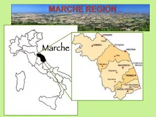
MARCHE REGION D.A.M.A.C. Security and defence of the sea and communications. Geof. LEONARDO POLONARA. D.A.M.A.C. Environment Defence of the Adriatic Sea and Communications.

E N D
MARCHE REGION D.A.M.A.C. Security and defence of the sea and communications Geof. LEONARDO POLONARA
D.A.M.A.C.Environment Defence of the Adriatic Sea and Communications The general purpose of the project called D.A.M.A.C. (Environment Defence of the Adriatic Sea and Communications) consists in organising within European Community Programme INTERREG III A an important partnership between Marche Region and Zadar County in order to start concrete actions useful to an integrated management as well as a process of sustainable development (economic, ecologic and emergetic one) in the Central Adriatic.
The DAMAC’s GIS uses the “Digital Chart of the World” which is ESRI Inc. vectorial world coverage geo-database in ArcInfo format.On this geographical chart some topics of interest are visualised. In this case, ship position (1830 transits in 2005) and main routs
Secur Sea Metodology • R (RISCK)= f (Ha x Vu x Ex) • Ha=HAZARD • - maritime traffic of the vessels which transport dangerous cargo ( petrol, chemicals) • - high concentration of maritime traffic • - natural phenomena (storm, waves generated by the seismic events, sea current direction) • Vu=VULNERABILITY • -vulnerability of the marine ecosystem • - human population • Ex=EXPOSITION • - economic estimation of the natural environment ecosystems • - fishing and tourist activities values Risk maps and environmental crisis analysis Proposal for the legal preventions measures in case of damage of the Italian or Croat Country
SCENARIOS MAN MADE DISASTERS IN ADRIATIC SEA EXPECTED, NOT IF… BUT WHEN! Prestige (Galizia) Jessica (Galapagos)
Le zone di cattura dell’Eledone moscata (Calamaro) in Adriatico (con i toni più scuri le aree di maggior cattura). Relazione con la dispersione dell’oil spill soprattutto sulla costa dell’Istria
Ipotesi: Km 47 di costa Non balneabilità per 3 mesi ESTIVI “SOFT” DISASTER 35 volte inferiore a quello della Prestige 1920 tons of oil released so far 450 Hours after start of spill 200.0 Pixel size (m) for spill plotting - modello MEDSLIK 39.78 % evapora 12.39 % superficie 19.39 % disperso 28.44 % raggiunge la costa
“SOFT” DISASTER Tourist activities and the beaches would disappear during the first year of disaster? Or it would move to similar resorts to the north and south? What would happen in the years to come?
Plan Proposal to reduce the danger -Forming a permanent working group for confrontation and agreement between small and big interested parties -VTS monitoring Plan -Limit value for vessel to be destroyed and severe vessel control -Limits to the navigation in bad meteorological conditions -Automatic Identification System(AIS) -Monitoring systems and their improvement -Sea highway
IMPOSSIBLE SEA HIGHWAY ONLY TWO POSSIBLE HAROBOURS: PLOCE AND RIJEKA
AUTOSTRADA DEL MAREACQUE TERRITORIALI ACQUE INTERNAZIONALI-ZONA DI PROTEZIONE ECOLOGICA