Download
1 / 11
110 likes | 257 Views
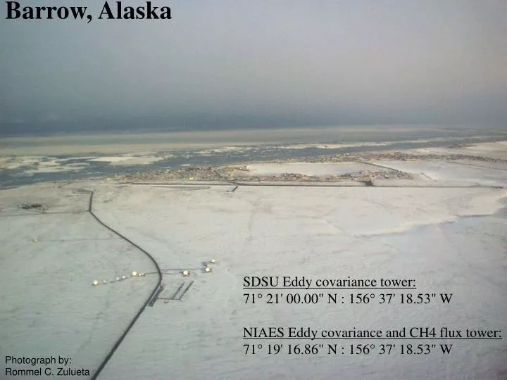
Barrow, Alaska. SDSU Eddy covariance tower: 71° 21' 00.00" N : 156° 37' 18.53" W NIAES Eddy covariance and CH4 flux tower: 71° 19' 16.86" N : 156° 37' 18.53" W. Photograph by: Rommel C. Zulueta. Year 2000 Snowmelt at Barrow, Alaska .

E N D
Barrow, Alaska SDSU Eddy covariance tower: 71° 21' 00.00" N : 156° 37' 18.53" W NIAES Eddy covariance and CH4 flux tower: 71° 19' 16.86" N : 156° 37' 18.53" W Photograph by: Rommel C. Zulueta
Year 2000 Snowmelt at Barrow, Alaska. Yoshinobu Harazono, Masayoshi Mano, Walter C. Oechel, Rommel C. Zulueta The Barrow research sites are located on the coastal plain just northwest of the village of Barrow. The vegetation is typical wet-sedge coastal plain tundra. The area has two year-round eddy covariance towers for CO2, CH4 H2O and energy flux along with other research projects in vegetation demography, tundra temperature/water manipulations, hyperspectral measurements and plant phenology. It should be noted that these sites are adjacent to the NOAA Climate Monitoring and Diagnostics Laboratory (CMDL) and the DOE's Atmospheric Radiation Measurement sites. Measurements: Snow depth was measured in 24 locations around the eddy covariance tower every 3 to 4 days. Snow surface temperature was measured with a infrared thermometer. Digital photographs were taken using a Nikon Coolpix 900.
NIAES Eddy covariance and CH4 flux tower: 71° 19' 16.86" N : 156° 37' 18.53" W May 18, 2000 Photograph by: Masayoshi Mano
NIAES Eddy covariance and CH4 flux tower: 71° 19' 16.86" N : 156° 37' 18.53" W May 31, 2000 Photograph by: Masayoshi Mano
NIAES Eddy covariance and CH4 flux tower: 71° 19' 16.86" N : 156° 37' 18.53" W June 6, 2000 Photograph by: Masayoshi Mano
NIAES Eddy covariance and CH4 flux tower: 71° 19' 16.86" N : 156° 37' 18.53" W June 9, 2000 Photograph by: Masayoshi Mano
NIAES Eddy covariance and CH4 flux tower: 71° 19' 16.86" N : 156° 37' 18.53" W June 11, 2000 Photograph by: Masayoshi Mano
NIAES Eddy covariance and CH4 flux tower: 71° 19' 16.86" N : 156° 37' 18.53" W June 13, 2000 Photograph by: Masayoshi Mano
NIAES Eddy covariance and CH4 flux tower: 71° 19' 16.86" N : 156° 37' 18.53" W June 15, 2000 Photograph by: Masayoshi Mano
NIAES Eddy covariance and CH4 flux tower: 71° 19' 16.86" N : 156° 37' 18.53" W June 17, 2000 Photograph by: Masayoshi Mano
Collaborators: National Institute of Agro-Environmental Sciences Japan Dr. Yoshinobu Harazono Masayoshi Mano San Diego State University Dr. Walter C. Oechel Rommel C. Zulueta Acknowledgements Funding for this research was provided by the National Science Foundation ARCSS (Grant No. OPP-9732105 ) and TECO (Grant No. DEB-9730004) Photograph by: Rommel C. Zulueta