Download
1 / 30
300 likes | 465 Views
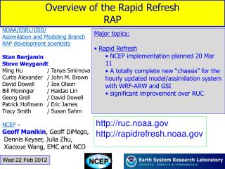
Rapid Update Cycle-RUC Rapid Refresh-RR High Resolution Rapid Refresh-HRRR RTMA. http://rapidrefresh.noaa.gov/. Rapid Update Cycle: RUC (replaced last year).

E N D
Rapid Update Cycle-RUCRapid Refresh-RRHigh Resolution Rapid Refresh-HRRRRTMA
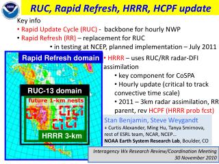
Rapid Update Cycle: RUC (replaced last year) • A major issue is how to assimilate and use the rapidly increasing array of off-time or continuous observations (not a 00 and 12 UTC world anymore!) • Want very good analyses and very good short-term forecasts (1-3-6 hr) • The RUC ingested and assimilated data hourly, and then makes short-term forecasts • Used the MAPS mesoscale model…which used a hybrid sigma/isentropic vertical coordinate • Resolution: 13 km and 50 levels
13km RUC Terrain elevation - 100 m interval
Observations used in RUC Data Type ~Number Freq. -------------------------------------------------- Rawinsonde 80 /12h NOAA profilers 30 / 1h VAD winds 110-130 / 1h Aircraft (V,temp) 1400-4500 / 1h Surface/METAR 1500-1700 / 1h Buoy/ship 100-150 / 1h GOES precip water 1500-3000 / 1h GOES cloud winds 1000-2500 / 1h GOES cloud-top pres 10 km res / 1h SSM/I precip water 1000-4000 / 6h -------------------------------------------------- GPS precip water ~300 / 1h Mesonet ~5000 / 1h METAR-cloud-vis-wx ~1500 / 1h --------------------------------------------------
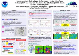
RUC History – NCEP (NMC) implementations • - First operational implementation of RUC • - 60km resolution, 3-h cycle • 1998 – 40km resolution, 1-h cycle, • - cloud physics, land-sfc model • 2002 – 20km resolution • - addition of GOES cloud data in assimilation • 2003 – Change to 3dVAR analysis from previous OI • (April) • 2004 – Vertical advection, land use (April) • PBL-depth for surface assimilation (September) • 2005 – 13km resolution, new obs, new model physics • (June) • 2012 – WRF-based Rapid Refresh w/ GSI replacedRUC
Rapid Refresh • A new version of RUC has been developed, that uses the WRF model instead of the MAPS model. Called the Rapid Refresh. • Larger domain
RTMA(Real Time Mesoscale Analysis System) NWS New Mesoscale Analysis System for verifying model output and human forecasts.
RTMA • Downscales a short-term forecast to fine-resolution terrain and coastlines and then uses observations to produce a fine-resolution analysis. • Performs a 2-dimensional variational analysis (2d-var) using current surface observations, including mesonets, and scatterometer winds over water, using short-term forecast as first guess. • Provides estimates of the spatially-varying magnitude of analysis errors • Also includes hourly Stage II precipitation estimates and Effective Cloud Amount, a GOES derived product • Either a 5-km or 2.5 km analysis.
RTMA • The RTMA depends on a short-term model forecast for a first guess, thus the RTMA is affected by the quality of the model's analysis/forecast system • CONUS first guess is downscaled from a 1-hour RR forecast. • Because the RTMA uses mesonet data, which is of highly variable quality due to variations in sensor siting and sensor maintenance, observation quality control strongly affects the analysis.
Why does NWS want this? • Gridded verification of their gridded forecasts (NDFD) • Serve as a mesoscale Analysis of Record (AOR) • For mesoscale forecasting and studies.
RTMA 2dVAR update RUC-RTMA downscaling to detailed RTMA background
RTMA 2dVAR update RUC-RTMA downscaling to detailed RTMA background