Download

1 / 30

E N D
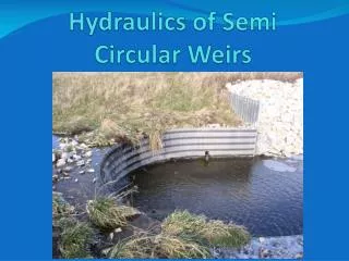
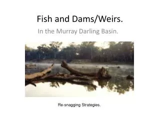
SINGLE STONE BENDWAY WEIRS (SSBW) follow all design rules for Bendway Weirs, but are typically constructed of just one very large stone, typically 5 to 7 ft long, 3 to 4 ft wide, angled 70 degrees upstream to the bank, level-crested one ft above base flow water surface elevation, & keyed into the bank. Spacing rarely exceeds 50 ft, SSBW typically are 25 to 35 ft apart. SSBW are designed to reduce near bank velocities & shear stress, & relocate the thalweg to a smoothed alignment off the stream ends fo the SSBW. A general rule of thumb for any Bendway Weirs, the shorter the weir, the closer the spacing, the longer the weir, the greater the spacing.
AERIAL VIEW OF STONE TOE PROTECTION WITH SINGLE- STONE BENDWAY WEIRS (SSBW). THALWEG REALIGNMENT DUE TO SSBW!! SSBW Thalweg Realigned by SSBW Stone Toe protection Original Thalweg SSBW
ICE DAMAGE REDUCTION PROJECT- CHAUTAUQUA CREEK @ MOUTH (LAKE ERIE) WESTFIELD, NY Pix by Dave Spann
CHAUTAUQUA CREEK ICE DAMAGE REDUCTION PROJECT –Near its mouth @ Lake Erie • Severe scour from ice & high flow velocities eroded a 285 ft section of the right descending bank landward 30 ft, resulting in an overwidened section of stream. • Mid-channel sediment bars, shallow areas, & mouth of creek @ Lake Erie clogged, resulting in blockage of fish migration for spawning • No holding areas or habitat for steelhead or salmon • A heavily used public fishing section of stream
Conceptually the project should: • Provide a very smooth, armored, & well-aligned right descending bank • Establish dense upper bank and top bank vegetation for shade, detritus, and reduce the chance of overbank ice jams (picket fence theory) • Move the thalweg 5 to 7 ft streamward of the toe of the bank protection with a series of Single Stone Bendway Weirs spaced 50 ft apart). • Provide in-stream habitat & holding areas for sport fish • Provide a replacement fisherman’s path along top bank • BONUS: Blow out the sediment block at the mouth of the creek (where it empties into Lake Erie)
Single Stone Bendway Weirs (pegged to bedrock) NEED PLANS & SPECS Trenched Stone & Stacked Stone Wall Key Sloped Stone using “Big Flats” (large 4 ft by 7 ft wide stones) thalweg Key Flow Realigned Key Key Key Key Key
DRILLING & PEGGING TOE STONES & SINGLE STONE BENDWAY WEIRS TO BEDROCK WITH 1 5/8” DIAMETER METAL RODS
Construction June 2006. Looking DS @ 2 hoes jack hammering a footer trench through solid stone Pix by derrick
7 ft long, 1 5/8 inch diameter rebar rods for pegging stone to bedrock. Pix by Joe Galati
Dave Spann of Chautauqua County Soil & Water Conservation District with a 7 ft long, 1 5/8 inch diameter rebar. Dave did everything from writing the grant to providing extraordinary project management. On time & under budget!!!! Pix by Joe Galati
Construction June 2006. Looking DS. Drilling 2.5 inch dia. holes to peg stone to bedrock. The 2.5 inch bit was the only one they had on hand… Pix by Joe Galati
Construction June 2006. A good hole in a footer stone. Pix by Joe Galati
Construction June 2006. Looking US. Metal pinning rods not cut off yet. Pix by derrick
Aug 31, 2006, looking US at two pegged to bedrock Single-Stone Bendway Weirs (50 ft apart) in the stacked stone wall section. Pix by derrick
Aug 29, 2006 -high water- Looking US, note dead water near toe & thalweg location near arrow, all due to the Single Stone Bendway Weirs Photo by Dave Spann
Looking downstream at the SINGLE-STONE BENDWAY WEIRSHIGH WATERAUG 29, 2006
Aug 29, 2006-high water-looking DS Photo by Dave Spann Note rooster tail defining right edge of high velocity water
Aug 29, 2006-high water-Looking DS toward Lake Erie Photo by Dave Spann
Mar 14, 2006. Looking DS. Three submerged Bendway Weirs can be located due to surface disturbance.Thalweg well-aligned streamward of the stream ends of the SSBW Pix by Joe Galati
Mar 14, 2006. Looking DS. Close-up of two submerged Bendway Weirs. Slow water near bank Pix by Joe Galati
Nov 8, 2007. Looking DS. Base flow, thalweg off the ends of the SSBW Pix by Joe Galati
Project effects downstream at the mouth (Lake Erie) Feb 7, 2007
Looking DS on Feb 7, 2007 at ice mountains blocking mouth of Chautauqua Creek @ Lake Erie {approx. 700 ft DS of DS end of project}. Pix from Joe Galati-NYSDEC
Looking DS at ice mountains blown out by concentrated flow from our project. This is approx. 700 ft DS of DS end of project. Mar 14, 2007 Pix from Joe Galati-NYSDEC
This PowerPoint presentation was developed & built by Dave Derrick. Any questions or comments, call my personal cell @ 601-218-7717, or email @ d_derrick@r2d-eng.comEnjoy the information!!