Download
1 / 14
140 likes | 316 Views
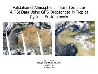
Validation of Atmospheric Infrared Sounder (AIRS) Data Using GPS Dropsondes in Tropical Cyclone Environments. Eddy Hildebrand University of Miami-RSMAS Miami, FL 13 May 2010. Objectives.

E N D
Validation of Atmospheric Infrared Sounder (AIRS) Data Using GPS Dropsondes in Tropical Cyclone Environments Eddy Hildebrand University of Miami-RSMAS Miami, FL 13 May 2010
Objectives • Validate the performance of AIRS in measuring temperature and moisture profiles in the environments surrounding Irene (2005), Debby (2006), and Helene (2006) • Temporally average AIRS data to show seasonal variability in tropical North Atlantic moisture • Compare AIRS moisture data with other satellite measurements such as SSM/I • Examine the relationship between dry air and intensity change of tropical cyclones • Dry air from Saharan Air Layer (SAL) and/or mid-latitude origins • Also consider SHIPS wind shear and SST
Defining and Tracking the SAL Occasional dust outbreaks (every few days) originating over Africa Most frequent in June/July (Dunion 2010, Dunion and Marron 2008) Propagate across the Atlantic at nearly the same speed as tropical waves Tracked using several methods: VIS, IR, and MW satellites (GOES, Meteosat) Navy Aerosol Analysis and Prediction Scheme (NAAPS) Hybrid Single Particle Lagrangian Integrated Trajectory (HYSPLIT) model Radiosondes and GPS dropsondes (sparse coverage)
AIRS Background Aboard Aqua satellite (part of A-Train) launched in May 2002 2378 spectral channels Expected performance ability (Tobin et al. 2006): Temperature – RMS differences of 1K in 1km layers RH – 20% in 2km layers ~50km horizontal resolution with 28 vertical levels (Wu et al. 2006) Match individual AIRS profiles with NOAA/HRD GPS dropsonde data from each TC Courtesy: CIRA Courtesy: www.nasa.gov
35 GPS dropsondes released in SAL environments • 84 “matching” AIRS profiles • Greatest dropsonde-AIRS mixing ratio difference: ~3.1 g/kg at 850 hPa
Seasonal Variability • All AIRS mixing ratios 0-40N 15-90W • June: secondary peak at 5 g/kg from ~800-850 hPa • August: weaker peak • October: mid-latitude dry air
Dry Air and Intensity Change • Named storms within the domain during AIRS lifetime (’03-’08): 57 • Storm days: 327 (176 intensification, 67 steady, 84 weakening) • Determine intensity change based on quadrants with dry air • Dry air defined as TPW < 45 mm (Dunion 2010) • 400 km radius from storm center (Shu and Wu 2009)
Intensifying Weakening Intensifying Weakening AIRS Microwave • AIRS: weakening becomes more likely as % of dry air increases • Microwave data: likelihood of intensification less than what AIRS shows; weakening generally more common with increased dry air
Dry Air and Wind Shear Low wind shear (< 15 kt or ~8 m/s): -Intensification more likely no matter how much dry air is present -Likelihood of intensification decreases with increasing dry air High wind shear (> 15 kt or ~8 m/s): -Weakening more likely -Likelihood of weakening increases further when there is more dry air on the east side of the storm
Dry Air and SST SST > 28C: -Intensification generally more likely -Odds of weakening increase with dry air SST < 28C: -Storms still can intensify with SST < 28C -Weakening more likely with more dry air
Conclusions and Future Work • Deep convection, especially that associated with tropical cyclones, impacts AIRS low-level moisture retrievals • AIRS struggles in areas immediately surrounding cloud-flagged pixels – extremely low TPW near the core of tropical cyclones • AIRS can differentiate between a dry (SAL or mid-latitude air) environment and a moist tropical one • AIRS total precipitable water can be used on individual days and for temporal averaging to determine variability in tropical North Atlantic moisture • Relationship between dry air and intensity change suggests that dry air combines with other factors (high shear and/or low SST) to increase the chances of weakening • Expand to other ocean basins – no SAL, but they all have mid-latitude dry air
References • Dunion, J. P., 2010: Re-Writing the climatology of the tropical North Atlantic and Caribbean Sea atmosphere. J. Climate (Accepted). • Dunion, J. P., and C. S. Marron, 2008: A reexamination of the Jordan mean tropical sounding based on awareness of the Saharan Air Layer: results from 2002. J. Climate, 21, 5242–5253. • Shu, S., and L. Wu, 2009: Analysis of the influence of Saharan air layer on tropical cyclone intensity using AIRS/Aqua data. Geophys. Res. Lett., 36, L09809, doi:10.1029/2009GL037634. • Tobin, D. C., and Coauthors, 2006: Atmospheric Radiation Measurement site atmospheric state best estimates for Atmospheric Infrared Sounder temperature and water vapor retrieval validation. J. Geophys. Res., 111, D09S14, doi:10.1029/2005JD006103. • Wu, L., S. A. Braun, J. J. Qu, and X. Hao, 2006: Simulating the formation of Hurricane Isabel (2003) with AIRS data. Geophys. Res. Lett., 33, L04804, doi:10.1029/2005GL024665. Courtesy: Chidong Zhang