Download
1 / 18
190 likes | 205 Views
Gravity for the Redefinition of the American Vertical Datum (GRAV-D) Update. Monica Youngman 1 , Vicki Childers 1 , Theresa Damiani 1 , Sandra Preaux 1 , Simon Holmes 2 , Carly Weil 3 1 NOAA’s National Geodetic Survey, 2 Stinger Ghaffarian Technologies, 3 Data Solutions Technology.

E N D
Gravity for the Redefinition of the American Vertical Datum (GRAV-D) Update Monica Youngman1, Vicki Childers1, Theresa Damiani1, Sandra Preaux1, Simon Holmes2, Carly Weil3 1NOAA’s National Geodetic Survey, 2Stinger Ghaffarian Technologies, 3Data Solutions Technology AGU/CGU Joint Assembly – May 6th, 2015
Overview • Background – why airborne gravity collection • Methods – data collection and processing • Validation – internal and external quality evaluation • Research – ongoing improvements • Data Use – experimental geoids
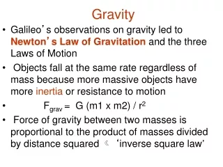
Background • National Geodetic Survey mission: define, maintain, and provide access to the National Spatial Reference System (NSRS) • Problem: Known issues with the current vertical datum (NAVD 88) • Goal: move to a gravity based vertical datum with a 1 cm accurate geoid • Gaps in gravity data coverage • Inconsistent terrestrial surveys • Medium wavelength gap Ex. Southern U.S. Coast 20-100 km gravity gaps along coast
Measuring the Gravity Field Long Wavelengths (≥ 250 km) GRACE/GOCE/Satellite Altimetry + Intermediate Wavelengths (500 km to 20 km) Airborne Measurement + Short Wavelengths (< 100 km) Surface Measurement and Predicted Gravity from Topography
GRAV-D Project Overview • Overall Target: orthometric heights accurate to 2 cm from GNSS and a geoid model • GRAV-D Goal: Create gravimetric geoid accurate to 1 cm where possible using airborne gravity data • GRAV-D: two phases • Airborne gravity survey of entire country and its holdings • Long-term monitoring of geoid change • Leveraging partnerships to improve and validate gravity data
Data Collection Scope • Entire U.S. and territories • Total Square Kilometers: 15.6 million • ~200 km buffer around territory or shelf break if possible • Initial target area for 2022 deadline
Methods: Survey Reconnaissance Parking spot ID A10 measurement Vertical gravity gradient GPS Base Stations
GRAV-D Aircraft • NOAA • Gulfstream Jet Prop • Orion P-3 • Cessna Citation (Jet) • DOI Bureau of Land Management • Pilatus PC-12 • King Air 200 • Naval Research Lab • King Air RC-12 • Contract Aircraft • King Air E-90A (Fugro) • Cessna Conquest (Fugro) • King Air 200T (Dynamic Aviation) Pilatus PC-12 King Air E-90A King Air RC-12 Turbo Commander
Data Collection • Equipment • Micro-g TAGS III Air-Sea Gravimeter • GNSS Antenna and Receiver on aircraft • NovAtel SPAN Inertial Measurement Unit with Honeywell µIRS IMU • At least 2 GNSS antennas and receivers at the airport • Data Collection • 10 km data line spacing • 80 km cross line spacing • 20,000 ft (6090 m) flight height • ~250 kts flight speed Micro-g LaCoste TAGS Gravimeter NovAtel SPAN-SE
Data Processing • Field Quality Control Processing • GPS/IMU combined solution using differential positioning • Gravity processing with Issac (internal software) • Final Processing • GPS/IMU combined solution using Precise Point Positioning (PPP) • Gravity processing with Newton (internal software) • Quality evaluated and data minimally trimmed • Processed data and documentation released
Southern Alaska Northeast Coast Central U.S. (Iowa) Lake Michigan
Validation • External Validation • Updates to EGM08 compared to GOCE • Geoid Slope Validation Surveys (2011, 2014, 2016) • Internal Validation • Crossover analysis • Line to line comparison • Line reflights
Research and Development • Gravity Processing • Off-level correction • Platform model • Tilt monitoring • Filter effects • Unmanned aircraft • Small Business Innovation Research Grant • Geoid creation • Methods of spectral combination Aurora Flight Sciences Centaur Optionally Piloted Aircraft
Data Use: Experimental Models xGG2014 (June 2014) Annually update and release an experimental gravimetric geoid with airborne gravity data • Gravimetric Geoids • from USGG2012 (last non-GRAV-D gravimetric geoid) • through xGG201? (annual experimental geoid) • to USGG2022 (the final geoid with GRAV-D) • Improve computation methods • Website access allows points queries
Thank you for your attention Monica Youngman, GRAV-D Project Manager Monica.Youngman@noaa.gov GRAV-D Website: http://www.geodesy.noaa.gov/GRAV-D/ Experimental Geoid: http://beta.ngs.noaa.gov/GEOID/xGEOID14/ GSVS Webpages: http://www.geodesy.noaa.gov/GEOID/GSVS11/ http://www.geodesy.noaa.gov/GEOID/GSVS14/