Download
1 / 19
190 likes | 277 Views
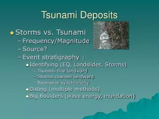
Tsunami Deposits Workshop Seattle, June 12-15, 2005. San Diego Supercomputer Center (SDSC) & NEES Cyberinfrastructure Center (NEESit): Tsunami Reconnaissance Data Repository. Anke Kamrath ( kamratha@sdsc.edu );

E N D
Tsunami Deposits WorkshopSeattle, June 12-15, 2005 San Diego Supercomputer Center (SDSC) & NEES Cyberinfrastructure Center (NEESit): Tsunami Reconnaissance Data Repository Anke Kamrath (kamratha@sdsc.edu); PI/Director, NEESit and Division Director, SDSCVladimir Veytser (veytser@sdsc.edu); NEES/SDSC Software Developer http://it.nees.org
Overview • What is NEES? • NEESit Data Repository • Tsunami Reconnaissance Data Repository
NEES Infrastructure NEESinc Headquarters NEES Cyberinfrastructure Center
NEESit Data Repository • Data Services: • https://central.nees.org • Central portal for providing NEESit services • Authentication and Authorization management services: username and password • Data repository: interface and tools used to store, modify, search, and retrieve data and metadata • GOAL: No Data Lost! • 3 copies of data
Getting Started with NEES • See http://it.nees.org • http://tsunami.nees.org coming soon • How to contact us: • Email: it-support@nees.org • Toll free number: 1-866-260-4100 • Web • http://it.nees.org/support
NEESit File Hierarchy • NEEScentral provides a web-interface into metadata model • High-level model based on existing data and practices from equipment sites • Hierarchical model with metadata values added to individual directory level nodes
NEES Tsunami Reconnaissance Data Repository • Partnership: • UCSD: • SDSC (San Diego Supercomputer Center) • NEESit • Oregon State University • Harry Yeh • Project includes four primary elements • Data/Metadata Structure: Working with the reconnaissance teams to ensure adequate metadata to facilitate reuse and queries of the data • Storage: Formal storage strategy to ensure its long-term reliability, • Curation: Data librarian and curation effort to review and validate the metadata and data entering the repository, • Query: Query and browsing interfaces to allow easy downloads of the data
Initial Efforts • Creating Data Upload Environment • Preliminary metadata structure • File hierarchy for upload • Query/Browsing Environment • Google Maps (maps.google.com) as catalog browser (all data geo-referenced) • Evaluating Visualization tools (Geoplayer/GeoFusion) • Inclusion of before/after remote sensing data • Coordination with NSF SBE Recon Teams • EERI Recon Teams • Telecon being planned with experts to inform metadata structure • Work with teams to upload data
Documentation/Reports • Tsunami Repository Prototype File Hierarchy • Orange folders include subfolders as needed • Blue represents metadata <project> People, Summary, Scope, Sponsorship, Dates Surveys Geological& Geographical Societal Data Seismic Data Hydrodynamic Data Environmental Data Engineering Data • Tsunami Runup Height • Inundation Distance • Flow Directions • Flow magnitudes • Number of run-ups and their arrival times • Tide gage data • Site configuration-topo & bathymetry • Subsidence & uplift • Tsunami deposit • Scour • Morphological changes • Submarine & subaerial Landslides • Paleo-tsunami data • Vegetation • Marine Bio • Animals • Site information - roads, bridges, buildings, etc. • Damage of buildings • & infrastructures • Fires • Lifeline • EQ effects • Casualties • Injured & missing people • Public & authorities response (Immediate,Short term, Intermediate and Long term) • Preparedness (Warning, Awareness & eduaction) • individual behaviors • Political background • Societal background • Local seismographs Each file should have Time&Date, GPS, recorder’s name, remarks.
Metadata for survey categories • 4) Engineering MetaData: • Site information - roads, bridges, buildings, etc. • Damage of buildings & infrastructures • Fires • Lifeline • EQ effects • 5) Societal Metadata: • Casualties • Injured & missing people • Public & authorities response (Immediate,Short term, Intermediate and Long term) • Preparedness (Warning, Awareness & eduaction) • individual behaviors • Political background • Societal background • 6) Seismic Metadata: • Local seismographs 1) Hydrodynamic Metadata: • Tsunami Runup Height • Inundation Distance • Flow Directions • Flow magnitudes • Number of run-ups and their arrival times • Tide gage data 2) Geological & Geographical Metadata: • Site configuration-topo & bathymetry • Subsidence & uplift • Tsunami deposit • Scour • Morphological changes • Submarine & subaerial Landslides • Paleo-tsunami data 3) Environmental Metadata: • Vegetation • Marine Bio • Animals
Metadata for Multimedia Files • All field data geo-referenced • EERI recommended metadata for recon image(s) • File name, date and image description • Lat/Long (in decimal degree format) or street address if lat/long information is not available. • Photographer Orientation. • Researcher’s contact information. • Simlar for video, scanned paper clippings… • Surveys/interviews also to be geo-referenced
Future Directions • Working with other national and international groups/organizations • Enhancement and extension of metadata • Extension to other earthquake events • Enhancement of user interface/query environment • Integration with other data resources (NEES,, remote sensing, ?)
Questions? More info: • Anke Kamrath – kamratha@sdsc.edu • Vladimir Veytser – veytser@sdsc.edu • it.nees.org