Download
1 / 30
350 likes | 736 Views
“Α contemporary perspective of GEODESY in positioning spatial geo-data” M.G.Doufexopoulou Associate professor “Physical Geodesy” NTUA, Athens Review for Master-courses Spring 2010. What is Geodesy Why needed? How it applies & who needs it?.

E N D
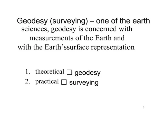
“Α contemporary perspective of GEODESY in positioning spatial geo-data”M.G.DoufexopoulouAssociate professor “Physical Geodesy” NTUA, AthensReview for Master-coursesSpring 2010 M.G.Doufexopoulou - Lectures about Geodesy 2010
What is Geodesy Why needed?How it applies & who needs it? • A “system” (=model) is a reasonable configuration about reality • Systems „react” to internal ( physical ) and external changes (= knowledge, manmade, professional needs, social conditions ). • There is need for standards of reference ( = a model of the Earth’s system ) Goal is = the comparison of the Earth’s system ( to same system or another system) in spatial or temporal coordinates • The “Earth’s system” is a platform used to describe all information about geo-spatial data. In particular it “says” “WHERE” are the geo-data? M.G.Doufexopoulou - Lectures about Geodesy 2010
Positions of geo-data • Need to represent all “information” related to the Earth’s system by a position with respect to an Earth’s standard (= an Earth’s prototype!) • Less accurate positions are provided by “images” of the Earth ( general maps, satellite imagery, photos, Earth Google ). • A uniform and accurate positioning is given by GEODESY. Geodesy aims to determine an Earth’s prototype in its geometry & gravity field and to use it for positioning. • Users of Geodesy need to know positions with respect to a coordinate system M.G.Doufexopoulou - Lectures about Geodesy 2010
1.What is Geodesy? - many perspectives 2.Why needed ?- too many applications3.How it applies?- many methods ( ONE principle ) 4.Who needs Geodesy? - many professions 4000 years existence of GEODESY as Earth discipline Many perspectives: LEARN about - USE GEODESY. Many types of measurements BUT ONE PRINCIPAL OBJECTIVE!! ( find POSITIONS in geo- environment with respect to the Earth or to an Earth related coordinate system) Objective: find Coordinates of positions with respect to an adopted model about the EARTH & its gravity field M.G.Doufexopoulou - Lectures about Geodesy 2010
Foundations of Geodesy • A GEOMETRY perspective of 3D space • A configuration about the “geometry” of Earth ( shape and size ) • Description of the 3D space by surface coordinates ( 2D ) & height ( 1D ) using two different Earth’s models! • Relativity theory introduces also time as coordinate (4D! ) • The Earth’s general shape depends on laws of Newton’s Physics applied to Earth. Consequence: PHYSICS has to involve in Geodesy!!!! • GEODESY IS FOUNDED ON COORDINATE GEOMETRY AND LAWS OF PHYSICS M.G.Doufexopoulou - Lectures about Geodesy 2010
Definition of the goals of Geodesy • Geodesy aims goals to determine the shape and size of Earth, its gravity field and the time / space variations at different size of regions (local, regional, entire Earth) • The goals “serve” to answer all 4 questions at the start, if needed measurements are available! • Geodesy provides an answer “where” is “something” IF the measurements to compute “where” ( set of 3D coordinates ( local coordinates, global coordinates ) are used • Measurements, coordinate systems, a “model” of the Earth are the basic entries to apply Geodesy to provide 3D positions. M.G.Doufexopoulou - Lectures about Geodesy 2010
Models of the shape of the Earth (I) • The models of the Earth’s shape depend on the size of a region at which we need the “where” • “Where” is given within a part of Earth or for entire Earth (relative - absolute coordinates) • More than one models of Earth’s shape are used - many coordinate systems ( local & global ) - Geodetic frames • An Earth’s model expresses aMathematical or a Physical model of its own topography! M.G.Doufexopoulou - Lectures about Geodesy 2010
Models of the shape of the Earth (II) • A Mathematical model of the Earth represents at “best” the topography in a region ( criteria ) • The extend of the region defines which is the “better” model! • A plane, a sphere or ellipsoid express with respect to their geometry, relations among the coordinates, used to compute (distances, volumes, areas, orientations ) • A geodetic Coordinate system is planar, spherical, ellipsoidal • We choose its origin and axes M.G.Doufexopoulou - Lectures about Geodesy 2010
Models of the Earth’s geometry (III) • Two reasons why Geodesy is based in parallel Mathematical and Physical model of Earth. • 1.ALL measuring devices are aligned to the local horizon & thus the perpendicular is the direction of local gravity force • 2.Most used heights H are the elevations above the Mean Sea Level ( the zero height ). • These reasons are the cause to use an Earth’s physical model, based on its gravity field. This model is computed by measures of the gravity field M.G.Doufexopoulou - Lectures about Geodesy 2010
Conclusions about foundations • Geodesy provides coordinates of positions with respect to Earth models using a Geometry configuration of the space. This Geometry is affected by the impact of gravity field ( only locally space is Euclidean) • The particular geometry in use depends on the extend of a region ( = how much the Earth’s curved shape affects the “parallelism” of local verticals) • Except geometry to use with a coordinate system for the full description of a position, two models of the Earth’s shape are used in parallel: A Mathematical model used as reference surface for horizontal coordinates • Physical model used as reference surface for elevations above Mean Sea Level, along the local vertical. • Measurements in Geodesy depend on the direction of the vertical and on much more physical and instrumental factors. • GEODESY IS FOUNDED ON A COORDINATE GEOMETRY AND NEWTONEAN PHYSICS- APPLIED WITH 2 EARTH’S MODELS M.G.Doufexopoulou - Lectures about Geodesy 2010
Geodesy applies to determine coordinates • GEODESY IS FOUNDED ON A COORDINATE GEOMETRY ( 2D+1D or 3D ) AND NEWTONEAN PHYSICS • APPLIED WITH 2 EARTH’S MODELS • Mathematical model = surface coordinates • Physical model= elevations above “Mean Sea” • The size of region defines the coordinates • ( planar, spherical, ellipsoidal or “other” ) M.G.Doufexopoulou - Lectures about Geodesy 2010
TYPES OF MEASUREMENTS At present (2010) many and different types of measurements can be used for the goals of Geodesy. Classified under perspectives ( terrestrial / spatial, mechanical / automated, direct/indirect) All types have to be processed for two goals: to be converted as geometry quantities ( distances or coordinates ), to evaluate their accuracy PRINCIPLES OF USE Use of geodetic measurements is pretty simple in concept!!!! After processing they represent geometry quantities( distances, coordinates, elevation difference, or orientation angles ) We use coordinate Algebra to solve for the coordinates of points, which are line intersections of few or many simple geometric configurations and connect known with unknown positions through geometry or mathematical rules! A particularity is that figures should be over-determined for UNIQUE solution MEASUREMENTS IN GEODESY M.G.Doufexopoulou - Lectures about Geodesy 2010
Types of measurements used in Geodesy(I) • Classification ( direct or indirect ) • A direct measurement aims to measure a geometric quantity ( distance, angle of orientation, elevation difference ) • An indirect measurement provides measures of variables which relate to a geometric quantity by a formula. By an analytic computation we can estimate a measure of the optimal value of the needed geometric quantity. • Obviously, we consider measurement & computational errors and we need to know values about parameters which can have impact on the result of a measurement • We need to estimate the ACCURACY of any measurement M.G.Doufexopoulou - Lectures about Geodesy 2010
Types of measurements used in Geodesy(II) • Classification according to spatial and terrestrial character • Until 1960 Geodesy was based on using terrestrial measurements only { angles mainly, elevation differences & very few small distances to scale the geometry of simple figures on a reference surface. • Instruments operated mechanically ( Classic Geodesy - geometry ) • Instrumentation progressed greatly after 1950. Presently (2010 ) the “market” provides fully automated electronic measuring systems, a built in computational software and can be connected to a computer network ( Automated Geodesy ) - measurements go to a computer . • Users of all measurements need training about how to use them for his/her needs and how to estimate the accuracy of the result. • This knowledge is widely extended, with experience and skills to use instruments ( for professionals in Geodesy ). • The start of Space exploration ( 1957 ) initiated an abundance of new types of space-based measurements ( direct and indirect ) M.G.Doufexopoulou - Lectures about Geodesy 2010
Types of measurements used in Geodesy(III) • Space-based data • Satellite altimeters • Gravity field models • Global Positioning • ( GPS ) • Radar on satellites • Processing methods, impact of many factors, large numbers of data “Black-box” operation, software to use ( geometry & physics ) M.G.Doufexopoulou - Lectures about Geodesy 2010
Use of measurements as “geometric” data • Processing ends to data • After the elimination of all not wished impacts ( from various causes ) most data represent a “distance in space” with respect to a model “geometry” (Euclidean, spherical, ellipsoidal, differential) • Inputs distances = to solve for the coordinates at the common points of many intersections • Over-abundant data need to optimize for unique positions • Need for ERROR models! M.G.Doufexopoulou - Lectures about Geodesy 2010
Example: GPS coordinates • GPS coordinates = a common point at which 4 imaginary spheres with radii ri intersect • The radii represent distances from the radar on satellite to the GPS receiver. • distances are estimated after the arrival time of a pulse from the radar to the receiver • Parametric space, abundance of observations, not Euclidean geometry, statistical model M.G.Doufexopoulou - Lectures about Geodesy 2010
From a Reference coordinate system to U.T.M coordinatesBasic stages between theory and practical useNotice: ALWAYS the space to represent by its coordinates, has LESS parameters (X) than the number of impacts(Y) for processing measurements into input data ( Y>>X ) M.G.Doufexopoulou - Lectures about Geodesy 2010
The Cartographic Projection PLANAR coordinates (UTM )UTM coordinates are planar X, Y coordinates after the projection of meridians and parallels of Earth’s datum onto an enveloping surface of a cylinder and then the “stressing” of the surface into planar!National UTM coordinates carry Cartographic deformations M.G.Doufexopoulou - Lectures about Geodesy 2010
National UTM coordinates ( continued )The entire Earth is divided into 60 zones between meridians apart at 6o degrees (= keeps small scale deformations at edges)Along the CENTRAL meridian of each country NO scale deformationBeware: Different geodetic datum give different UTM coordinates M.G.Doufexopoulou - Lectures about Geodesy 2010
Height reference systems & height datum • Two DIFFERENT systems are in use: • 1. Mean Sea Level (geoid) • H=0 H, along the vertical • 2. Surface of horizontal datum h=0 h, along perpendicular • small angle ε of different orientation= deflection of the vertical • H is not the same with h!!!! • “Surface” 1 with respect to “surface” 2 gives geoid height , N= geoid height / undulation M.G.Doufexopoulou - Lectures about Geodesy 2010
Leveling with vertical rods from point to point and “add” the sum gives a δΗ Imagine an orthogonal triangle, measure necessary quantities, solve to find the δΗ ( Trigonometric method ) More useful the NATURAL heights only δΗ show the real direction of mass flow - δh do NOTGPS heights are h heights- need conversion to H ( h=N+H ) M.G.Doufexopoulou - Lectures about Geodesy 2010
Need to determine accurate height datums for many reasons & applications • Many methods and perspectives to determine a height datum ( “a” geoid ) for a region ( relative datum ) or for the entire Earth ( absolute datum) • Problem to set up: • Find: measures N(φ,λ) and ε(φ,λ) accurate to +/- 0.01m and at least +/- 0.1’’ for ε • Given: gravity field data ( various types ) • Hints: • Use good theory, accurate and dense data, do accurate computations. Use optimally many types of observations and data types! - A HIGHT REFERERENCE • ( a particular extended subject of Geodesy ) M.G.Doufexopoulou - Lectures about Geodesy 2010
Principles of all Methods in Geodesy • 1.The common approach is the GEOMETRY as defined by the used Reference datum ( =used to compare the results) • 2.Use as many observations as possible among known and not known positions ( over- determined geometric figures ) • 3.Process the observations for the objective to eliminate all known impacts ( instrumental, environmental, e. t. c ). • 4. Use then the processed observations to compare with their expected value as it can be expressed with the geometry induced by the Reference datum • 5. Apply to residuals r=x( is ) - x( should be ) a statistical error model ( stochastic ) - optimize extra observations for UNIQUE coordinates M.G.Doufexopoulou - Lectures about Geodesy 2010
Applications of positioning & heights • POSITIONS • Accurate surface coordinates ( maps, survey plans for engineering projects and for scaling satellite imagery, Earth’s dynamics ) • Less accurate surface coordinates ( positioning geo-data - Geography and environmental issues) • HEIGHTS ( DEPTHS ) • Height differences δΗ can be used to find exact slopes ( engineering & environment - roads, highways, floods, water basins, lod) • Changes of heights per time are used for Earth’s kinematics(stability) • Accurate topography and ocean depths used to predict the evolution of dynamical Earth’s phenomena ( weather, streams, wind, pollution, tsunamis, e. t. c) - long term / short term M.G.Doufexopoulou - Lectures about Geodesy 2010
The near future for Earth’s models • By year 2015 all Earth disciplines will be suggested to use ONE Earth’s model common for use ( = to avoid inconsistency among datum ) • Global Geodetic Observation System ( = GGOS ) through the data of many dedicated satellite missions • WGS84 - ITRF - EUTRF - National Datum ( coordinate transformation) • Geodetic coordinates ( φ,λ,Η(h)or X,Y, H(h) ) project onto the National UTM system. Heights H or h form either a contour map or DTM or DEM • ( there are small linear scale deformations 0.4% - to be corrected ) • 3D position coordinates + any other geo-data “information” • USERS restrict to possess and use these data bases M.G.Doufexopoulou - Lectures about Geodesy 2010
Visit please the site to learn how Geodesy is useful for you: http://www.iag-ggos.org/You_and_GGOS/ These slides will be available soon at: http://www.doufexopoulou.com M.G.Doufexopoulou - Lectures about Geodesy 2010
Examples of geo-applications • Simply positions of geo-data of any sort • Monitor changes in land use • Monitor changes of land form ( from many causes) • Find optimal locations for “services” or engineering constructions • Confirm that a region ( soil, geology ) is stable • Delineate the contour of basins, volume of excavations, estimate lengths of transport • Many others depending on the profession….. M.G.Doufexopoulou - Lectures about Geodesy 2010
Did you learn about Coordinates? M.G.Doufexopoulou - Lectures about Geodesy 2010