Download
1 / 13
140 likes | 426 Views
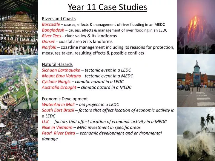
Year 11 Case Studies. Rivers and Coasts Boscastle – causes, effects & management of river flooding in an MEDC Bangladesh – causes, effects & management of river flooding in an LEDC River Tees – river valley & its landforms Dorset – coastal area & its landforms

E N D
Year 11 Case Studies Rivers and Coasts Boscastle– causes, effects & management of river flooding in an MEDC Bangladesh– causes, effects & management of river flooding in an LEDC River Tees – river valley & its landforms Dorset – coastal area & its landforms Norfolk – coastline management including its reasons for protection, measures taken, resulting effects & possible conflicts Natural Hazards Sichuan Earthquake – tectonic event in a LEDC Mount Etna Volcano– tectonic event in a MEDC Cyclone Nargis – climatic hazard in a LEDC Australia Drought – climatic hazard in a MEDC Economic Development WaterAid in Mali – aid project in a LEDC South East Brazil – factors that affect location of economic activity in a LEDC U.K - factors that affect location of economic activity in a MEDC Nike in Vietnam – MNC investment in specific areas Pearl River Delta – economic development and environmental damage
MEDC Flooding – Boscastle Background: A flash flood on 16th August 2004 in the small village in North Cornwall • Causes • Over 60 mm of rainfall (typically a month's rainfall) fell in two hours. • The ground was already saturated due to the previous two weeks of above average rainfall. • The drainage basin has many steep slopes, and has areas of impermeable slate causing rapid surface run-off. • Boscastle is at the confluence (where tributaries meet) of three rivers - Valency, Jordan, and Paradise. A large quantity of water all arrived within a short space of time causing the rivers to overflow. • The flooding coincided with a high tide, making the impact worse. • Responses: • Immediate: Emergency services responded speedily and efficiently – helicopters lifted 80 people off rooftops • Long term: In order to reduce the flood risk in the future a £4.6 million flood scheme was completed by 2008, improvements include: • River bed deepened by six foot so more water can be held in the channel • Raised car park so above flood level • Increased drainage • Channel widened so can hold more water and create slower flow • Remove vegetation from the channel, but encourage landowners to plant trees on valley sides • Build new flood defences
LEDC Flooding – Bangladesh Background: Bangladesh is one of the world's most densely populated countries. It has has a population of 125m inhabitants. The Ganges Meghna& the Brahmaputra run through Bangladesh. It experiences floods and tropical storms every year and a particularly bad year was 1998. Short Term Management Boats to rescue people , Emergency supplies for food, water, tents and medicines, Fodder for livestock Repair and rebuild houses, as well as services such as sewage etc , Aid from other countries Long Term Management Reduce Deforestation in Nepal & Himalayas Build 7 large dams in Bangladesh to store excess water $30-$40 million and 40 yrs to complete Build 5000 flood shelters to accommodate all the population Build 350km of embankment - 7 metres high at a cost of $6 billion to reduce flooding along the main river channels Create flood water storage areas
River Landforms – River Tees The River Tees flows for 128km from its source high in the Pennine Hills at Cross Fell to its mouth in the industrial conurbation of Teeside, where it flows into the North Sea. The river exhibits many classic landforms. In the upper section you will find High Force waterfall, here the waterfall owes its formation to a band of hard rock which cuts across the river valley. The river is unable to erode the hard rock as much as the underlying softer rock and therefore the river plunges over the waterfall, it undercuts the weaker rock, creating an overhang, which eventually collapses under its weight. The subsequent plunge pool is deepened by the abrasion of loose pieces of rock. A few kilometres to the south-east of Darlington the River Tees starts to meander through farmland. Here the river has more energy and a higher volume of water. The gradient here is gentle and erosion is lateral rather than vertical as it was in the upper section. As the river erodes laterally, to the right and left, it forms large bends that are known as meanders. As the river reaches its mouth, just to the North of Middlesbrough, the vast flat valley floor leads into an estuary. Formed by the flooding of river-eroded or glacially-scoured valleys, this area has been extensively developed for industry because of its wide river mouth for its shipping and safe harbours.
LEDC Tectonic Hazard – Sichuan Background detail: On 12th May 2008 at 2.28pm an earthquake struck measuring 7.9 on the Richter scale. People were at work and school and out shopping in the southern province of Sichuan in China. Cause: Along the Longmensham Fault line, which is a transform boundary ,where plates move alongside one another, building up friction and pressure that eventually is released as the earthquake. Primary effects: the tremor lasting over 2 minutes that led to landslides occurring Secondary effects can be split into economic , social and environmental Responses: It was a very slow response but eventually after 72 hours the Army were brought in to rescue people with the help of 29 aircraft. It took millions of dollars of international aid to help the people of Sichuan, but there are many areas that are still piles of rubble.
MEDC Tectonic Hazard - Mount Etna Etna is a strato volcano that has formed as a result of repeated volcanic eruptions, it has been erupting gently since 2001 but there was a significant eruption in Nov 2002. Cause: the volcanic eruption was created by a convergent plate boundary. The denser African plate was subducted under the Eurasian plate and it melted creating new magma that was released in the explosion. There was also a series of earthquakes before the eruption as the pressure and friction built up as the plate was subducted and was eventually released. Primary effects: the release of magma, ash and gas Secondary effects can be split into economic , social and environmental • There was significantly less damage than in a LEDC because of their ability to plan for the hazard and respond to it. Responses included: • Government caused State of Emergency • People were evacuated away from the lava flows with the help of the Army • Medical ships were dispatched from mainland Italy • In the long term $5.6 million given to help people rebuild the area. This included tax breaks.
LEDC Climatic Hazard Cyclone Nargis Beginning in April 2008 over the Bay of Bengal, the warm water caused rapid evaporation, as the water vapour rose, cooled, condensed and formed clouds the Coriolis force meant the clouds began to spin. The evaporation also caused the rapid onset of low pressure, which drew air in from the sides and caused high wind speeds of up to 217mph. Alongside this, there was torrential rain and storm surges. When Cyclone Nargis eventually made landfall it did considerable damage, including 140, 000 dead, 450,000 homes destroyed making 2-3 million people homeless, 1700 schools destroyed, 200, 000 farm animals killed, $4 billion worth of damaged, crops destroyed and water became polluted and toxic. The response in Myanmar was heavily criticised. The national government did not have the money to either prepare for the cyclone initially, cope with the short term impacts or help people in the long term to rebuild their lives. Additionally, for 3 weeks Myanmar refused the help of international bodies such as the UN and Red Cross as they did not want ‘outsiders’ to be in the country. To begin with they even dropped leaflets, insisting that people should stop taking the aid on offer to them.
MEDC Climatic Hazard – Australian Drought Australia is prone to a number of climatic hazards and one that occurs regularly is severe drought. Caused by the a meteorological event called El Nino, Australia suffered from drought particularly badly in 2002. The El Nino effect is when normal atmospheric and ocean patterns switch so that instead of the warm water being found off the west coast of Australia, this switched and the trade winds now carried warmer water to the east cost of Peru and Chile. This meant that they got the heavy rain as water evaporated, cooled and condensed and Australia, with the cooler water, did not get this happening. The effects of this can be split into economic, social and environmental: • As Australia is an MEDC it can respond in a number of ways. • Hosepipe/sprinkler ban for certain things – such as watering the lawn • Time restrictions on water use during the day • Installed high technology irrigation systems to prevent unnecessary water loss • Move surplus water from some regions to other regions that need it • Monitor weather patterns via satellites etc. to predict when will need to start conserving water • Plant drought resistant crops
WaterAid in Mali The Non Governmental Organisation (NGO) WaterAid was established in 1981, first helping the country of Zambia. In 2000 it started projects in Mali and continues to work in the country. WaterAid prides itself on trying to promote sustainable living for the poorest of nations. Mali comes into this category and is particularly vulnerable to problems because of its harsh physical geography. It has very low rainfall and this is decreasing. It is 65% desert already and desertification is increasing this all the time and only 50% of people have access to a sustainable water supply. • WaterAid recognised that privatising water in Bamako, Mali’s capital, was leaving the poorest of people in rural and urban areas without access. They wanted to the national government and other potential donors that Mali could have a socially and economically stable water supply. • They did the following things to aid Mali • built a new water network • trained local people to manage the system • raised money to keep it working • encouraged investment by local people to start improving all the infrastructure • educated people about the importance of a clean water supply • The impact on people was huge, with the health benefits that came from clean water and sanitation having a significant impact on making the local people stronger and able to attend school and work and thus encouraging economic growth into the future.
Economic Activity in U.K (S.E.) Primary Industry Secondary Industry Although small industry is found in the area, there is not a lot of secondary industry as the area has been through the deindustrialisation process and most manufacturing of British products is done abroad. Areas further North such as Newcastle, Manchester and Liverpool are home to more industry. Top farm, Huntingdon, is 200 hectares in size and is run as an agribusiness. On the flat Eastern counties of England, arable farming is the main activity because of the favourable physical and human factors. The area is characterised by gently undulating and low relief and deep, fertile, drained alluvium boulder clay deposited on chalk. The area has warm sunny summers (18-20°C) for ripening crops and cold winters with frosts that break up soil and kill pests. The area tends to get 650mm rain mainly in the growing season. The farm traditionally grows wheat, barley and sugar beet. Although more perishable crops such as salad vegetables are also grown. The produce is generally sold to the large nearby markets in South England, assisted by the excellent communications with the A1 and the A14. Tertiary Industry Quaternary Industry • Cambridge is home to a well known Science Park that offers high quality research and development facilities. Built in the 1970s the park is located in this area for a number of regions including: • Access to the highly skilled graduate workforce of Cambridge University • Excellent road links to A14 and M11 • A local airport nearby • Large flat land, that has potential for easy expansion • Popular residential areas close by, such as Milton village • A lot of Greenspace for those wanting to work in attractive surroundings • Excellent facilities on site , such as a nursery and gym. The City of London is the most important concentration of tertiary industry in the U.K. 300,000 people work there and 75% of those work in banking, finance, insurance and business services. There is also specialist services such as entertainment and retailing in the West End. London is seen as one of 3 global cities, as it offers highly skilled workers, impressive communication facilities, quality living and working environment and ability to attract all the sought after companies in the world.
Economic Activity in South East Brazil • Primary Industry • There is a lot of primary industry in SE Brazil because of the raw material availability. People find work relatively easily compared to the rest of Brazil, and this is why it is called the core region. Primary industry includes • Farming coffee, beef, rice and sugar cane • Mining/extracting gold, iron, oil and gas • Creation of energy through HEP because of appropriate river systems • Fishing as areas such as Rio de Janeiro are on the coast Secondary Industry There has been a lot of domestic (Brazilian) and foreign investment in this area. It has been designated as a hub for roads and railways and is has NIC status within its own country. There are more MNCs in S.E. Brazil than everywhere else in the country put together. Foreign and domestic companies are encouraged to locate there because of the good facilities, the easy access to raw material, the established competition and skilled workers. It is particularly famous for its car manufacturing, including brands such as Fiat, Toyota, Ford and VW. Tertiary Industry With the development of secondary economic activity you also get the growth of the service as businesses need Quaternary Industry Due to brazil being a developing nation Quaternary industry is relatively small. However , there are some public and private research and development facilities. For example 83km from Sao Paulo is Sao Jose dos Campos, which is the Aerospace Technical Centre, where a lot of education and research is done about the aerospace industry. financial services and employers and employees have money to spend. Sao Paulo in S.E. Brazil is the financial capital of South America and is home to most of the foreign and domestic banks headquarters.
Nike in Vietnam Nike is one of the world’s leaders of supplying sports footwear, apparel and equipment. Founded in 1972 it has its headquarters in USA but contracts out production to South Korean and Taiwanese companies. The subcontracted companies operate not only in their home country but also in lower-wage Asian economies such as Vietnam and the Philippines. Nike is an example of the New International Division of Labour, because it has 650,000 contract works in 700 factories worldwide. Over 75% of the workforce is based in Asia. There are potential benefits and problems for countries such as Vietnam, where production occurs and also in the USA.
Pearl River Delta The Pearl River Delta region is an area the same size as Belgium in South-East China. It is a focal point of massive foreign investment into China. The regions manufacturing industries already employ 30 million people, but this will undoubtedly increase in the future. There are 3 main environmental problems that have occurred due to increased economic activity. 1. Air pollution: The high concentration of factories, car ownership and power stations means emissions of nitrogen oxides and sulphur dioxides have increased. When combined with water vapour this creates acid rain. In 2007 8 out of every 10 rainfalls in Guangzhou was classified as acid rain. 2. Water pollution: half the waste water in Guangdong urban areas is not treated before being dumped in rivers. 3. Deforestation: almost all the urban areas have over exploited their neighbouring uplands, causing a considerable reduction in vegetation cover. This has resulted in serious soil erosion. • Management: The Environmental Protection Bureau classifies the environmental situation as severe, and says that the government is committed to taking the necessary measures to reduce pollution. These measure include: • Guangdong government is reducing chemical pollution of water by 15% from 2005 levels • Stricter pollution regulations on factories • Tougher national regulations on vehicle emissions