Download
1 / 9
90 likes | 280 Views
smart cities. Increasing urbanization Increasing traffic Increasing communication Internet of Things Smarter ITS. Robert Nordentoft General Manager traffic now. Urban Innovation Forum Sofia, 23/04/2013. The vehicle in 1998 .

E N D
smartcities Increasing urbanization Increasing traffic Increasing communication Internet of Things Smarter ITS Robert Nordentoft General Manager trafficnow Urban Innovation Forum Sofia, 23/04/2013
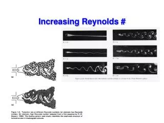
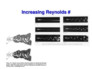
The vehicle in 1998 How did Intelligent Transportation Systems see the vehicles 15 years ago? Metal-reflection Heat Vehicle shapes Engine Acoustics Video Pixel Changes License Plates Metal magnetic field presence Weight/pressure
The vehicle in 2013 How do the new Intelligent Transportation Systems see the vehicles today? Vehicle Diagnostics: Bluetooth Hands free-sets: Bluetooth Mobile phones: Bluetooth GSM Vehicle Tags: RFID Micro wave Bluetooth GPS Navigation Systems: Bluetooth Floating Vehicle (GPRS) Portable PC / PDA: Bluetooth WiFi V2X Communication: WAVE* * Still under trials
THE KING OF SENSORS LIVE JOURNEY TIME INFORMATION ORIGIN/DESTINATION MATRIX
The king of sensors • Low power consumption; 1.8W (12-24 VDC) • Flexibility; DIN-rail, 3U rack, pole, mast arm • Urban; small and easy to mount • Inter-urban; two channels for the best detection rate • Range; more than 100 meters • Connection; GPRS – Ethernet • Diagnostics; Three-color LED • Clock synchronization; GPS - GPRS – Ethernet • Central software; international patent pending unique algorithms FOR INTEGRATING IN YOUR TRAFFIC CONTROLLER THE MOST POWERFUL BLUETOOTH SENSOR IN THE WORLD
Results; Live traffic information Detailed Live information from the selected route Live Level of Service Historic volume and speed data from the selected route
Results; Advanced traffic analysis Route analysis/comparison Advanced Origin/Destination Matrices Detailed vehicle information
Field Experience; Highways north of Paris • SANEF chose the DeepBlue Bluetooth system for the deployment of travel time: • Best ratio price / precision TT • Easy to implement and integrate • Autonomous in energy and communication • Faster reaction time • Allows different applications: • Calculate travel time • Crossing time (Toll, road works,…) • Realization of O / D matrix • SANEF Highway concessionaire: • Around 1,900 km of motorway • 90 000 events managed by the TCCs • 3,500 employees • 250 million euros of investments planned over 3 years in connection with green commitments Real-time Travel time information: Traffic Management Center alarm system SANEF Web page Variable Message Signs Radio & Web 107,7 FM Traffic Alerts
THANK YOU Robert Nordentoft rnordentoft@trafficnow.eu Todor Anastassov tsa02@tri.bg