Download
1 / 22
220 likes | 381 Views
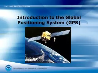
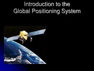
Introduction to the Global Positioning System. What is the GPS?. Orbiting navigational satellites Transmit position and time data Handheld receivers calculate latitude longitude altitude velocity Developed by Department of Defense. History of the GPS.

E N D
What is the GPS? • Orbiting navigational satellites • Transmit position and time data • Handheld receivers calculate • latitude • longitude • altitude • velocity • Developed by Department of Defense
History of the GPS • 1969—Defense Navigation Satellite System (DNSS) formed • 1973—NAVSTAR Global Positioning System developed • 1978—first 4 satellites launched Delta rocket launch
History of the GPS • 1993—24th satellite launched; initial operational capability • 1995—full operational capability • May 2000—Military accuracy available to all users
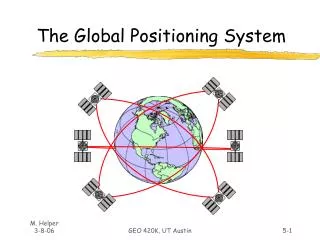
Components of the System Space segment • 24 satellite vehicles • Six orbital planes • Inclined 55o with respect to equator • Orbits separated by 60o • 20,200 km elevation above Earth • Orbital period of 11 hr 55 min • Five to eight satellites visible from any point on Earth Block I Satellite Vehicle
GPS Satellite Vehicle • Four atomic clocks • Three nickel-cadmium batteries • Two solar panels • Battery charging • Power generation • 1136 watts • S band antenna—satellite control • 12 element L band antenna—user communication Block IIF satellite vehicle (fourth generation)
GPS Satellite Vehicle • Weight • 2370 pounds • Height • 16.25 feet • Width • 38.025 feet including wing span • Design life—10 years Block IIR satellite vehicle assembly at Lockheed Martin, Valley Forge, PA
Components of the System User segment • GPS antennas & receiver/processors • Position • Velocity • Precise timing • Used by • Aircraft • Ground vehicles • Ships • Individuals
Components of the System Ground control segment • Master control station • Schreiver AFB, Colorado • Five monitor stations • Three ground antennas • Backup control system
How does GPS work? • Satellite ranging • Satellite locations • Satellite to user distance • Need four satellites to determine position • Distance measurement • Radio signal traveling at speed of light • Measure time from satellite to user • Low-tech simulation
System Performance • Standard Positioning System • 100 meters horizontal accuracy • 156 meters vertical accuracy • Designed for civilian use • No user fee or restrictions • Precise Positioning System • 22 meters horizontal accuracy • 27.7 meters vertical accuracy • Designed for military use
System Performance • The earth's ionosphere and atmosphere cause delays in the GPS signal that translate into position errors. • Some errors can be factored out using mathematics and modeling. • The configuration of the satellites in the sky can magnify other errors. • Differential GPS can reduce errors.
Application of GPS Technology • Location - determining a basic position • Navigation - getting from one location to another • Tracking - monitoring the movement of people and things • Mapping - creating maps of the world
Application of GPS Technology • Private and recreation • Traveling by car • Hiking, climbing, biking • Vehicle control • Mapping, survey, geology • English Channel Tunnel • Agriculture • Aviation • General and commercial • Spacecraft • Maritime
GPS News • http://www.gpseducationresource.com/gpsnews.htm • One–page reading exercise • Center of page—main topic • Four corners—questions & answers from reading • Four sides—specific facts from reading • Spaces between—supporting ideas, diagrams, definitions • Article citation on back of page
Military Uses for the GPS Operation Desert Storm • Featureless terrain • Initial purchase of 1000 portable commercial receivers • More than 9000 receivers in use by end of the conflict • Foot soldiers • Vehicles • Aircraft • Marine vessels
Handheld GPS Receivers • Garmin eTrex • ~$100 • Garmin-12 • ~$150 • Casio GPS wristwatch • ~$300 • The GPS Store