Download
1 / 33
330 likes | 412 Views
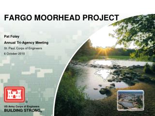
City of Moorhead Geographic Information Systems The City of Moorhead and the Flood of 2010. Brad Anderson, GISP City of Moorhead GIS MnGeo Statewide Geospatial Advisory Council Meeting Wednesday, March 31 st 2010. The Flood of 2010 at the City of Moorhead.

E N D
City of MoorheadGeographic Information SystemsThe City of Moorheadand the Flood of 2010 Brad Anderson, GISP City of Moorhead GIS MnGeo Statewide Geospatial Advisory Council Meeting Wednesday, March 31st 2010
The Flood of 2010 at the City of Moorhead • The spring flood of 2010 crested in the Moorhead and Fargo metro area at a river stage of 36.99 feet on Sunday, March 21st. This was the 7th highest crest on record. • This event was easier for the City to manage not only because it was 4 feet lower than the record crest of 2009, but for the experience gained from last year’s event and actions implemented to mitigate future floods. • Aggressive flood mitigation infrastructure projects • Emergency Flood Plan Manual updated with the goal of protecting Moorhead to a river stage of 43 feet • Division of the City into eight zones, with Engineering, Police and Fire staff committed to each Zone • Zone Map Books – Flood Plan steps and stage elevations
The Flood of 2010 at the City of Moorhead • There were also two new GIS applications that assisted city staff and residents during the 2010 flood • ArcGIS Server interactive flood website displaying ½ foot incremental river stages from 18 feet to 43 feet • Difficult to estimate the number of telephone calls to City Hall that were eliminated as a result of this new website • Property and Structure flood stage information • Spatial geoprocessing provides critical river stage information for all property and structures in the city • ESRI’s ArcGIS API for FLEX – ProWest and Associates
The Flood of 2010 at the City of Moorhead An internal ArcGIS Server website to provide flood related information to city staff WebFusion - Developed by ProWest and Associates The surprising early crest prediction and rapid rise of the Red River prevented deployment before the flood; now in place as a post flood information application These web-based GIS applications proved extremely useful and efficient in disseminating flood related information and GIS data to city staff and to the public Both applications utilize GIS data hosted locally and from the Moorhead & Clay County shared SDE geodatabase
Emergency Measures 20092010 40.84 feet 36.99 feet Clay levees 71,500 cubic yards 10,000 cubic yards 8 miles 1 mile Sandbag levees 2.5 million 300,000 ≈ 9 miles ≈ 2.7 miles Storm & Sanitary sewers 62 manholes with temporary plugs 20 61 emergency pumps rented 28
Lessons Learned from 2009 & 2010 • Interim measures are needed: • Less dependent on external resources that take time to mobilize • More permanent measures for quicker implementation (flood gates, pump stations, short levees, etc) • Long-term measures are needed: • Comprehensive flood risk management for the Moorhead & Fargo metro area • US Corps of Engineers working with Moorhead and Fargo on Diversion Channel Alternatives
Flood Mitigation Projects in the City of Moorhead Green dots signify Projects that were completed in 2009 Overall, there are approximately 80 flood mitigation projects that will improve city infrastructure and result in much higher levels of protection from flooding
Alignment Alternatives released by the US Army Corps of Engineers for the Fargo – Moorhead Metro Area Feasibility Study. ( October 19th 2009 ) Fargo, ND Moorhead, MN
Moorhead’s Old Emergency Flood Plan • > 65 Action Steps • Storm & Sanitary sewer gate closures & plugs • Activate pump stations • Deploy emergency pumps • Road closures • Short levees, etc… • Measures designed for • Typical spring flood event with significant warning • Methodical implementation • Expanded to 180 actions after the flood of 2009
New Action Steps for Emergency Flood Manual added during the flood of 2009
Moorhead’s New Eight Neighborhood Flood Zones City staff from Engineering, Police and Fire stationed in each Zone throughout the day and night Established Neighborhood liaisons for more effective communication with the public
Map Books for Zone Staff – Sub Zone Maps with Labeled Flood Plan Steps
Interactive ½ Foot River Stages and which stage may affect structures
ArcGIS Server Internal Application - Flood 2010 Information for City Staff
GPS Collected Data before and after Sandbag and Levee Construction
River Modeling Cross Sections with Profile Elevations & 1 Foot Contours
Post Flood - Call Center Records Mapped for Documentation of Event
City of MoorheadGeographic Information Systems Brad Anderson, GISP City of Moorhead GIS 219.299.5125 brad.anderson@ci.moorhead.mn.us
City of MoorheadGeographic Information Systems Brad Anderson, GISP City of Moorhead GIS 219.299.5125 brad.anderson@ci.moorhead.mn.us