Download
1 / 20

E N D
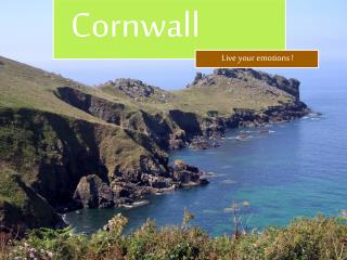
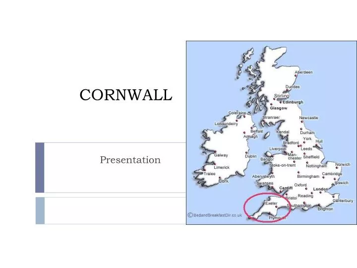
CORNWALL Presentation
The South West • Most of the South West occupies a peninsula between the English Channel and Bristol Channel. It has the longest coastline of England's regions. Much of the coast is now protected from further substantial development because of its environmental importance. • Cornwall and West Devon's landscape is of rocky coastline and high moorland (lande). These are due to the granite and slate (ardoise) that underlie the area. The highest point of the region is High Willhays, at 2,038 feet (621 m), on Dartmoor. • The climate of South West England is classed as oceanic (i.e. cool winters with warmer summers and precipitation all year round, with more experienced in winter.) It is the second windiest area of the United Kingdom. Inland areas of low altitude experience the least amount of precipitation. They experience the highest summer maxima temperatures, but winter minima are colder than the coast. In comparison to inland areas, the coast experiences high minimum temperatures, especially in winter, and it experiences slightly lower maximum temperatures during the summer. Rainfall is the lowest at the coast and snowfall is rarer than the rest of the region. Coastal areas are the windiest parts of the peninsula and they receive the most sunshine. • The boundaries of the South West Region are based upon those devised by central government in the 1930s, and subsequently used for various statistical analyses. The boundaries were carried forward into the 1990s, when regional administrations were formally established as Government Office Regions. A regional assembly and regional development agency were added in 1999. • It has been argued that the official South West region does not possess a cultural and historic unity or identity of itself, which has led to criticism of it as an "artificial" construct. The large area of the region, stretching as it does from the Isles of Scilly to Gloucestershire, encompasses diverse areas which have little more in common with each other than they do with other areas of England. In particular, Cornwall's inclusion in the region is disputed by Cornish nationalists. The United Kingdom government has stated in the past that Cornwall is too small to become a region in its own right, having around one fifth of the population of the smallest existing English region.
Révisez vos comparatifs et superlatifs Traduisez les phrases suivantes: • Les Cornouailles sont la partie la plus rocheuse et la plus preservée de la région. • Les terres intérieures sont les plus froides en hiver. • La côte est plus ventée que l’intérieur mais plus ensoleillée. • Les Cornouailles sont la partie la moins peuplée de la région. • Il y a cinq fois plus d’habitants dans la plus petite région anglaise qu’en Cornouailles. • De plus en plus de touristes visitent la pointe la plus au Sud de l’Angleterre. • Plus l’on se rapproche de la côte, plus les températures sont hautes en hiver. • Les températures sont susceptibles de devenir de plus en plus chaudes.
Antique map by John Speed, 1676 (originallydesigned in 1611) This stunninglydecoratedmapisaimedprimarilyatsailors. In the top left hand corner an insetrepresents a harbour. Vessels and fish or marine monsters are paintedaround the coastlines. One mayalsomake out a compass. At the bottom of the map one mayseeheraldry. The title of the mapisfeatured in a medalliondecoratedwith a lion and a unicorntogetherwith the coat of arms of an important family.
JOHN SPEED, AN ENGLISH CARTOGRAPHER • John Speed created a comprehensive atlas of the British Isles, 'The Theatre of the Empire of Great Britaine', which included county maps. • The atlas was finally completed and published in 1612. • The town plans contained in the atlas provide the some of the earliest visual accounts of many British towns.
JOHN SPEED’S MAP OF THE WORLD 'A Prospect of the Most Famous Parts of the World‘ 1627.
Bowen and Owen map of Cornwall, 1720 • This 18th centurymap of Cornwall depicts the main road from Exeter to Truro, the capital of Cornwall. The main touristic attractions are featured. • Such a document testifies to the development of tourism in England and Wales.
AONBs An Area of Outstanding Natural Beauty is a precious landscape whose distinctive character (flora, fauna, historical and cultural associations) as well as scenic views and natural beauty are so outstanding that it is in the nation's interest to safeguard them. There are 38 AONBs in England and Wales. Created by the legislation of the National Parks and Access to the Countryside Act of 1949, AONBs represent 18% of the Finest Countryside in England and Wales. Their care has been entrusted to the local authorities, organisations, and community groups who live and work within them or who value them.
http://www.cornwall-aonb.gov.uk/management-plan/documents/ManagementPlanSection1_000.pdfhttp://www.cornwall-aonb.gov.uk/management-plan/documents/ManagementPlanSection1_000.pdf • « The primary purpose of AONB designation is to conserve and enhance natural beauty. However, in pursuing this, account should be taken of the needs of agriculture, forestry, other rural industries and the economic and social needs of local communities. Particular regard should be paid to promoting sustainable forms of development that in themselves conserve and enhance the environment. The demand for recreation should be met so far as this is consistent with the conservation of natural beauty and the needs of agriculture, forestry and other uses”. • Read pp. 11-12 of the report
An area of outstanding beauty • A geographicallandmark • An astounding, breath-takinglandscape • Eye-catchingsceneries • Unspoilt areas • Natural wonders • Listedheritage • Places of interest • Noteworthy sites
Cape Cornwall (left) and Trevoselighthouse (right) The seascape Cliffs, sandycoves, creeks A lighthouseoverlooking the sea A ruggedcoastline Stone walls Fields and pasture Foam
Industrialheritage http://www.youtube.com/watch?v=_qydn7Zq5EU&feature=player_embedded
Picturesque villages Port Isaac , Saint Ives, and Mousehole
Mount St Michael, Penzance, a tourist attraction Welcome to St Michael's Mount Explore the amazing island world of St Michael’s Mount and discover legend, myth and over a thousand years of incredible history… Stroll across the causeway where a legendary giant once walked. Follow the footsteps of pilgrims. Boat hop to an island where modern life meets layers of history. Discover a medieval castle, a sub-tropical paradise and a close-knit island community. Delve into the history of a fortress, a priory, a harbour and a home. Stray from the mainland on foot or by boat and get up close to the beguiling beauty of the castle-topped isle standing proud in Mount’s Bay. Come ashore for a family outing, a tour of the castle or a garden visit. Scale the fairytale turrets for dazzling views. Listen to live music on the village green. Tuck into fresh local food in the Island Café or the Sail Loft Restaurant. In the text, whatmayseduce the visitorsintocoming to Mount St Michael? http://www.stmichaelsmount.co.uk/
Lizard’speninsula The … Lizard Peninsula. A …back water - almost an island, girded on three sides by the sea and the fourth by the …waters of the Helford river, only a … land bridge connecting us to the rest of Cornwall. Whatever your taste or choice for relaxation we have everything for you to explore from …beaches to …coves, …cliff tops to …rivers and creeks full of bird life. Freshwater lakes, open heathland, … Serpentine rock outcrops and gardens full of …. sub-tropical plants. Add to this an …choice of …restaurants and pubs, an eclectic selection of craftspeople and every activity from surfing to sailing, hiking to horse-riding and all in a … (comparatif) setting than you ever thought possible in Cornwall. Land’s end Fill in the blankswith an adjective.