Download
1 / 16
160 likes | 313 Views
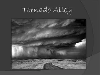
Sir Tristram Alley. John Ehinger November 26, 2012. Location. Google Earth; JE . Apparent Vagrant Camp. Several adjacent residents report years long problem of people in secluded area behind Sir Tristram alley May be criminal, homeless, or youth or combination thereof

E N D
Sir Tristram Alley John Ehinger November 26, 2012
Location Google Earth; JE
Apparent Vagrant Camp • Several adjacent residents report years long problem of people in secluded area behind Sir Tristram alley • May be criminal, homeless, or youth or combination thereof • Area littered with trash and apparently human feces with toilet paper • Recently used as camp for some purpose • Significant property crime, vandalism and theft from vehicle in adjacent areas of CH and Carrollton • Also recent fire in adjacent resident’s truck
Gym bag, dumped paint and … meat? JE photos from area - 11/23
Tent, ski mask GS photos from area
Possible Criminal Activity (Lewisville PD) (5/26 to 11/26) Crimereports.com – layers for “theft from vehicle”, “other”, “property”
Possible Criminal Activity (Carrollton PD) (5/26 to 11/26) Cityofcarrollton.com crime map – all crimes for police bead 343
Challenges • No fence on CH side • Fence on Quail Creek alley • Hedges on Sir Tristram alley and QC fence conceal camp area • Ownership of property is uncertain – maybe old RoW for Polser Rd. • Property appears to contain the 5-foot strip of Lewisville surrounding CH • May also include Town of Hebron 5 foot strip
DCAD Map Dentoncad.com showing details of parcel – no ownership indicated
Possible Solutions • Trim hedges at bottom to increase visibility • Quail Creek fence and top of hedges will still create privacy for both neighborhoods • Add fence along hedge • Can be climbed but residents feel area is used as a base for petty theft and vandalism due to ease of ingress/egress • Physical barrier of HOA style fence like 1-D’s fence on Polser may eliminate this ease of access
Possible Solutions (cont.) • Work with property owners to close access from west, close gaps with Quail Creek fence along south and east • Identify and resolve any ambiguities of ownership, jurisdiction • Short term: • Iron Guard patrols • Paid LPD weekly patrols • Ask LISD to prohibit some parking at Polser ES • Get adjacent property owners to post and enforce no trespassing • Coordinate with City of Carrollton, Carrollton PD and Quail Creek HOA
Go Big? • Remove hedges and replace hedges with green space – possibly extend asphalt path • Consider making pedestrian only connection to Quail Creek allowing pedestrian access to Polser ES and Castle Hills ES • Could further extend path along Sir Lancelot alley to provide medical office buffer