Download
1 / 23

E N D
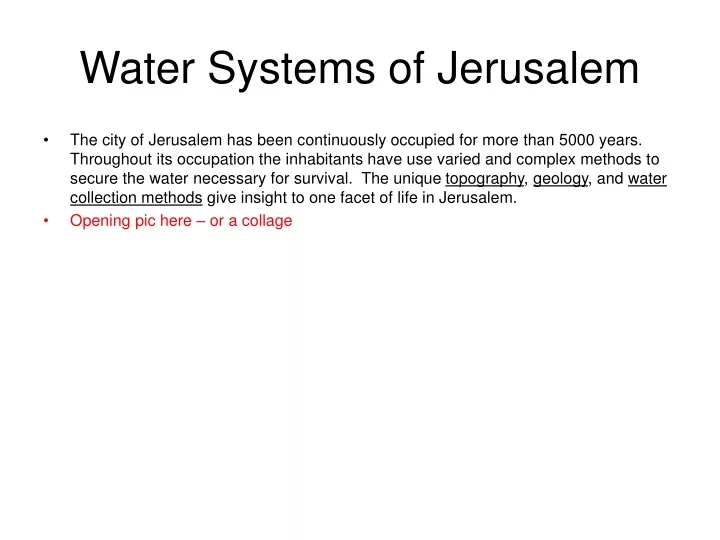
Water Systems of Jerusalem • The city of Jerusalem has been continuously occupied for more than 5000 years. Throughout its occupation the inhabitants have use varied and complex methods to secure the water necessary for survival. The unique topography, geology, and water collection methods give insight to one facet of life in Jerusalem. • Opening pic here – or a collage
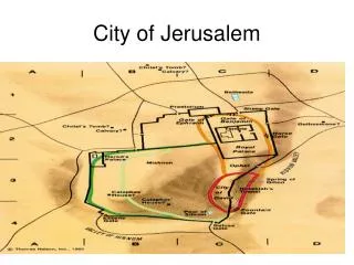
Topography of Jerusalem • (we need a picture and a better topo map) • Jerusalem is situated on a series of hills divided by 3 valleys: the Kidron on the east, the Ben-Hinnom on the west and south, and the Tyropean, which runs in between the Kidron and the Ben-Hinnom. • From the Middle Bronze Age until the time of Solomon, Jerusalem occupied the small southern spur, now known as the City of David, and was surrounded by these three valleys. Later, the city expanded to the west and the Tyropean valley was gradually filled in by centuries of building. • This topography provided a defensible location with natural water sources. • Source of map?
Geologic Rock Layers • Jerusalem’s 3 layers of limestone • 1. Senonian: softest, found near the surface (only on Mt Scopus) • 2. Turonian: middle layer, divided into Meleke* and Mizzi Hillu* • 3. Cenomanian: hardest, lowest layer, divided into Mizzi Ahmar* and Mizzi Yahudi* • *(royal, sweet hard stone, hard red, hard like a Jew) • Rain water seeps through the upper, softer layers, forming caves as it dissolves the limestone. Then it flows along the top of the harder Cenomanian layer. Due to tectonic shifts, the layer of Cenomanian limestone in Jerusalem is higher in the west than in the east. Therefore, the water that feeds the Gihon spring runs from the west, along the top of the Cenomanian layer, to the spring’s outlet on the east of the City of David. This is what is known as a siphon-type karst spring. • Source of section?
Jerusalem’s Water Systems • Due to the arid climate of Israel, water is scarce. Throughout Jerusalem’s history, its inhabitants have used three different strategies for acquiring water, allowing for a permanent settlement. • Utilizing natural sources • Channeling water • Storing water • Fix this – overlap. Two different sources of water: spring, rainfall. Acquisition techniques: reservoirs, cisterns, channelling.
Utilizing Natural Water • Jerusalem has two natural sources of fresh water, which attracted the first settlers to the area. • One source of fresh water for the city of Jerusalem is the rain water that runs through the valleys surrounding the city. These three valleys are the Kidron, the Tyropean, and the Ben-Hinnom. The water flowing in these valleys also provided fertile soil for agriculture outside the city. However, this water source is seasonal, leaving the area dry and uninhabitable during the summer months. • The second source of fresh water is the Gihon spring, which is perennial. This spring made it possible for people to live in Jerusalem all year. The Gihon is a karst spring whose waters flow irregularly. The outlet for the Gihon is in the Kidron valley. • Source of illustration?
Spring Within MB Walls • Modern archeological excavations near the Gihon spring reveal early attempts to protect the spring from enemies of the city. During the Middle Bronze (MB) period the city walls of Jerusalem were near the bottom of the Kidron valley and included the outlet of the Gihon spring. Later, walls were constructed at the crest of the hill, providing a more strategic defense of the city but leaving this important water source exposed. • Better plan?
Pool Tower • Modern excavations conducted by Ronny Reich and Eli Shukron have revealed two ancient towers dating to the MB period. These towers were part of the ancient wall system and specifically defended the Gihon spring against attack. Must be a better pic
Warren’s Shaft Reassessment • Originally scholars believed that Warren’s shaft was used by the inhabitants of Jerusalem to access fresh ground water during a time of siege without being exposed outside the city walls. However, recent excavations have expanded the Warren tunnel system to reveal a complicated tunnel network leading to an underground pool fed by a network of channels from the Gihon spring. Warren’s shaft was not part of the original system and seems to be an unfortunate discovery made centuries later by workers modifying the tunnel network. Make drawing larger
Hazor Compare • Warren’s underground water system is similar to other complex water systems found at sites throughout Israel, including Gibeon, Gezer, Hazor, and Meggido. However, most of these systems date to the Iron age. ?
Channeling Water • One way to optimize the use of natural water resources is to channel water from the source to a desired location. The following are primary ancient water channels in Jerusalem: • Siloam channel • Hezekiah’s tunnel • Hasmonean aqueduct • Lower aqueduct • Upper aqueduct
Siloam Channel and New Pool • The Siloam channel, also known as channel II in modern excavations, was built in the MB age to move water from the Gihon spring down the Kidron Valley to a pool. Along the course of the channel smaller channels branched off to irrigate fields in the valley. The pool at the end of this channel is currently being excavated and may call into question the location of the Siloam pool.
Hezekiah’s Water Tunnel • This tunnel, built by Hezekiah (II Chronicles 32:2-4, 30), is 513 meters long and channels water from the Gihon spring, which was outside the city walls, to a location within the city walls. Hezekiah dug the tunnel to prepare for the Assyrian siege led by Sennacherib in 701 BC and had the Siloam channel, which was outside the city, destroyed. This prevented the Assyrians from accessing Jerusalem’s water during the siege.
Lower Aqueduct • The Lower Aqueduct is an open-air channel utilizing water from the Arrub springs. It follows the contour of the land and terminates in Jerusalem. The entire system relies on gravity to move the water from the lowest pool of Solomon, south of Bethlehem, to the Serpent Pool and the Temple Mount. Based on textual evidence it appears to have been constructed in the Hasmonean period. • Need plan
Upper Aqueduct • The Upper Aqueduct was built using stone pipes sealed together with plaster to create a siphon. This aqueduct moved water from the upper pool of Solomon, fed by the Wadi Biyar in Hebron, to the Mamilla pool and eventually to the Temple Mount. The siphon allowed the aqueduct to travel a more direct route because the water flow was not disrupted by regional increases in elevation. Names of Roman commanders from the 10th legion inscribed on this aqueduct date it to no later than the second century CE. However, it is unclear who built it. Need plan
Hasmonean Aqueduct • This water channel was built during the time of the Hasmoneans, bringing water from the present-day Damascus Gate through the Strouthion Pool to the Baris Fortress, the residence of the Hasmonean kings, where it was collected in cisterns. It was originally an open channel, roofed with large stone slabs. Herod’s expansion of the Temple Mount later made the channel unusable.
Water Collection • Another way of optimizing the natural sources of water is to collect the water when it is available and store it for future use. From ancient times, citizens collected rainwater and stored it for their own private use. In the Bronze and Iron Ages, large jars stored the water, and in the Hellenistic period and following, private cisterns were used. In addition, Jerusalem’s public officials would provide for their citizens by collecting water in large public pools. These include: • Warren’s pool • Siloam pool • Bethesda pools • Serpent pool • Mamilla pool • Strouthion pool
Warren’s Pool • The excavations begun in 1996 have uncovered a pool that was part of the Warren tunnel system. This underground pool was fed by water diverted from the Gihon spring.
Siloam Pool • The pool located at the end of Hezekiah’s tunnel is commonly referred to as the Siloam pool. However, current excavations south of this location are unearthing a pool fed by the Siloam channel, which may, in fact, prove to be the original Siloam pool mentioned in the Bible (Nehemiah 3:15). The current Siloam pool may have been a continuation of Hezekiah’s water channel.
Bethesda Pools • The two pools known as the Beth-zetha pools were constructed in the Beth-zetha valley, which is north of the Kidron valley. The northern pool was constructed in the first temple period, and the second was constructed in the Hellenistic period. There is a long tradition connecting these pools with healing from Christian and Roman sources. Jesus’ healing of an invalid (John 5:1-15) is a well-known example. The pools are located on the grounds of the Monastery of St. Anne in the old city.
Serpent Pool The Serpent Pool, also called the Sultan’s Pool, is located in the Ben-Hinnom Valley on the west of Mount Zion and was fed by the Lower Aqueduct and run-off from the valley. The pool was formed by damming up the lower end of the valley. It is mentioned by Josephus (War of the Jews 5:3:2) and was likely built by Herod who wanted a source of water near his palace. It is currently being used as an open-air theater.
Mamilla Pool • The Mamilla pool is located in the present-day Independence Park, west of the Old City. The Upper Aqueduct fed this large public pool, which provided water for the Citadel near the Jaffa Gate and the Temple Mount during the Second Temple period.
Strouthion Pool • The Srouthion Pool was dug by Herod the Great. It collected water channeled from higher ground, and at one time was fed by the Hasmonean aqueduct. The pool was part of the Antonia fortress and was originally open to the air. Around 135 CE the emperor Hadrian covered the Srouthion pool with twin barrel vaults, protecting the water source while building a street over it. The pool is currently located under the Sisters of Zion Convent and at the end of the Western Wall Tunnel.
Temple Cisterns • Due to the lack of comprehensive archeological excavations on the Temple Mount, the complex network of ancient cisterns has yet to be adequately studied. However, Warrens explorations more than a hundred years ago provides us with the location of thirty seven cisterns on the Temple mount. Many of these cisterns may date to the second temple period.