Download

1 / 29
290 likes | 857 Views
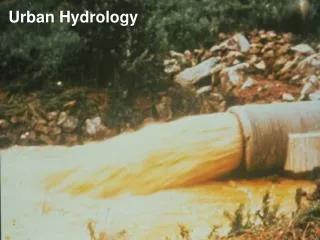
TR-55 Urban Hydrology for Small Watersheds. Simplified methods for estimating runoff and peak discharge for small urban/urbanizing watersheds. Ch 1 Intro Ch 2 Estimating Runoff Ch 3 Time of Concentration Ch 4 Peak Runoff Method Ch 5 Hydrograph Method

E N D
Simplified methods for estimating runoff and peak discharge for small urban/urbanizing watersheds • Ch 1 Intro • Ch 2 Estimating Runoff • Ch 3 Time of Concentration • Ch 4 Peak Runoff Method • Ch 5 Hydrograph Method • Ch 6 Storage Volumes for Detention Basins
Chapter 5 Tabular Hydrograph Method • Can be used to estimate runoff from nonhomogenous watersheds • Input: • Same as Chapter 4 for each subarea • Tt-travel time for each routing reach
Steps • Use Worksheet 5a to calculate/summarize info on each subarea • Use worksheet 5b to route the various subareas
Limitations • Accuracy decreases as complexity increases • Accuracy (+/- 25%) • Where possible, compare to gaged data • TR-20 (not TR-55) should be used if: • Tt > 3hours • Tc for any subarea > 2 hours • Drainage areas differ by a factor of 5 or more • Entire hydrograph is needed for detailed flood routings • Peak discharge time must be determined accurately
Subareas 1 & 2 routed through 3,5 and 7 Subareas 3 & 4 routed through 5 & 7 Subareas 5 & 6 routed through 7 Proposed subdivision in 5, 6 and 7
Table 5-1 Initial abstraction as a function of curve number Ia/P values are then calculated
Exhibit 5 tables (4 different exhibits based on the 4 rainfall distribution types) Prerouted using ATT-KIN method Tables give unit peak discharge (multiply by DA and Q to get Discharge) Ia/P values are rounded off to the nearest 0.1, 0.3 or 0.5 (or interpolated) Travel time must be rounded off to table values
Impact of Development Peak flow is higher after development Peak flow occurs earlier after development
Low Impact Development • http://www.epa.gov/nps/lid/ • http://www.lowimpactdevelopment.org/ • http://www.psat.wa.gov/Programs/LID.htm • http://www.lid-stormwater.net/intro/background.htm
Porous Concrete Pavers • http://www.concretenetwork.com/concrete/porous_concrete_pavers/
Pervious Pavements in Cold Weather • http://stormh2o.com/september-2008/pervious-asphalt-concrete.aspx
Rain Gardens • http://www.ci.des-moines.ia.us/departments/PR/rain_gardens.htm
Ch 6 Estimating Storage Volumes for Detention Basins • Approximate method (+/-25% storage error) • Can be used for single and multi-staged outflow structures • Worksheet 6a-estimate storage volume given desired peak outflow • Worksheet 6b-estimate peak outflow given storage volume
Detention Outlet Structures • Single Stage (culvert or orifice) • Multi-Staged to handle different flows • Combination of orifices &/or weirs
Example 6-1Single-Stage Outflow • 75-Acre Development • Developed Peak flow is 360 cfs (Q25) • Present channel can handle only 180 cfs w/o significant damage • Storage-elevation curve is given-see worksheet • Determine storage volume of a detention basin • Assuming a rectangular weir, determine the weir length needed to limit the flow to 180 cfs
Determining weir length • Flow=3.2*Weir Length*(Weir Head)1.5 • 180=3.2*Weir Length*(5.7) 1.5 • Weir Length=4.1 feet • Notes: • Weir head=max. storage elevation-crest elev. • A weir length greater than 4.1 feet would let more than 180 cfs into the drainage channel
Example 6-3 • 10-Acre Development • Existing peak flow is 35 cfs • Developed peak flow is 42 cfs (24-hr, Q100) • Detention basin volume is 35,000 cubic feet • Estimate peak outflow