Download

1 / 17
170 likes | 583 Views
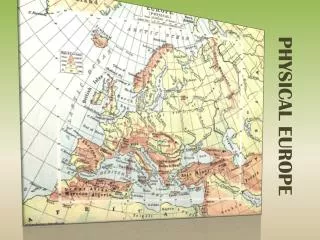
Physical Features of Europe. Europe Unit. Peninsula of Peninsulas. Europe is a large peninsula that consists of many smaller peninsulas Most places in Europe are no more than 300 miles from an ocean or sea. Northern Peninsulas.

E N D
Physical Features of Europe Europe Unit
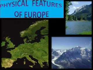
Peninsula of Peninsulas • Europe is a large peninsula that consists of many smaller peninsulas • Most places in Europe are no more than 300 miles from an ocean or sea
Northern Peninsulas • The Scandinavian Peninsula is made up of Norway and Sweden and is bounded by the Norwegian, North, and Baltic Seas • Glaciers created fjords – steep U-shaped valleys that connect to the sea and that filled with seawater after the glaciers melted
Northern Peninsulas • The Jutland Peninsula forms the largest part of Denmark and a small part of Germany • The Jutland Peninsula consists of gently rolling hills and swampy low-lying areas which are different than the rocky land of the Scandinavian Peninsula
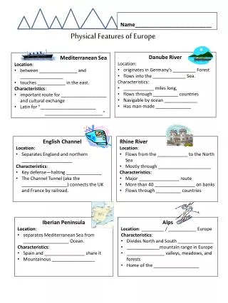
Southern Peninsulas • The Iberian Peninsula is home to Spain and Portugal. The Pyrenees Mountains block it off from the rest of Europe • The Italian Peninsula is home to Italy. It is shaped like a boot, extends into the Mediterranean Sea • The Balkan Peninsula is bordered by the Adriatic, Mediterranean, and Aegean Seas. It’s mountains make transportation difficult
Islands • The larger islands are Great Britain, Ireland, Iceland, and Greenland all located in the North Atlantic • The smaller islands are Corsica, Sardinia, Sicily, and Crete all located in the Mediterranean Sea
MOUNTAINS • The Alps cut Italy off from the rest of Europe just as the Pyrenees restrict movement from France to Spain and Portugal • The Apennines divide the Italian Peninsula into east and west while the Balkans block off the Balkan Peninsula from the rest of Europe • Resulted in the isolation of ethnic groups from each other
These are the Alps, which are the most famous mountain range in Europe
Rivers • Rivers are used to transport goods between coastal harbors and the inland region • 2 major rivers: Danube and Rhine • The Rhine flows from the interior to the North Sea while the Danube flows west to east through Europe touching 9 countries
Volga River • The Volga River begins near Moscow and is the longest river on the European continent