Download
1 / 14
140 likes | 221 Views
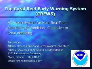
Coral Reef Early Warning System (CREWS) RPC Experiment. L. Estep, J. Spruce, C. Hall NASA Stennis Space Center, MS. CREWS/ICON Talk Overview. Background Objectives Methodology and Discussion Validation Present Status. Background.

E N D
Coral Reef Early Warning System (CREWS)RPC Experiment L. Estep, J. Spruce, C. Hall NASA Stennis Space Center, MS
CREWS/ICON Talk Overview • Background • Objectives • Methodology and Discussion • Validation • Present Status National Aeronautics and Space Administration
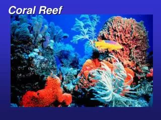
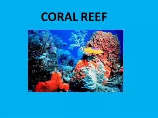
Background • Coral reefs are some of the most biologically rich and economically important ecosystems on Earth. • Coral reefs worldwide have declined seriously primarily due to bleaching events. • “Bleaching” is the loss of symbiotic algae living with the coral host, upon whom the corals depend for survival. • Increasingly warmer waters are suggested as the primary cause of coral reef decline, although there are other causes for coral reef loss – for instance, disease (e.g., black-, red-, white-band disease), natural events (e.g., earthquakes), and anthropogenic causes (e.g., polluted runoff). • Summer of 2005 saw exaggerated levels of coral bleaching in the GOM (Gulf of Mexico) and Caribbean. • Some experts have suggested that 10% of all coral reefs have died and another 60% are at risk. National Aeronautics and Space Administration
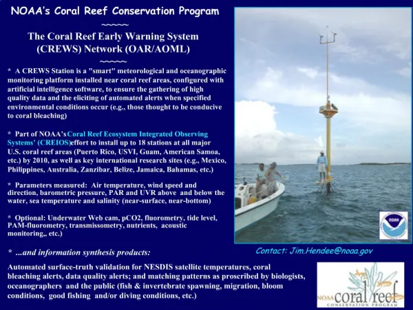
Background Cont’d • NOAA has been tasked by Executive Order P.L. 13089 to provide a strong supporting role in the U.S. Coral Reef Task Force. • NOAA instituted the CRW (Coral Reef Watch) program that instrumented various sites at key coral reef areas to collect long-term datasets. • RPC CREWS (now subsumed under ICON) links to NOAA’s DST that uses CRW and other data plus custom software to generate coral bleaching forecasts. • Input layers to the CREWS DST include sea temperature, salinity, PAR, UVR, and, at some stations, meteorological parameters. • Potential NASA contribution to CREWS DST centers on remotely sensed imagery products. • Contact made with J. Hendee as NOAA POC. National Aeronautics and Space Administration
Objectives • Objectives – CREWS/ICON RPC experiment • Identify potential next-generation sensor data applicable to CREWS DST-- VIIRS and LDCM targeted. • Demonstrate that RPC simulated VIIRS and LDCM would be useful to the NOAA CREWS DST. • Simulated imagery used to produce water clarity parameters – e.g., chl-a, absorption • Additionally, the RPC imagery would be used to produce a map of the benthos (i.e., bottom habitat types). • Perform validation of the simulated CREWS GIS data layers to show viability of the NASA next-generation sensor data. • Provide partner agency with results of the experiment. National Aeronautics and Space Administration
Basic Methodology • Acquire hyperspectral datasets over target area(s). • Preprocess the acquired datasets. • Submit to RPC for simulation of VIIRS and LDCM imagery. • Process the RPC provided imagery to produce salient CREWS/ICON DST data input layers. • Perform validation of the RPC image derived data layers by comparing to field data. • Analyze the value of the simulated datasets in CREWS/ICON GIS DST. • Write and submit End-of-RPC-experiment report. • Provide results to NOAA through its POC. National Aeronautics and Space Administration
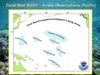
Discussion • Selected areas for CREWS/ICON RPC Experiment are Looe Key, FL, and Kaneohe Bay, HI. • EO-1 Hyperion data downloaded for Looe Key. • Key field data provided by NRL Stennis for Looe Key. • Recently, AVIRIS 3-m data procured from JPL for Kaneohe Bay. • Field data hunt is still ongoing for the AVIRIS data. • RPC simulated VIIRS (spectral only to this point) performed on EO-1 imagery. • RPC simulated LDCM on Hyperion data is still in progress. • AVIRIS data will begin RPC processing shortly. • MODIS SST data has been downloaded and will be used to simulate VIIRS SST imagery. National Aeronautics and Space Administration
Results to Date Hyperion True Color Image – Looe Key • Atmospheric correction performed on EO-1 data. • Imagery de-glinted. • Vertical striping in image – left as is. • Bad lines in imagery corrected. • VIIRS simulated imagery used to produce preliminary Chl-a map (Cannizzaro and Carder, 2006) over Looe Key. • VIIRS simulated imagery used to produce preliminary benthos mapping. • Atmospheric correction performed on AVIRIS imagery. National Aeronautics and Space Administration
Results II Chlorophyll-a Image – Looe Key Computed from Hyperion-Based VIIRS Simulation • Chl-a image of Looe Key, FL, derived from the simulated VIIRS multispectral image. • Image is of offshore water area only. • Have not processed image yet to quantitative Chl-a values. • Red pixels are proximate to urban area of Big Pine Key. The deep blue pixel area is indicative of deeper offshore water. • Intermediate colors - the coral reef area that runs like a ridge across the scene National Aeronautics and Space Administration
Results III Looe Key – Preliminary Benthic Habitat Map • Preliminary benthos map produced • Four classes parsed out of VIIRS simulated image – map will undergo refinement – will employ LDCM simulated data when available to aid in producing the benthic map Black – unclassified Dark blue – sea grass Green – coral Yellow – sand substrate Light blue – margin reefs and rubble National Aeronautics and Space Administration
Validation Field Data – Colored Symbols Early validation efforts have compared the Rrs values from field data collect to that of the atmospheric correction performed on the EO-1 data and how that carries through to the VIIRS imagery. Ordinate axis: Rrs Abscissa axis: Lambda Due to the simulation of VIIRS band M1 – the blue end of the spectrum is impacted Mean bias error ~ 30% Image provided by NRL National Aeronautics and Space Administration
CREWS/ICON Status • The near-term focus will be on getting Looe Key, FL, simulated image data products complete and delivered to the RPC CREWS/ICON team. • The corresponding related CREWS/ICON data layer products – i.e., SST imagery, Chl-a, absorption, and benthic mapping – will be then be weeks away from completion. • AVIRIS imagery will be worked in parallel – however, 70% of the effort will go into early completion of the Looe Key site. • Continuing effort will be expended to find appropriate field reference data to support analysis of the AVIRIS-based VIIRS/LCDM simulation products. National Aeronautics and Space Administration
Relevant References Gao, B.-C, K. H. Heidebrecht, and A. Goetz, 1993, ‘Derviation of Sclaed Surface Reflectance from AVIRIS Data,” Rem. Sens. Env., 44:165-178. Gao, B.-C and C. Davis, 1997, “Development of a Line-by-Line Based Atmospheric Removal Algorithm for Airborne and Spaceborne Imaging Spectrometers,” in Imaging Spectrometry III (Descour and Shen eds.), Proceedings of SPIE Vol. 3118:132-141. Glynn, P. W., 1984. Widespread coral mortality and the 1982-83 El Nino warming event. Environmental Conservation, 11:133–146. Goreau, T. J., and R. M. Hayes, 1994. Coral bleaching and ocean ‘hotspots’. Ambio., 23:176–180. Hendee, J., G. Liu, A. Strong, J. Sapper, D. Sasko and C. Dahlgren, 2002. Near real-time validation of satellite sea surface temperature products at rainbow gardens reef, Lee Stocking Island, Bahamas. Seventh International Conference on Remote Sensing for Marine and Coastal Environments, Miami, Florida. Holderied, K., R. Stumpf, S. Rohmann, A. Shapiro, M. Anderson, and W. Smith, 2002. Benthic habitat mapping of pacific ocean coral reefs with high-resolution satellite imagery. Seventh annual International Conference on Remote Sensing for Marine and Coastal Environments, Miami, Florida. Jerlov, N.G. 1976: Marine Optics. Elsevier, Amsterdam, 231 pp. Montes, M., B.-C. Gao, and C. Davis, 2003, “Tafkaa Atmospheric Correction of Hyperspectral Data”, in Imaging Spectrometry IX (Shen and Lewis eds.), Proceedings of SPIE Vol. 5159:162-167. NOAA Report. 2003. NOAA Satellites Give Early Warning for Coral Bleaching in Northwestern Hawaii Archipelago http://www.epa.gov/owow/estuaries/coastlines/jun03/NOAA_Sat.html (accessed on 27 August 2006). National Aeronautics and Space Administration
Participation in this work by Science Systems and Applications, Inc., was supported by NASA at the John C. Stennis Space Center, Mississippi, under Task Order NNS04AB54T.