Download
1 / 22
230 likes | 384 Views
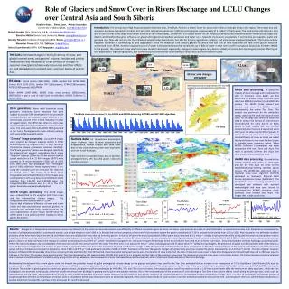
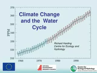
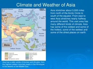
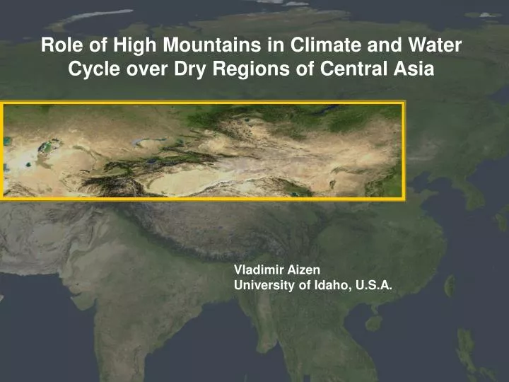
Role of High Mountains in Climate and Water Cycle over Dry Regions of Central Asia. Vladimir Aizen University of Idaho, U.S.A. Yenisey. Ob’. Amur. A l t a i -S a y a n. Sirdarya. Ili. Tien Shan. Amydarya. Tarim. Pamir. Kunlun. 20. 80% freshwater originated in mountains

E N D
Role of High Mountains in Climate and Water Cycle over Dry Regions of Central Asia Vladimir Aizen University of Idaho, U.S.A.
Yenisey Ob’ Amur A l t a i -S a y a n Sirdarya Ili Tien Shan Amydarya Tarim Pamir Kunlun 20 80% freshwater originated in mountains 40% seasonal snow 25% from glaciers ~5% from permafrost 60 160 40 60 140 60 120 80 100 40 40 > 1,000,000km2 mountainous area over 1,000 m 45,000 km2 glacierized area ~ 80,000 km2 frozen ground area > 3,000 km3 fresh water stored in the glaciers > 200 million water consumers Source: Dolgushin, 1989; Gorbunov, 2001; Kotlyakov, 1996 Karakorum 20 20
KAZAKHSTAN MONGOLIA UZBEKISTAN KYRGYZSTAN TURKMENISTAN AFGHANISTAN TAJIKISTAN C H I N A No glacier – no life in the central Asia dry lands!
winter spring summer autumn
Altai Myuyn Kum G o b i Tien Shan Kizil Kum Takla Makan Kara Kum Pamir Qaidam Dasht-e Margow Total annual number of dust storms observed at ten central Asian stations. Days Source: Weihong Qian, et al., JC, 2001
The increase in air temperature can be one of the main factor of dry land and hydrological cycle instability Air temperature, C Source: Carbon Dioxide Information Analysis Center (CDIAC); Lugina et al. 2000
Ann air temperature, oC Sibrian Altai (1940-2005, 12 stations):air temperature increased at low elevations more (0.3oC yr-1) than at high elevations (0.01oC yr-1). Precipitation decreased at low elevations and increased at high elevations (3.8mm yr-1), notably in spring months. Ann precipitation, mm Tien Shan (1940-2005, 18 stations):air temperature increased at low elevations (0.02oC yr-1) more than at high elevations.Precipitation have insignificant increasing trend over the entire Tien Shan. Pamir (1940-2005, 4 stations): air temperature increased at low elevations (0.03oC yr-1) and 0.01oC yr-1 at high elevations over 3,000m a.s.l. Precipitation increased at low elevations (0.08mm yr-1) and particularly at high elevations of western and central Pamir (8.1mm yr-1), notably in winter months
Snow covered areas by 1,000m isohyps over the Tien Shan for the last twenty years reconstructed by surface observational, AVHRR and MODIS data Duration of snow melt from the date of maximum snow cover to date of it’s disappearance reduced on 30 days during the last twenty years, equal 138 days in 2007. Snow melt 30 days faster then 20 years ago. The decrease of snow cover is not linear process. Further decrease of snow covered areas may be accelerated due to reduced snow covered area and consequently lesser of heat input necessary for snow melt. ten days AVHRR data calibrated with surface observational data eight days MODIS data
Interaction between the general circulation of the atmosphere, the meridional gradient of global air temperature, and snow covered area in Eurasia B A
11% 19.2% 11.1% 17.1% 4.2% Altai, Tien Shan, Pamir, Karakoram and Kunlun are the major mountain ridges of dry central Asia that maintain high volume of snow and ice, the main sources of water in this region 5.2%
Akshiirak glacierized massif, Central Tien Shan 1943 1977 2003 182 glaciers 406.8 km2 glacierized area 4.2% area reduction (aerial photogrammetry 1943/1977) 178 glaciers 371.6 km2 glacierized area 8.7% area reduction (aerial photogrammetry 1977/ASTER 2003) Aksiirak glacierized massif 182 glaciers 427 km2 glacierized area (aerial photogrammetry 1943) Source: Aizen, and others, AG, 2006
2007 2002 1995 1977 1956 1943 1869 ~1800 Petrova Glacier termini, Akshiirak glacierized massif (65.33 km2, from 1869 to 2007 this glacier retreated on 3 km) Source: Aizen, and others, AG, 2006
Akshiirak glacial surface change between 1977 and 2000 evaluated by aerial photogrammetry and SRTM data 100 m decrease in glacier surface 9.6 km3 ice-volume reduction since 1943 Source: Aizen, et al., Annals of Glaciology, 2006
Altai The Tien Shan High Mountains experimental Lidar station. Deviations from long-term average (background) of reverse aerosolscattering coefficients in layer of Stratospheric Aerosol (15-30 km). The background value over central Asia is 1.56 · 10-4. Aerosols: impact Pakistan Lop Nor India Kuwait Lop Nor • snow and glacier surface albedo • change intensity of snow/ice • melt and near surface heat • exchange • contaminate atmosphere and • water quality • increase or decrease global air • temperature
Permafrost: impacts In mountainous areas, thawing permafrost increases risk of landslides and rock falls and has impacts on infrastructure. Permafrost in Tien Shan has degraded over the past 40 years and is projected to decrease by 20-30% in this century. Measured mean annual ground temperatures at different depths at the “Tien Shan” meteorological station (3614 m). Source: Aizen, Marchenko, NSF annual report, 2000
glaciers: impacts Shrinkage of glaciers leads to ice instability and formation of ice and debris dams, resulting in more flooding, debris flows ice and avalanches.
In river basins with small glacierized areas, increase of glacier melt has already led to a decline in river discharge that partly explain the wastage of large Central Asian lakes. lakes:impact more than one-third of glacial lakes with surface areas between 1 and 5 km2 have disappeared in central Asia Merzbacher Lake Issik Kul Lake Aral Lake
Earlier, synchronous snow and glacier melt changes regime of river runoff causing hydrological instability, spring cloudburst flooding, and protracted period of glacier melt, which temporary increase river discharge but facilitate quick glacier recession. rivers:impact snow peak in 1960- mid 1980th glacier melt glacier and snow melt peak since mid 1980th
Alpine climate and environmental changes impact and consequences • earlier disappearance of seasonal snow cover, shrunk of the glaciers, • and alpine permafrost (particularly from the middle of 1970th) • increase evaporation accelerate desertification at lowlands intensify • of dust storms and aerosol loading to atmosphere increasing near • surface heat balance and regional and global air temperatures • extend snow and glacier ablation period and land-soil instability • causes change frequency and magnitude of natural hazards • change central Asian hydrological cycle • lack of surface and ground water decrease water quality causes • salinization and decline of agricultural production • increase of mortality rate and people migration.
We need more research and information • high-elevation meteorological monitoring • integrative ice-core ground- based and remote sensing data analysis during • the last 30 to 50 years • high-elevation atmospheric dust-aerosol monitoring • alpine ice-core paleo-climate and environmental analysis • atmosphere - land surface (alpine terrain) interactive analysis and modeling