Download
1 / 13
130 likes | 578 Views
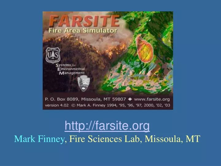
http://farsite.org Mark Finney , Fire Sciences Lab, Missoula, MT. What is FARSITE?. is a fire growth simulation model. It uses spatial information on topography and fuels along with weather and wind files.

E N D
http://farsite.org Mark Finney,Fire Sciences Lab, Missoula, MT
What is FARSITE? • is a fire growth simulation model. It uses spatial information on topography and fuels along with weather and wind files. • incorporates the existing models for surface fire, crown fire, spotting, post-frontal combustion, and fire acceleration into a 2-dimensional fire growth model. • runs under Microsoft Windows operating systems (Windows 98, me, NT, 2000, and XP) and features a graphical interface. • users must have the support of a geographic information system (GIS) to use FARSITE because it requires spatial landscape information to run.
What does FARSITE do? • Computes wildfire growth and behavior through time under heterogeneous conditions of terrain, fuels, and weather. • Uses existing fire behavior models for surface and crown fires, post-frontal combustion, and fuel moisture. • It is a deterministic model, meaning that you can relate simulation results directly to your inputs. • Produces outputs that are compatible with PC and GIS. • Can simulate air and ground suppression actions. • Can be used for fire gaming, asking multiple "what-if" questions and comparing the results.
Learn more by reading the FARSITE User’s Guide http://farsite.org/root/farsite/WebHelp/farsite4.htm
Landscape Layers from GIS Required Elevation Aspect Slope Fuel Model Canopy Cover Optional Crown Bulk Density Crown Base Height Stand Height Duff Loading Course Woody
All raster data must be converted to ASCII GRIDS in ArcINFO or ArcToolbox
Required • Weather (.WTR) • Wind (.WND) • Adjustment Factors (.ADJ) • Initial Fuel Moistures (.FMS) • Optional • Custom Fuel Models (.CFM) • Burn Period (.BPD) • Coarse Woody Profiles (.CWD) • Fuel Model Conversions (.CNV)
Advance of the Maloney Creek Fire on Craig Mountain, August 2000 Enable spot fires! Barriers can be added Start Aug 12?