Download
1 / 21
210 likes | 220 Views
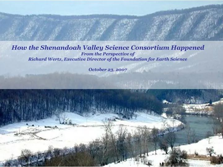
How the Shenandoah Valley Science Consortium Happened From the Perspective of Richard Wertz, Executive Director of the Foundation for Earth Science October 23, 2007. ME. America Rivers Most Endangered River Sections 2006. Pajaro River Upper Yellowstone River Willamette River

E N D
How the Shenandoah Valley Science Consortium Happened From the Perspective of Richard Wertz, Executive Director of the Foundation for Earth Science October 23, 2007
America RiversMost Endangered River Sections 2006 • Pajaro River • Upper Yellowstone River • Willamette River • Salmon Trout River • Shenandoah River
What Are You Doing About My River? Wertz County Supervisor Staelin
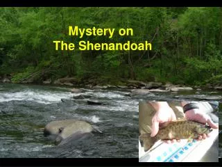
Shenandoah River Water Resources Problems • Water Availability • Average Annual Rainfall Equal to San Antonio, Texas • Drought Prone Area • Rapid Population Growth in Northern Valley • Water Quality • Fish Kills • High Mercury Content from WWII-Vintage Waste Sites • Agricultural Waste Run Off • Complicating Factors • Karst Geographic Features • River Is the Reservoir/Storage Facility • Impact of Air Pollution from Ohio River Coal Burning Electricity Generating Plants • Multi-County, Interstate
Regional Resources Policy Committee • Elected Officials from 9 Virginia & West Virginia • Counties and Cities Represented • Created a Strategic Plan for Regional Policy to Provide Long-Term Protection of the and Plan for Using Ground and Surface Water
STRATEGIC PLAN Strategy #1 – Meet Virginia requirements for water supply planning. Strategy #2 – Establish a regional drought awareness and response system Strategy #3 – Cooperatively build local government tools to address mutual water issues. Strategy #5 – Establish partnerships among localities and stakeholders. Strategy #6 – Make existing laws more effective through thru coordinated enforcement. Strategy #7 – Develop a better picture of short and long-term water quality trends. Strategy #8 – Develop an education and outreach plan. Strategy #9 – Engage more local and regional elected officials and decision-makers in the process. Strategy #10 – Further develop “greenways/green space” as a regional water quality tool. Strategy #11 – Develop a marketing strategy that creates economic incentives for agriculture, rural businesses, industry, and local communities to practice water stewardship.
Bedrock of the Strategic Plan Strategy #4 – Develop a “Shenandoah Valley Water Resources Science Plan” to provide decision-makers with the ability to better see how policy actions affect future watershed conditions.
Science Resources Available REGIONAL WATER RESOURCES POLICY COMMITTEE GREAT VALLEY WATER SCIENCE FORUM SHENAIR LOCAL GOVERNMENT COMMITTEE REGIONAL SCIENCE ADVISORY COMMITTEE
SCIENCE QUESTIONS POSED TO USGS • 1. What is the inter-relationship of flow between groundwater and stream flow in the Shenandoah Valley? • 2. What are the current levels of groundwater pollution in the Valley (How much of the problem is caused by natural causes, septic failures, farming, urban runoff, etc. and how can these be remediated and prevented?) • 3. Can groundwater budgets be defined by local area? • 4. If #3 is not possible, can underground “watersheds” be defined for karst areas? • 5. What is the potential for deepwater reservoirs as either a source of water or as a storage AREA? • 6. What is the interrelationship between air quality and water quality? (The NOAA funded, ShenAir project should provide useful data but the data will need to be studied and interpreted.) • 7. What is the interrelationship between soil quality and water retention and water quality?
What Can the Foundation Do About Our River? Wertz Staelin
So, Who’s On the Hook? FOUNDATION FOR EARTH SCIENCE UNITED STATES GEOLOGICAL SURVEY
Foundation for Earth Science • Operations Arm of the Federation of Earth Science Information Partners (ESIP Federation) • http://www.esipfed.org • ESIP Federation Includes More than 100 Partner Organizations • NASA, NOAA and USGS Data Centers • Government Research Labs • Universities • Technology Developers • Education, Nonprofit and Commercial Resource Providers • NASA, NOAA and EPA Are Strategic Partners • More Than 400 Individuals Involved
ESIP Federation Contributions to the Shenandoah River Science Consortium • Satellite and In Situ Data (including models, visualizations and decision support tools) • Data Fusion Technology • Technical Assistance for Using and Interpreting Data **ESIP Contributions are supplemental and complementary to USGS Field Science Work.
So, How to Proceed? • Regional Water Resources Policy Committee, USGS and Others Formed Shenandoah River Science Consortium. • Consortium Planned Shenandoah River Natural Systems Symposium • “Taking Care of the Water” • October 15-16, 2007 in Winchester. • Symposium Objective: Aggregate Science Input and Resource to Develop A Water Resrouces Science Plan.
Building the Consortium US Geological Survey • Involve USGS Science Centers • Involve USGS Regions • Involve USGS Headquarters • Provide Symposium Funding Water Policy Committee • Involve VA and WV State Agencies • Involve Local Elected and Appointed Officials • Involved Local Citizen Action Committees Foundation for Earth Science • Involve NASA, EPA and NOAA • Involve ESIP Water Management Cluster Members • Involved Area Universities • Involve Private Sector ShenAIR Committee • Involve Air Quality Interests • Involve More Universities • Involve More State and Local Officials • Fund Science Writer
Expected Results From Symposium • Broad-Based Water Resource Community of Practice Formed. • Inter-Disciplinary Science Plan Will Be Developed. • USGS Will Fund Additional Research. • Other Federal Agencies Will Use the Valley as a Testbed. • ESIP Federation Demonstrated the Value of Inter-Disciplinary/Inter-Agency Collaboration.
Collaboration Tools • Brand Niemann Created Wiki for Symposium: • http://colab.cim3.net/cgi-bin/wiki.pl?ShenandoahValleyScience • Conference Calls and Wiki Enabled Symposium Planning. • Wiki Produced Almost Instant Record that was Used in Breakouts. • Webcasting Allowed Remote Participation; Video-Casting almost Allowed Governor to Participate. • Wiki will be used for Follow-Up Science Inventory and to Draft Science Plan.
FINAL THOUGHTS • As Tammany Hall Boss George Washington Plunkett, Perhaps the Greatest Collaborationist of any Generation Once Said, “I SEEN MY OPPORTUNITIES AND I TOOK ‘EM”. • The Shenandoah Valley Science Collaborative Resulted when the Unexpected Alignment of Need, Common Interest and MutualBenefit Created an Opportunity. • We need to be Positioned to Recognize Opportunities like this, Take Advantage of Them and have the Communications Tools Required In Place to Support Creative Collaborative Initiatives.
Questions Richard Wertz Foundation for Earth Science 540-837-9613 dick.wertz@earthsciencefoundation.org