Download
1 / 20
200 likes | 361 Views
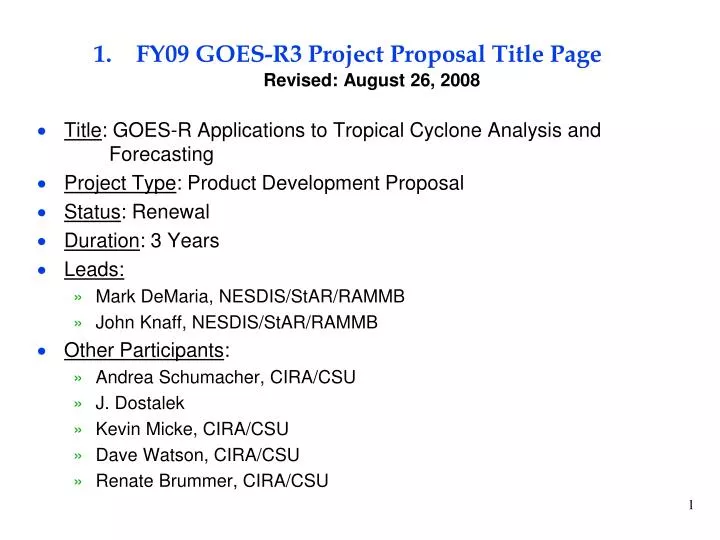
FY09 GOES-R3 Project Proposal Title Page Revised: August 26, 2008. Title : GOES-R Applications to Tropical Cyclone Analysis and Forecasting Project Type : Product Development Proposal Status : Renewal Duration : 3 Years Leads: Mark DeMaria, NESDIS/StAR/RAMMB John Knaff, NESDIS/StAR/RAMMB

E N D
FY09 GOES-R3 Project Proposal Title PageRevised: August 26, 2008 • Title: GOES-R Applications to Tropical Cyclone Analysis and Forecasting • Project Type: Product Development Proposal • Status: Renewal • Duration: 3 Years • Leads: • Mark DeMaria, NESDIS/StAR/RAMMB • John Knaff, NESDIS/StAR/RAMMB • Other Participants: • Andrea Schumacher, CIRA/CSU • J. Dostalek • Kevin Micke, CIRA/CSU • Dave Watson, CIRA/CSU • Renate Brummer, CIRA/CSU
2. Project Summary • Proxy GOES-R data will be used to develop tropical cyclone applications • Genesis and Intensity Forecasting • Test existing frameworks with proxy GOES-R data • NCEP/TPC SHIPS statistical intensity prediction model and rapid intensity index (RII) • NESDIS/SAB tropical cyclone formation probability product • Uses discriminant analysis • Proxy datasets • World Wide Lightning Location Network (for lightning mapper) • MSG observations (for ABI) • Utilize AWG technique to derive ABI from MSG channels • Evaluate predictive signal in lightning data • Intensification relationships may depend on shear • Confirm preliminary studies on TC genesis but with other data present • Tropical Cyclone Structure Analysis • Generalize GOES inner core wind algorithm to ABI channels • Storm structure analysis with proxy sounder data • AIRS, IASI, Cosmic satellite soundings, NOAA Jet GPS sondes • Eye sounding technique • Nonlinear balance winds • Impact on Dvorak intensity estimation method
3. Motivation/Justification • Supports NOAA Mission Goal(s): Weather and Water • Improved intensity forecasting identified as high priority in NOAA and NCEP/TPC • Intensity forecast skill still lags that of track forecasting • Unanticipated rapid intensity changes are a major problem for coastal evacuations • TC genesis forecasting capabilities are very limited • TC structure analysis can help compensate for loss of scatterometers • Addresses AWG request for more studies of ABI and polar data synergy
4. Methodology • Intensity Forecasting • SHIPS model statistically combines satellite, SST and model output • Evaluate predictive signal of ABI from MSG data • Use AWG tool for combining MSG channels to simulate ABI • Test predictive signal of WWLLN (lightning) data relative to other available information • Stratify by storm environment • Take similar approach with Rapid Intensity Index • Look for precursors to rapid intensification (cloud top signatures, lightning patterns) • Genesis forecasting • Develop experimental version of operational NESDIS TC genesis product • Test proxy ABI and lightning data • Upper level effects of ozone channel • Tropical Cyclone Structure Analysis • Eye soundings using AIRS, IASI retrievals • Wind diagnosis from temperature and moisture profiles (AIRS, IASI, COSMIC) using nonlinear balance equation • Additional tests with synthetic ABI/sounder data from models • Synergistic approach with high/low vertical/temporal polar data and low/high vertical/temporal GOES data
5. Summary of Previous Results • Proxy ABI datasets collected from MSG under previous GOES-R project • Mechanisms developed for creating synthetic ABI data from mesoscale and radiative transfer models • Large IR ABI tropical cyclone datasets collected for AWG project • Mass storage and computer cluster obtained from previous project • Preliminary analysis of ABI channels for storms from 2006 hurricane season • Hurricane eye sounding procedure developed under previous project
Proxy ABI and Sounder Data from Hurricane Helene 18 September 2006 C COSMIC Sounding MSG IR Channels
6. Expected Outcomes • Develop large proxy ABI, lightning and sounding databases for statistical analysis of tropical cyclones • Demonstrate the utility of lightning and ABI data for genesis and intensity forecasting • Develop synergistic polar/GOES-R algorithms for wind structure analysis • Demonstrate eye sounding capabilities for intensity estimation • Develop real time web page with experimental TC products • Publish papers on GOES-R applications to TC analysis and forecasting
World Wide Lightning Locator Network DataDaily Strikes September 10-20 2006
7. Major Milestones • FY08 • Assemble proxy lightning mapper, ABI and sounding databases • Modify SHIPS, Rapid Intensity Index, TC genesis parameter to use GOES-R inputs • Test eye sounding technique on large sample of cases • Present preliminary results at AMS tropical conference
Assemble proxy lightning mapper, ABI and sounding databases • The collection of MSG data in the tropical Atlantic for use as proxy ABI data continues using an automated procedure • Algorithm to create simulated ABI channels (7-16) from MSG data • Note: the collection of soundings from the AMSU instrument has long been automated for global tropical cyclones • The AIRS sounding database via the AIRS science team for historical storms has also completed • COSMIC Soundings have been collected from NCAR • The analysis of the World Wide Lightning Location Network (WWLLN) data (2003-2007) continues • comparison with the global lightning climatology from the TRMM mission in 50km X 50km bins • Work has begun to develop a IASI sounding database
MSG Tropical Sector, 11 Channels (2005-2008) MSG Ch 5 (7.3 um) 1515UTC 18 Aug 2008 Hurricane Helene 12UTC 18 Sept 2006 x SABI Ch 9 (6.95 um) 1515UTC 18 Aug 2008 COSMIC Sounding 12UTC 18 Sept 2006
Modify SHIPS, Rapid Intensity Index, TC genesis parameter to use GOES-R inputs • The developmental code of these statistical forecast model algorithms have been adapted to utilize satellite data in McIDAS format. • Current GOES/POES • ABI proxy data • simulated ABI channels • Primary emphasis in 2008 is on using WWLLN data in SHIPS intensity forecast model
Calibration of WWLLN Data • WWLLN data available from Aug 2003-Dec 2007 • Calculate lightning density (strikes/km2-year) • Compare with 1995-2005 OTD/LIS climatology OTD/LIS (0.5 deg) Scaled WWLLN (0.5 deg) Average Scale Factor = 57
Cumulative PDFs of the simulated ABI and GOES-E data over the overlap area in the eastern Atlantic 6.7um 6.95um Calibrate geostationary water vapor data to GOES-E is accomplished using the pdf-based method discussed/developed in Kidder, S.Q., and A.S. Jones (2007). In this manner data from all Geostationary platforms, including GOES-R can be easily used in the tropical cyclone formation product or other algorithms. This methodology is also easily applied to any closely related satellite channel/wavelength.
Initial tests on AIRS/AMSU retrievals Real time intensity/structure estimation from AMSU on POES Real time tests from IASI/AMSU under development Test eye sounding technique on large sample of cases AMSU Intensity Estimates for Hurricane Bertha July 2008
Present preliminary results at AMS tropical conference • Two papers were presented at the AMS tropical conference that included discussions of the utilization of GOES data in tropical cyclone forecast algorithms • DeMaria, M., 2008: A simplified dynamical system for tropical cyclone prediction. 28th AMS Conference on Hurricanes and Tropical Meteorology, 28 April-2 May, Orlando, FL. • Knaff, J.A., 2008: Rapid tropical cyclone transitions to major hurricane intensity: Structural evolution of infrared imagery. 28th AMS Conference on Hurricanes and Tropical Meteorology, 28 April-2 May, Orlando, FL.
7. Major Milestones for FY09 & FY10 • FY09 GOES-R3 • Expand proxy datasets • Evaluate impact on forecast algorithms • Begin real time web site to demonstrate experimental GOES-R products • Present results at AMS Annual Meeting • Begin publication of results AWG • Create synthetic ABI imagery and corresponding MSG SEVERI IR window channel imagery for the seven tropical cyclones from 2006-2008 • Documentation for proxy datasets • Inputs to ATBD and Algorithm Implementation and Test Plan documents • Monthly reports • FY10 GOES-R3 • Continue data collection and statistical analysis • Expand real time demonstration web page • Submit paper on synergistic TC wind structure analysis • Submit paper on ABI lightning application to genesis/intensity forecasting AWG • Continue working on AWG milestones
8. Funding Profile (K) Summary of leveraged funding StAR base funding for J. Knaff and M. DeMaria Computer infrastructure from previous GOES-R3 project and CIRA base funding Experimental TC web page developed for current GOES from GIMPAP funding SHIPS and RII development supported by Joint Hurricane Testbed
9. Expected Purchase Items • FY09 $91,000 Total Project Budget GOES-R3 • (46K): 6 months of Res. Sci./Res. Assoc. support (2 people) from 5/09 to 5/10 • (4K): Federal travel to scientific meeting AWG • (41K): 5 months of Res. Sci./Res. Assoc. support (2 people) from 5/09 to 5/10 • FY10 $91,000 Total Project Budget GOES-R3 • (46K): 6 months of Res. Sci./Res. Assoc. support (2 people) from 5/09 to 5/10 • (2K): Federal travel to scientific meeting • (2K): Federal publication charge AWG • (41K): 5 months of Res. Sci./Res. Assoc. support (2 people) from 5/09 to 5/10