Download
1 / 22
220 likes | 379 Views
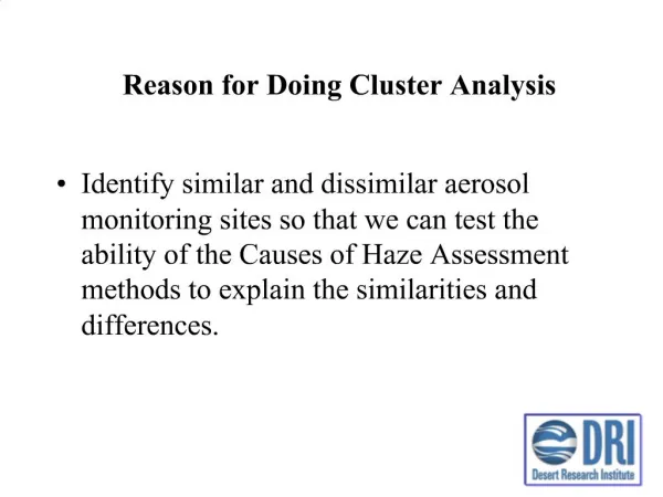
Reason for Doing Cluster Analysis. Identify similar and dissimilar aerosol monitoring sites so that we can test the ability of the Causes of Haze Assessment methods to explain the similarities and differences. Objectives of the Cluster Analysis.

E N D
Reason for Doing Cluster Analysis • Identify similar and dissimilar aerosol monitoring sites so that we can test the ability of the Causes of Haze Assessment methods to explain the similarities and differences.
Objectives of the Cluster Analysis • Group the sites with similar chemical speciation together. Discuss the common properties in the clusters and the difference between the clusters, as well as the major factors that decide the grouping. • Discuss the different causes of the regional haze for different groups of locations. • Identify the anomalous sites (close sites in different groups, far away sites in the same group, et al.). Discuss the difference of aerosol properties of those sites and the major chemical components that contribute to the difference. Interpret the possible reasons that lead to the anomaly. • Investigate the temporal stability of the clusters. Discuss the temporal trend of the aerosol properties and the possible reasons for that. • Obtain information for further detail data analysis for specific regions and locations.
Cluster Analysis Methodology (Tree Clustering) Join together objects into successively larger clusters, using some measure of similarity or distance. The higher the level of aggregation, the less similar are the members in the respective class. • Elements in the cluster analysis – Quarterly averaged concentrations of major chemical species normalized to the mean values of the whole network. • Coarse Mass • Elemental Carbon • Organic Carbon • Sulfate • Nitrate • Fine Soil Mass • Euclidean distance: • Distance(x,y) = [i (xi – yi)2]1/2 • Linkage rule: • Weighted pair-group average: The distance between two clusters is calculated as the average distance between all pairs of objects in the two different clusters weighted to the size of the respective clusters.
Cluster Tree Diagram Based on Normalized Quarterly Average (1/2001-10/2002) Major Aerosol Chemical Speciation
Elevation Adjustment • Objective • Eliminate the influence of elevation to the air density. • Methodology • All the concentrations are normalized to the ground level (elevation = 0) based on the elevation of each site and the air density profile of the standard atmosphere.
23 Clusters Based on Elevation Adjusted Aerosol Chemical Speciation
Examples of Anomalies Yosemite National Park Hoover Washington D.C. Arendtsville Saguaro West Saguaro National Monument
Difference of Aerosol Chemical Speciation Between SAGU1(R) and SAWE1(S) for Quarter 1 – 4 Both sites have relatively high soil concentrations. Aerosol loading is generally higher in Saguaro West than Saguaro National Monument. Most of the difference is caused by the soil and coarse mass.
Difference of Aerosol Chemical Speciation Between YOSE1(G) and HOOV1(L) for Quarter 1 – 4 During Quarter 1, Hoover has much more soil and coarse mass in aerosols than Yosemite National Park; while Yosemite National Park has more OC/EC and Nitrate throughout the year.
Difference of Aerosol Chemical Speciation Between AREN1(I) and WASH1(M) for Quarter 1 – 4 During the cold seasons (quarter 1 and 4), the aerosol loading of Washington D.C. is much higher than Arendtsville. EC is the major chemical component that contributes to the difference between Washington and Arendtsville (20% and 19% in Quarter 1 and 2, respectively).
Cluster Temporal Stability Analysis • Objective • Investigate the temporal trend of the aerosol properties and the possible reasons for that. • Methodology • For a given site, in each year when aerosol measurements are available, calculate the distance between the site and each cluster obtained from the 2001-2002 aerosol data. • Decide which cluster the site belongs to (with the shortest distance) for the given year.
Big Bend National Park (BIBE1) K has more soil and coarse mass, while B has more EC/OC and sulfate. The contributions of dust source and anthropogenic sources decide if BIBE1 belongs to cluster B or K.
Gila Wilderness (GICL1) Shifting of Gila Wilderness from cluster D to G is caused by dramatically increase in OC/EC concentrations in Quarter 3, which may be caused by specific pollution events
Acadia National Park (ACAD1) Aerosol loading, especially coarse mass concentration in ACAD decreased, causing it to transfer from Cluster B to Cluster A in recent years
Yosemite National Park (YOSE1) Very unstable site. Compare with D, A has much less soil and coarse mass, especially in quarter 2; C has more OC in quarter 3 and 4 and less soil and CM in quarter 1 and 2; F has much more Nitrate during quarter 2-4; G has more EC/OC in quarter 3.
Summary of Preliminary Results • Air density adjustments for some sites explain cause for some sites’ data to differ from others • Anomalous sites are often caused by exposure to nearby sources • Unstable sites seem to be the results of changing source influence (smoke from fires, longer term emission trends, etc.)
Next Steps • Identify groups of sites with similar worst 20% visibility days and try to understand source implications by • Examining seasonality of worst days • Identify responsible species • Characterizing meteorology during worst days • Examining anomalous and unstable sites