Download
1 / 29
290 likes | 398 Views
Data Sharing: An Enterprise Approach in Ohio. Leveraging Geospatial Across the Enterprise. Agenda. NSGIC Data Sharing and Data Delivery in Ohio GIServOhio – Spatial Portal Summary. What is NSGIC?.

E N D
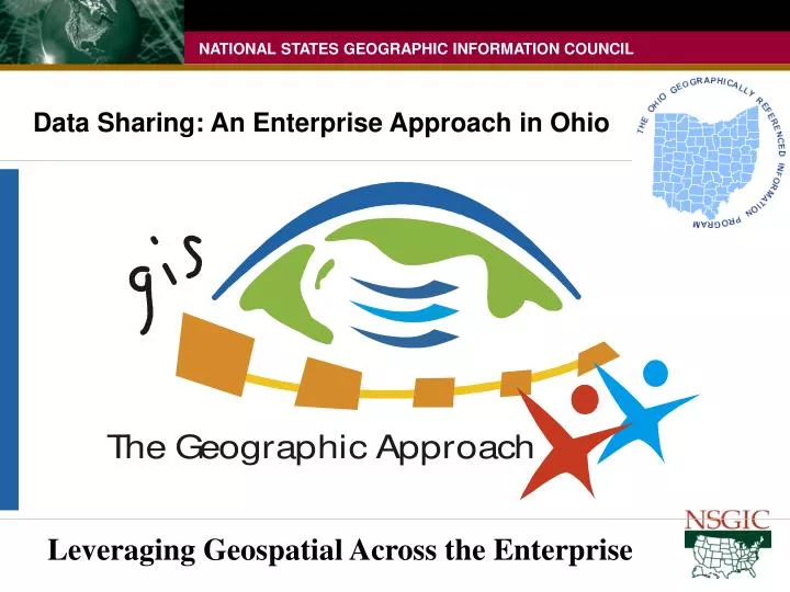
Data Sharing: An Enterprise Approach in Ohio Leveraging Geospatial Across the Enterprise
Agenda • NSGIC • Data Sharing and Data Delivery in Ohio • GIServOhio – Spatial Portal • Summary
What is NSGIC? • NSGIC is an organization committed to efficient and effective government through the adoption of geospatial or mapping information technologies. • NSGIC members are actively involved in the coordination and application of mapping technologies in their States, the creation and management of mapping data as well as information technology policy • Membership - senior state geographic information system (GIS) managers and coordinators, representatives from federal agencies, local government, the private sector, academia and other professional organizations.
We have common needs, but every state is different due to demographics, geography & “hot” issues
What NSGIC Does • Provide a unified State voice on geographic information and technology issues, • Strong advocate for State interests, • Support back to the membership through national initiatives with statewide impacts • NSGIC promotes mapping information integration and systems development and provides input and advice to public and private decision-makers on national issues impacting the States. NSGIC advocates the benefits of mapping technologies and data that can only be realized through intergovernmental and private sector cooperation, coordination, collaboration and partnerships.
Federal Level Apps Programs Regional multi-state Minimum Attributes Low Resolution Least $$ Less detailed data Integrat ion State Level Apps State & Federal Programs Multi-County Multi-State Less Attributes Lower Resolution More $$$ Local Level Apps Serve People Multi-Neighborhood More Attributes Higher Resolution Most (BIG) $$$$ More detailed data
Collect it once - use it a bunch…. and maintain it • Develop solid GIS foundation (one geography) • Sustained and maintained foundation • Interoperability - Other organizations use foundation for their specific applications • Create enterprise-wide perspective viewing information as a “community” resource
Benefits of Vertical Integration Geographic Data Sharing - more effective use of dollars - develop applications faster - improve customer satisfaction - provide better decision-making - utilize data produced by others - extend analysis beyond jurisdictions - resolve problems created by conflicting data - redirect resources associated with duplication - reduce dissemination costs by direct access Internal GIS Use
A collective voice brings change! • Coordinators can assist in several ways: • Communicate about other initiatives that may impact your state • Connect and Contact other GIS Professionals • Coordinate Data Resources and initiatives • Coordinators need your Participation and Expertise • Get involved with your coordinator • Work with organizations to definestatewide program components http://nsgic.org/states/index.cfm
NSGIC Initiatives • 50 States Initiative – strengthens coordination and collaboration within and without States • Ramona GIS Inventory System • Imagery for the Nation – first step for sustainable funding for imagery meeting requirements of multiple levels of governments http://nsgic.org/hottopics/index.cfm
Data Sharing: An Enterprise Approach In Ohio
Lessons Learned • Currency Is Imperative - Worth building, worth maintaining • Accuracy Is Crucial - Must support all levels of government • Interoperability – Datasets built on common spatial framework • Cooperative efforts for data acquisition, development and sharing Integration and Collaboration - Only way to prepare for Ohio’s future
GIServOhio • Spatial content and service delivery platform • Data discovery and access • OGC Services • centerlines • imagery • Enterprise geocoding service • Service Oriented Architecture (SOA) • software architecture that defines the use of loosely coupled software services to support the requirements of a business
Application B (Nat Res) • Geocode Addresses • Edit Shapes • Present Maps to Users • Output Reports • Application A (HLS) • Geocode Addresses • Add/Edit Events • Present Maps to Users • Output Reports • Both applications need the same fundamental methods. • Why write the same methods multiple times, replicating effort and COST? • How can we stop duplicating code and save money? Report Widget Add Event Widget Geocode Widget Map Widget Geocode Widget Map Widget Timmons Group
SOA Platform Routing Widget Event Widget Report Widget Map Widget Geocode Widget • How? Service Oriented Architecture (SOA). • Create smaller, more generic methods that can serve multiple purposes • Centralize those methods where they can be accessed and consumed by other applications, methods or entities • WEB SERVICES Application A Application B Timmons Group
Dept Emergency Mgt HLS Application State Board Elections Services Routing Widget Event Widget Report Widget Health Dept BMV Map Widget Geocode Widget Desktop Apps Local EOC DOT Timmons Group
HS Bound- aries Address MAF Health DOT Tax EMA EOC Center- lines Imagery Cadastral Events Routing Geocode Data Provision Metadata PIP Hydro Applications Shared Services Data Assets
Benefits • Rapid development & deployment • Decreased development costs • Reusable components • Consistency across applications • Increased Integration
Enterprise Geocoding Service • Vendor APIs • Address standardization • Geocoding - TeleAtlas Centerline • Point-in-polygon • Master Address File • Parcel centroids with site addresses • LBRS site addresses • Exposed through web service
Raster Image Provisioning • EarthWhere • Custom Image Products • Federal partners • State agencies • Counties • GIS Coordinators • EOC • Academic Institutions • Federal partners
Raster Image Sources State • Statewide imagery program • ODOT • ODNR • Licensed satellite data products • Counties • Countywide ortho imagery • Federal • DOQQ • NAIP • Satellite
County Profiles Survey • Survey Tool for GIS activity • Limited metadata output • Tied to OGRIP initiatives • Link to Ramona
Metadata Portal • Data discovery & access • GOS Harvesting • Contents • Natural Resources • DOQQs • Online Services
Business Impacts • Social Services • SACWIS – case workload management • ERIC – unemployment compensation tax & reporting • OJI – unemployment compensation benefits • Medicaid • Tax District Determination • Vehicle titling & registration, permissive tax • Streamlined Sales Tax – stable revenue source • School District IT Compliance – increase revenue for SDs • Public Safety • Critical Infrastructure Protection • Multi-Agency Statewide Radio Communication System • Mobile Transaction Gateway • Spatial content to wireless devices
Leveraging Geospatial efforts • - Build it once, use it a bunch • - Work in Partnership – mutually beneficial approaches are critical to the success of shared spatial data development • - Communication, Cooperation, Coordination and Collaboration • - Vertical Integration of: • Data (interoperability) • Data Development Funding (drilling spilling down) • Sustainable Funding and Economies of Scale
Get with you State Coordinator! • Coordinators can assist in several ways: • Communicate about other initiatives that may impact your state • Connect and Contact other GIS Professionals • Coordinate Data Resources and initiatives • Coordinators need your Participation and Expertise • Get involved with your coordinator • Work with organizations to definestatewide program components http://nsgic.org/states/index.cfm
QUESTIONS Stu Davis - NSGIC/Ohio Coordinator 614-466-4747 stu.davis@ohio.gov NSGIC Headquarters - 443-640-1075, ext 110fred@ksgroup.comwww.nsgic.org
NSGIC’s 2007 Annual Conference Mark Your Calendars! 2007 Annual Conference September 23-27, 2007 Madison Concourse Hotel Madison, Wisconsin