Download
1 / 26
260 likes | 461 Views
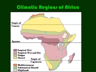
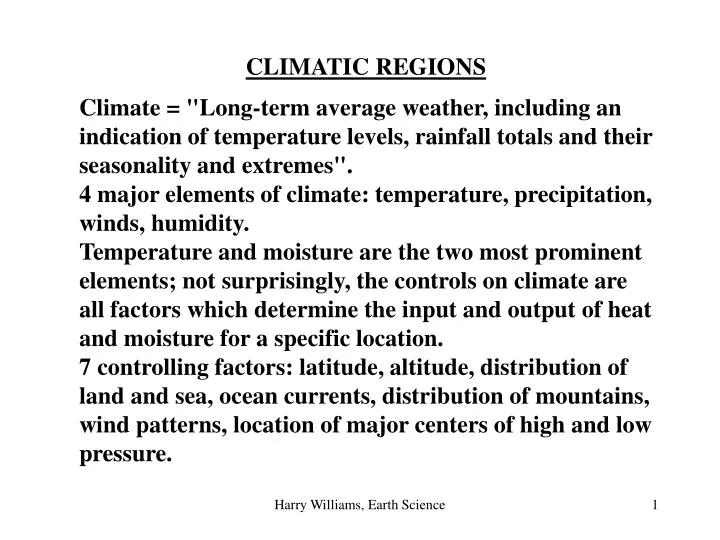
CLIMATIC REGIONS Climate = "Long-term average weather, including an indication of temperature levels, rainfall totals and their seasonality and extremes". 4 major elements of climate: temperature, precipitation, winds, humidity.

E N D
CLIMATIC REGIONS Climate = "Long-term average weather, including an indication of temperature levels, rainfall totals and their seasonality and extremes". 4 major elements of climate: temperature, precipitation, winds, humidity. Temperature and moisture are the two most prominent elements; not surprisingly, the controls on climate are all factors which determine the input and output of heat and moisture for a specific location. 7 controlling factors: latitude, altitude, distribution of land and sea, ocean currents, distribution of mountains, wind patterns, location of major centers of high and low pressure. Harry Williams, Earth Science
Koppen Classification This is the most widely used classification scheme - it is based simply on mean annual and monthly temperatures and precipitation levels. This data has the advantage of being simple to use and easily graphed as a climograph. There are 6 major classifications, A, C, D, E (all based only on temperature criteria), H (= Highland Climate - highly variable; controlled mainly by altitude and aspect - not discussed), B (Dry climates – based on temperature and precipitation criteria). These are subdivided by 2nd and 3rd letters (based on temperature or precipitation). Harry Williams, Earth Science
Fig 10.4 The climate zones clearly correspond to LATITUDE, but there are some obvious exceptions. Harry Williams, Earth Science
“A” Climates Harry Williams, Earth Science
A: Tropical Climates Average temperature of each month > 180 C. Characteristics: Low latitudes (ca. 20N-20S); warm year-round (no winter); Abundant rainfall. 2nd Letters: f: rain forest - average rainfall each month at least 6 cm m: monsoon - 1-3 months with < 6 cm rainfall w: savanna; 3-6 months with < 6 cm rainfall Harry Williams, Earth Science
Fig. 10.7 Harry Williams, Earth Science
Controls On “A” Climates Mainly equatorial; warm and wet every day -> seasonless; very small annual temperature range (2-30 C). Average temperatures usually about 800 F. Controlled by latitude -> constant high insolation. Usually 60-100 inches rainfall per year. Located close to ITCZ -> convergence of Trade Winds and convergent uplift. Heating -> convection. Onshore winds on east coasts -> orographic rainfall e.g. world record average annual rainfall = 460 inches in Hawaii (Denton gets about 33 inches). Major areas = Amazon Basin; Zaire Basin; East Indies. Harry Williams, Earth Science
“B” Climates Harry Williams, Earth Science
B: Dry Climates Potential evapotranspiration > precipitation Characteristics: cover 30% of land surface (largest of any group); no rain due to lack of uplift associated with subtropical highs - descending air). 2nd Letters: W: arid; precipitation less than half potential evapotranspiration. S: semi-arid; precipitation more than half potential evapotranspiration. 3rd Letters: h: hot - average annual temperature > 180 C. k: cold - average annual temperature < 180 C. Harry Williams, Earth Science
Bwhclimateeg.jpg Harry Williams, Earth Science
Fig. 10.25a Harry Williams, Earth Science
Controls On “B” Climates. - descending air, little precipitation. STH's are most pronounced on eastern side of ocean basins -> strongest effect on western edge of adjacent continents (deserts do not extend to eastern side of continents). The presence of Asia makes North Africa like a continent without an east coast (no source of moisture), therefore desert conditions extend further inland. - Atacama desert is created by high pressure; cold Humboldt current offshore -> stable air; Andes Mountains to east -> rainshadow for air coming from east. - the clear skies and tropical latitudes result in intense insolation in summer -> world record highest temperature (1360 F) world record daily temperature range (1000 F); world record highest average annual temperature (940 F); world record least annual average precipitation (0.03 inches). Harry Williams, Earth Science
“C” Climates Harry Williams, Earth Science
C: Mild Midlatitude Climates Average temperature warmest month > 10 0 C; average temperature of coldest month > 00 C. Pronounced seasons and variability (meeting of tropical and polar air). 2nd Letters: s: summer dry - driest summer month has < 1/3 average precipitation of wettest winter month. w: winter dry - driest winter month has < 1/10 average precipitation of wettest summer month. f: moist - no dry season (doesn't fit either above) 3rd Letters: a: hot summers - average temperature of warmest month >220C. b: warm summers - average temperature of warmest month < 220C. At least 4 months with average temperatures > 100 C. c: cool summers – 1 to 3 months with average temperatures > 100C. Harry Williams, Earth Science
Controls On “C” Climates Humid Subtropical (Cfa) - on eastern side of continents in midlatitudes away from influence of STH's. Hot humid summers, mild winters with occasional severe cold outbursts. e.g. winter temperatures minimums can be 10-200 F lower than in west coasts climates (Mediterranean) at similar latitudes. Summer maximum rainfall due to convection (thunderstorms in North Texas) and cyclonic storms; onshore air flows. Mediterranean (Csb) Influenced by STH’s in summer - west coast of large continents. Pronounced summer drought. Warm year-round. Harry Williams, Earth Science
“D” Climates Harry Williams, Earth Science
D: Severe Midlatitude Climates Warmest month average > 100 C; coldest month average < 00 C. Continentality -> large annual temperature range. Pronounced seasons. Summer maximum rainfall due to convection; winter rainfall due to cyclonic activity. 2nd and 3rd Letters same as for C climates, plus d = very cold winters - average temperature of coldest month < -380 C. Harry Williams, Earth Science
Controls on “D” Climates: Central-East side of continents in the higher midlatitudes; Day to day weather, especially in winter, characterized by variability associated with passage of pressure systems, cyclonic storms. Much winter precipitation is snow - especially further north. Inland locations exhibit continentality (NOT moderated by oceans - more “extreme” climates). Harry Williams, Earth Science
“E” Climates Harry Williams, Earth Science
E: Polar Climates No month with average temperature > 100 C; no true summer. Precipitation is very low, but so is evaporation, so the whole group is classified as humid. Low insolation -> coldest summers, lowest annual and absolute temperatures. 2nd Letter: T: tundra - at least 1 month with average temperature > 00 C < 100 C. F: frost - no month with average temperature > 00 C. Harry Williams, Earth Science
The tundra climate zone is defined mainly on the basis of vegetation: its equator-ward boundary is the 100 C average temperature of the warmest month isotherm - this is the poleward limit of tree growth (the tree line); its poleward limit is the 00 C average temperature of the warmest month isotherm - this is the poleward limit of vegetation growth. Found mostly in the northern hemisphere - little land at suitable latitudes in southern hemisphere. Harry Williams, Earth Science