Download
1 / 25
250 likes | 410 Views
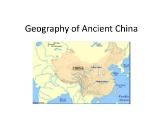
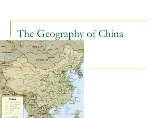
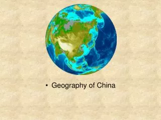
China’s Geography. FLEXI-D Group 1. Location of China. Exact Location: 20° - 53° N and 73° - 135° E Relative Location: North: Mongolia, Russia East: Korea, Korea Bay, Sea of Japan, Yellow Sea, and East China Sea

E N D
China’s Geography FLEXI-D Group 1
Location of China Exact Location: 20° - 53° N and 73° - 135° E Relative Location: • North:Mongolia, Russia • East:Korea, Korea Bay, Sea of Japan, Yellow Sea, and East China Sea • South:South China Sea, Philippines, Taiwan, Vietnam, Laos, Thailand, India, Myanmar, Nepal, Bhutan, Bangladesh • West:Kazakhstan, Kyrgyzstan, Tajikistan, Pakistan, Afghanistan
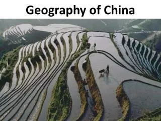
Topography • China has a varied topography: - Large plains - Basins surrounded by mountains - Mountains ( 2/3 of China is composed of mountains) - A vast plateau - Rolling land - Mountain ranges
Geographical Divisions • China is divided into four groups: -Northeast -Northwest -Southeast -Southwest
Climates in the different regions • Northeast: Dry winter climate • Southeast: Warm-moderate climate • Southwest: Snow/Dry climate • Northwest: Dry climate with very hot summers and very cold winters
Northeast • ‘Heartland of the Chinese civilization’ • Agriculture field: -Wheat -Barley -Millet • Northernmost is Manchuria • South is Beijing, the capital of China
Southeast • Plenty of forests • Rice is cultivated • Qinling-Shan separates Northeast China from Southeast China
Northwest • Tarim Basin which is separated by mountains: - Tian Shan in the north - Kunlun Shan in the south - Pamir and Karakorum in the west - Gobi desert in the east • East is Inner Mongolia
Southwest or Qinghai-Tibetan • Tibet “Roof of the World” • South of Tibet are the Himalaya Mountains • Capital of Tibet- Lhasa • People prefer to live in southern Tibet, where there are many steppes. • Barley is cultivated
Primary Natural Resources • Water - China has the world’s greatest potential for hydroelectric power - Yellow and Yangzi Rivers providing much of the potential *Development to China: • Natural resource of water not only for drinking, also for electricity • Large population would need electricity and abudance in water for drinking
Primary Natural Resources • Land/Agriculture - China ranks first in farm output, primarily producing rice, wheat, potatoes, etc. - Only 15% of total land area can be cultivated - Arable land represents 10% of total arable land in the world, supports over 20% of the world’s population *Development to China: • Employs over 300 million farmers • Able to feed very big population
Yangtze (Long River) • 3rd longest river in the world ( about 4000 mi) • Floods each year leaving fertile soil along the banks • High banks- keeps homes safe from the flooding • Irrigates the people’s crops
Huang He (Yellow River) • 3000 mi long • Where civilization began 5000 years ago • Starts from the Himalayas then goes to the Yellow Sea • Homes near the river were destroyed due to the flooding • People eventually learned flood control and used the water in their favor • Irrigate crops, drinking water, fishing, etc.
Taklamakan Desert • “Sea of Death” • 2nd Largest in the world • Takla Makan means “go in and never come out” • Ruined cities can be found in the desert *The deserts somehow taught the people to be conservative of their water
Gobi Desert • 1 of the driest deserts in the world • 4th largest in the world • Covers northern parts of China • The Himalayan mountains block the rain clouds from reaching the Gobi
Tourist Attractions • Forbidden City - ‘Imperial City’ during the Mongol Yuan Dynasty. - Declared a World Heritage Site in 1987 by UNESCO • Great Wall of China - Originally built to protect the northern borders of the Chinese Empire - 8,851.8 km or 5,500.3 mi
Tourist Attractions • Jade Buddha Temple - In 1882, a temple was build to keep two jade Buddha statues which have been brought from Burma by a monk named Huigen - The temple was destroyed, but the Buddhas were saved and a new temple was built in 1928 - Sitting Buddha and the Recumbent Buddha - Old-time and classical architectural style makes it unique
Tourist Attractions • Giant Buddha - A giant bronze Buddha - 111 feet tall or 34 meters high - Largest seated Buddha in the world - Can be found at Lantau Island in Hong Kong • Macau Tower - One of the biggest towers in the world - Standing at 338 meters high - Here you can bungee jump, or climb to the top of the tower
Uniqueness of China’s geography • The shape of China look like a CHICKEN
Uniqueness of China’s geography • China’s climate is very diverse - Dry winter climate to the northeast - Warm-moderated climate to the southeast - Snow/Dry climate to the southwest - Hot summers and Cold winters to the northwest
Sources • images.google.com • http://www.strategicforesight.com/yellowriver.htm • Chinese Influences ( SS book) • www.travelchinaguide.com/attraction/shanghai/jade_temple.htm • http://asianhistory.about.com/od/china/a/TibetandChina.htm • http://wikitravel.org/en/List_of_Chinese_provinces_and_regions