Download
1 / 11
110 likes | 210 Views
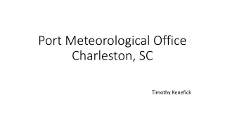
WFO CHS Participation in the GOES-R Proving Ground. Weather Forecast Office . Charleston, SC. WFO CHS Participation Timeline. 2005: Became a member of the SRSST/SOAWG 2006: Attended first GOES-R User’s Conference in Broomfield, CO

E N D
WFO CHS Participation in the GOES-R Proving Ground Weather Forecast Office Charleston, SC
WFO CHS Participation Timeline • 2005: Became a member of the SRSST/SOAWG • 2006: Attended first GOES-R User’s Conference in Broomfield, CO • 2009: Made two presentations at GOES-R Proving Ground Meeting in Boulder, CO • 2009: Made a presentation at the GOES-R User’s Conference in Madison, WI • 2010: Attended the Spring Hazardous Weather Experiment (using CTC, proxy lightning, etc.) • 2010: Starting ingesting UW-CIMSS GOES-based convective products into AWIPS for operational use. • 2010: Hosted the first ER virtual satellite workshop. • 2012: Started ingesting NSSL-WRF Simulated Satellite Imagery into AWIPS for operational use. • 2012: Made a presentation (virtually) on the use of simulated satellite imagery in operations at the 2012 National Weather Association annual meeting in Madison, WI. (Made the presentation again virtually for ER offices) • 2013: Co-hosted the second ER virtual satellite workshop. • 2013: Started ingesting SNPP imagery into AWIPS. • 2014: Made a presentation on the UW-CIMSS CTC product for both a GOES-R Brown Bag webinar and at the Palmetto Chapter of the AMS Mini-Tech. Weather Forecast Office Charleston, SC
Training Experiences • COMET • Several live COMET teletraining sessions were scheduled for the staff. • Recorded versions assigned in staff learning plans • OTJ Training • Point out proper use of the data “live” • Encouraged staff to mention products in AFDs • Locally made presentations Weather Forecast Office Charleston, SC
Future Training Needs • BANDWIDTH • Training available for all new “experimental” data. • Training on the use of the products in concert with other sources of data (i.e. radar, mesoanalyses, model output, etc.) • Focus on the added value to the entire forecast/warning process. • Continue to expand the use of GOES-R (and SNPP) products in Weather Event Simulations to aid integration. Weather Forecast Office Charleston, SC
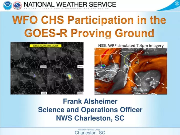
UW-CIMSS Cloud Top Cooling Strengths Weaknesses • Best for initiation. • Documented cases where the product produced superior lead time to radar alone. • Clean display which can be overlayed on satellite data in AWIPS. • Easy product to understand. • Cirrus shield renders product ineffective. • False Alarms can be large for severe thunderstorms. • Often times radar gives indicator before CTC signal. • (Potentially due to current limitations of GOES temporal resolution) Weather Forecast Office Charleston, SC
NSSL WRF Simulated Satellite Strengths Weaknesses • Excellent visualization tool. • Encourages the use of “alternative” imager bands. • Allows quick estimate of the models performance. • Nicely compliments simulated radar products. • Relatively easy to understand. • Only as good as the model output. • Hourly temporal output vs. more frequent satellite imagery. • Model only run once a day. Weather Forecast Office Charleston, SC
SNPP Data Strengths Weaknesses • Provides feature identification/texture that would otherwise be difficult to get. • Day-Night band allows for details impossible to see from traditional nighttime imagery. • All the typical polar orbiter issues • -- Latency • -- Temporal Frequency Weather Forecast Office Charleston, SC
Potential Improvement Areas • Cloud Top Cooling • Use SRSOR examples to recalibrate product for 5 minute and 1 minute scans. • Integrate radar and near storm environment data into the algorithm. • Operational Readiness: Needs some improvement to be reliably effective. • Simulated Satellite Imagery • Expand to other models that are run more frequently and have higher spatial/temporal resolution (HRRR). • Add in enough simulated channels to also simulate RGB imagery. • Operational Readiness: Yes, but needs to be expanded to other models for the true value to be appreciated.